CBSE Class 8 Geography Chapter 8 Chapter 1 Resources Notes

CBSE Class 8 Geography Chapter 8 Chapter 1 Resources

A resource is anything which has utility to satisfy our needs. For example, books, water, air, sunlight, etc.

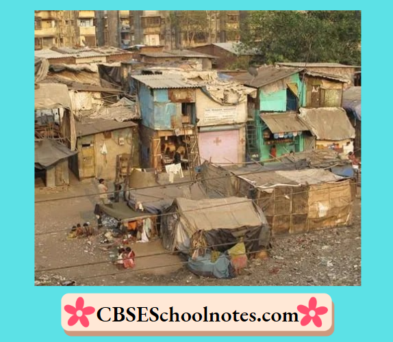
All the resources have some value like economic value. For example, metals may have an economic value but a beautiful landscape may not have economic value. However, both are important and satisfy our needs.

Some resource become economically valuable with time. Time and technology are two important factors that can change substances into resources.

The people’s ideas, knowledge, inventions and discoveries lead to the creation of more resources. For example, the discovery of fire and the invention of wheel.

CBSE Class 8 Geography Chapter 8 Chapter 1 Resources Types of Resources

Resources are generally classified into three types

(1) Natural resources

(2) Human-made resources

(3) Human resources

Natural Resources

The resources which are directly obtained from nature and used without modification are called natural resources.

For example, the air we breathe, water in rivers and lakes, soils, minerals, sunlight, animals, etc are natural resources.

The distribution of natural resources is unequal due to differences in the physical factors over the Earth like terrain, climate and altitude.

Natural resources are classified into renewable and non-renewable resources

(1) Renewable Resources The resources which get renewed or replenished quickly are called renewable resources. For example, solar and wind energy.

(2) Non-Renewable Resources The resources which take thousands of years to get renewed or replenished after exhausting are called non-renewable resources. For example, coal, petroleum and natural gas.

Human-Made Resources

When human beings change the original form of natural resource to make it more useful, it is called human-made resource.

For example, use of natural resources for making buildings, roads, machinery, etc. Technology is also a human-made resource.

Human Resources

Human resource refers to the number and abilities of the people.

Human Resources

Human resource refers to the number and abilities of the people

People themselves are human resources. Education and health help in making people a valuable resource.

Improving the quality of people’s skills so that they are able to create more resources is known as human resource development.

CBSE Class 8 Geography Chapter 8 Chapter 1 Resources Conserving Resources

The method of using resources carefully and giving them time to get renewed is called resource conservation.

The conservation of resources can be done by adopting the steps like reducing consumption of resources and recycling and reusing things

Sustainable development is another method for conserving resources. It refers to balancing the need to use resources and also conserve them for future.

Some principles of sustainable development are as follows

  • Respect and care for all forms of life.
  • Improve the quality of human life.
  • Conserve the Earth’s vitality and diversity.
  • Minimise the depletion of natural resources.
  • Change personal attitude and practices towards the environment.
  • Enable communities to care for their own environment.

Question 1. List out five resources you use in your home and five you use in your classroom.

Answer. Resources used in home

(1) Natural resources in home are

  • Air
  • Water
  • Minerals like: salt, sugar, etc.

(2) Human-made resources in home are

  • Air cooler
  • Refrigerator
  • Resources used in classroom

(1) Natural resources in classroom are

  • Air
  • Water
  • Solar energy/sunlight

(2) Human-made resources in classroom are

  • Desks
  • Chalk board
  • Furniture

Question 2. Circle those resources from Amma’s list that have no commercial values as yet.

Amma’s List

  • Cotton cloth
  • Iron ore
  • Intelligence
  • Medical knowledge
  • Medicinal plants
  • Coal deposits
  • Beautiful scenery
  • Agricultural land
  • Clean environment
  • Old folk songs
  • Good weather
  • Resourcefulness
  • A good singing voice
  • Grand mother’s home remedies
  • Affection from friends and family.

Answer. The resources from Amma’s list that have no commercial values are old folk songs, good weather, a good singing voice, grandmother’s home remedies and affection from friends and family.

Question 3. Think of a few renewable resources and mention how their stock may get affected by overuse.

Answer. Renewable resources are things that regenerate/ replenish over time, such as biomass (trees, crops, plants), water, wind, solar energy and geothermal energy.

The stock of these resources may get affected by overuse or over-exploitation which is discussed in the following examples

Natural Vegetation It is a renewable resource which is overused by people for their increasing demands. Trees are cut for wood, housing and other needs at a faster speed due to which problems like environmental pollution emerged.

Water It is a renewable resource which is overused by people for various needs. This overuse led to problems like water shortage in many parts of the world.

Question 4. Make a list of five human-made resources that you can observe around you.

Answer. Five human-made resources that I can observe around me are

(1) Benches

(2) Pen/pencil

(3) Buildings

(4) School bus

(5) Roads

Question 5. Answer the following questions.

(1) Why are resources distributed unequally over the Earth?

Answer. Resources are distributed unequally over the Earth due to the differences in uneven physical factors on which resource distribution depends. These factors are terrain, climate and altitude which are different from place to place over the Earth’s surface.

(2) What is resource conservation?

Answer. Resource conservation means using the resources carefully and giving them time to get renewed.

(3) Why are human resources important?

Answer. Human resources are important because nation’s development is mostly dependent upon human resources which include human’s skill, technology, thinking and knowledge, that leads to a nation’s power.

Only human skill and technology change the natural substances into a valuable resource.

(4) What is sustainable development?

Answer. Balancing the need to use resources and conserve them for the future is called sustainable development.

Question 6. Tick the correct answer.

(1) Which one of the following does not make substance a resource?

(a) Utility

(b) Value

(c) Quantity

Answer. (c) Quantity

(2) Which one of the following is a human-made resource?

(a) Medicines to treat cancer

(b) Spring water

(c) Tropical forests

Answer. (a) Medicines to treat cancer

(2) Complete the statement.

Non-renewable resources are……..

(a) derived from living things.

(b) made by human beings.

(c) derived from non-living things.

Answer. (a) derived from living things.

Question 7. Activity

“Rahiman paani raakhiye, Bin paani sab soon.

Paani gaye na ubere

Moti, manus, choon……”

[Says Rahim, keep water, as without water there is nothing. Without water pearl, swan and dough cannot exist.]

These lines were written by the poet Abdur Rahim Khankhana, one of the nine gems of Akbar’s court. What kind of resource is the poet referring to? Write in 100 words, what would happen if this resource disappeared?

Answer. The resource referred to by the poet is water.

Water is one of the most valuable resources of life. It is called ‘a life sustaining’ resource. It is very essential for the growth and development of living things like plants, human beings and animals, for cooking, for all sorts of activities like agricultural, industrial and household practices, and for our day to day life.

If this resource disappeared, the Earth will turn into desert and without forest cover, all the living things would die due to thirst and hunger. No plant can grow in the absence of water which further affects the lives of animals who depend upon them. In short, no form of life can survive without water.

Question 8. For Fun

(1) Pretend that you live in the pre-historic times on a high windy plateau. What are the uses you and your friends could put the fast winds to? Can you call the wind a resources?

Now Imagine that you are living in the same place in the year 2138. Can you put the winds to any use? Can you explain why the wind is an important resource. now?

Answer. If my friends and I had lived in the prehistoric period on a high, windy plateau, we would not have understood the utility of the high winds because technology was absent at that time. When the fast winds started blowing, we would have tried to hide in caves or behindrocks to protect ourselves. In this case, winds could not be called a resource because we would have been scared of fast winds, and they would have been of no use to us.

In the year 2138, wind can be important as resource in supplying renewable energy for electricity, supporting wind based transportation and climate control in response to environmental challenges.

(2) Pick up a stone, a leaf, a paper straw and a twig. Think of how you can use these as resources? See the example given below and get creative!

Class 8 Social Science Geography Chapter 1 Resources Question 8.1

Answer.

Class 8 Social Science Geography Chapter 1 Resources Question 8.2

Class 8 Social Science Geography Chapter 1 Resources Question 8.3

Class 8 Social Science Geography Chapter 1 Resources Question 8.4

CBSE Class 8 Geography Chapter 8 Chapter 1 Resources Review Exercise

Multiple Choice Questions (MCQs)

Question 1. The value associated with resources is ……

  1. economic value
  2. aesthetic value
  3. legal value
  4. ethical value

Answer. 1. economic value

Question 2. The technology to create…….. had turned energy in fast flowing water into an important resource.

  1. Thermal Power
  2. Solar Power
  3. Hydroelectricity
  4. Windmill

Answer. 3. Hydroelectricity

Question 3. The exclusive right over any idea or invention is called

  1. invention
  2. technology
  3. patent
  4. stock of resource

Answer. 3. patent

Question 4. Sunlight is which type of resource?

  1. Limited
  2. Unlimited
  3. Both (a) and (b)
  4. None of these

Answer. 2. Unlimited

Question 5……….. refers to the number and ability of the people, e.g., knowledge, skills, etc.

  1. Biotic resources
  2. Abiotic resources
  3. Human resources
  4. Human-made resources

Answer. 3. Human resources

Question 6. What makes an object or substance a resource?

  1. Utility
  2. Value
  3. Usability
  4. Both (a) and (c)

Answer. 4. Both (a) and (c)

Question 7. Resources drawn from nature and used without much modification are called

  1. human-made resources
  2. cultural resources
  3. natural resources
  4. All of the above

Answer. 3. natural resources

Question 8. …………help in making people as a valuable resources.

  1. Education and food
  2. Education and health
  3. Transport and trade
  4. Health and power

Answer. 2. Education and health

Question 9. It signifies development of human beings i.e. developing the quality and capacity of people state. Identify

  1. Human resources
  2. Human-made resources
  3. Human resources development
  4. None of the above

Answer. 3. Human resources development

Question 10. Using resources carefully and giving them time to get renewed is called

  1. resource balancing
  2. resource conservation
  3. resource depletion
  4. devaluation

Answer. 2. resource conservation

Question 11. Balancing the need to use resources and also conserve them for the future is called

  1. development
  2. sustainable development
  3. human resource development
  4. devaluation

Answer. 2. sustainable development

Question 12. Consider the following statements and choose the correct option.

1. Time and technology are two important factors that can change substances into resources.

2. The invention of the fire led to the development of newer forms of transportation.

  1. Both 1 and 2
  2. Only 2
  3. Only 1
  4. None of these

Answer. 1. Both 1 and 2

Question 13. Identify the resources from the information given below.

1. These resources may take thousands of years to be renewed or replenished.

2. Example of these resources are coal and petroleum.

  1. Renewable
  2. Non-renewable
  3. Human made
  4. Natural resources

Answer. 2. Non-renewable

CBSE Class 8 Geography Chapter 8 Chapter 1 Resources Match the Following

Question 1.

Class 8 Social Science Geography Chapter 1 Resources Match the Following Question 1

  1. A – 4, B – 1, C – 3, D – 2
  2. A – 1, B – 2, C – 3, D – 4
  3. A – 3, B – 2, C – 1, D – 4
  4. A – 4, B – 3, C – 1, D – 2

Answer. 1. A – 4, B – 1, C – 3, D – 2

CBSE Class 8 Geography Chapter 8 Chapter 1 Resources Assertion-Reason

Question 1. Assertion (A) The discovery of fire resulted in the development of cooking and various other techniques.

Reason (R) The invention of the wheel ultimately resulted in the development of newer modes of transport.

(a) Both A and R are true and R is the correct explanation of A

(b) Both A and R are true, but R is not the correct explanation of A

(c) A is true, but R is false

(d) A is false, but R is true

Answer. (b) Both A and R are true, but R is not the correct explanation of A

Question 2. Assertion (A) Water seems to be an unlimited renewable resource.

Reason (R) The shortage and drying up of natural water sources is a major problem in many parts of the world today. 

(a) Both A and R are true and R is the correct explanation of A

(b) Both A and R are true, but R is not the correct explanation of A

(c) A is true, but R is false

(d) A is false, but R is true

Answer. (a) Both A and R are true and R is the correct explanation of A

CBSE Class 8 Geography Chapter 8 Chapter 1 Resources Fill in the Blanks

Question 1. Metallic minerals, coal, natural gas and petroleum are some examples of …… resources.

Answer. non-renewable

Question 2. Technology is …………………………

Answer. human-made

Question 3. The discovery of ….. led to the practice of cooking.

Answer. fire

Question 4……… resources are those which get renewed or replenished quickly.

Answer. Renewable

CBSE Class 8 Geography Chapter 8 Chapter 1 Resources True/False

Question 1. Water is not precious. We should not bother about its wasteful use.

Answer. False

Question 2. All sources and substances have the equal economic value.

Answer. False

Question 3. We should minimise the depletion of natural resources.

Answer. True

Question 4. People are human-made resources.

Answer. False

Question 5. Technology is a human resource.

Answer. False

CBSE Class 8 Geography Chapter 8 Chapter 1 Resources Case Based Question

Question 1. Read the passage given below and answer the following questions.

Resources that are drawn from nature and used without much modification are called natural resources. The air we breathe, the water in our rivers and lakes, the soils and minerals are all natural resources. Many of these resources are gifts of nature and can be used directly. In some cases, tools and technology may be needed to use a natural resource in the best possible way. Natural resources can be broadly categorised into renewable and non-renewable resources.

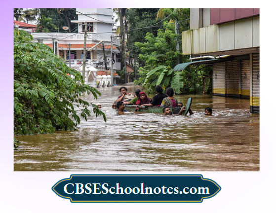
Renewable resources are those which get renewed or replenished quickly. Some of these are unlimited and are not affected by human activities, such as solar and wind energy. Yet careless use of certain renewable resources like water, soil and forest can affect their stock. Water seems to be an unlimited renewable resource. But shortage and drying up of natural water sources is a major problem in many parts of the world today.

Non-renewable resources are those which have a limited stock. Once the stocks are exhausted it may take thousands of years to be renewed or replenished. such resources are considered non-renewable. Coal, petroleum, and natural gas are some examples.

(1) Which of the following is considered a natural resource?

(a) Water

(b) Roads

(c) Railway

(d) All of these

(2) Resources can be replenished quickly and are known as ……….

(a) human-made

(b) renewable resource

(c) non-renweable resource

(d) human resources

(3) What is the major problem in today’s world?

(a) Shortage of solar energy.

(b) Excess of solar energy.

(c) Shortage of natural water resources.

(d) Excess of natural water resources.

(4) Identify the resource among the following which is considered as non-renewable.

(a) Coal

(b) Petroleum

(c) Water

(d) Both (a) and (b)

Answer. (1) (a) Water

(2) (b) renewable resource

(3) (c) Shortage of natural water resources.

(4) (d) Both (a) and (b)

CBSE Class 8 Geography Chapter 8 Chapter 1 Resources Very Short Answer Type Questions

Question 1. What is resource?

Answer. A resource is any thing which has utility to satisfy our needs.

Question 2. Mention the different types of resources.

Answer. The different types of resources are

(1) Natural resources

(2) Human-made resources

(3) Human resources

Question 3. How can a substance or material become a resource?

Or What makes a substance a resource?

Answer. If a substance or material has some utility, it can become a resource.

Question 4. How would you define the word utility?

Answer. Any thing has utility if it can be used in any way to satisfy human needs.

Question 5. What do you understand by the word technology?

Answer. The application of latest knowledge and skill in doing or making things is called technology.

Question 6. Name the two important factors which are responsible in making any substance into resource.

Answer. Time and technology are two important factors which are responsible in making any substance into a resource.

Question 7. Write the name of natural resources.

Answer. The air, the water, the soils and the minerals are all natural resources.

Question 8. How human-made resources differ from natural resources?

Answer. Human-made resources are different from natural resources as human-made resources are created by human beings while on the contrary, natural resources are directly obtained by environment/nature.

Question 9. What do you understand by human resource development?

Answer. Improving the quality of people’s skill so that they can be more advanced and useful, is called ‘human resource development’.

Question 10. What do you understand by stock of resource?

Answer. Stock of resources is the amount of resource available for use.

Question 11. How can we conserve the resources?

Answer. We can conserve the resources by reducing consumption, recycling and nursing.

CBSE Class 8 Geography Chapter 8 Chapter 1 Resources Short Answer Type Questions

Question 1. What is the significance of time and technology in making a substance a resource? Explain.

Answer. Time and technology are two most important factors in making substances as a resource.

With the passage of time, technology became more and more advanced.

As advanced technology is helpful in searching new directions to make life better, this advanced technology changes a useless substance in a useful resource.

For example, hydroelectricity which has made water a source of electricity.

Question 2. Some resources have economic value, while some don’t. Explain with example.

Answer. It is true that some resources have economic value, while some resources do not have economic value. Any resource used for production and is market-oriented has an economic value.

For example, cotton is used in industries to produce textiles and other goods, so cotton has economic value. However, moral values and love for friends and family do not have economic value but have social value.

Question 3. Why people are considered as a resource? What is human resource development?

Answer. People are considered as a resource because with their demands and capabilities, they can create new resources. People are considered as a special resource as they can make the best use of nature to create more resources when they have the knowledge, skill and the technology to do so. Education and health help in making people a valuable resource.

Improving the quality of people’s skills so that they are able to create more resources is known as human resource development.

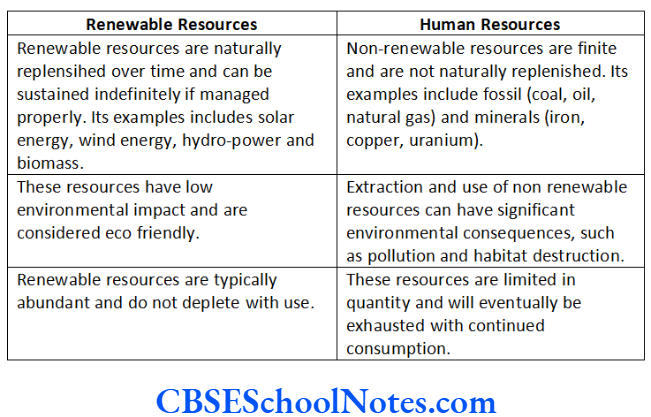
Question 4. Distinguish between natural and human resources.

Answer. The differences between natural and human resources are as follows

Class 8 Social Science Geography Chapter 1 Resources Short Answer Type Question 4

Question 5. What do you mean by human-made resources? Give some examples.

Answer. When human beings change the original form of natural resource to make it more useful, it is called human-made resource.

For example, people use natural resources to make buildings, bridges, roads, machinery and vehicles, which are known as human made resources. Technology is also a human made resource.

Question 6. People often got confused and think that human resources are similar to human-made resources. What do you think about it? Justify your answer.

Answer. People often got confused and think that human resources are similar to human-made resources. However, these types of resources are different from each other. When human beings change the original form of natural resources for their use, it is known as human-made resource while people themselves are human resources as it refers to the number and abilities of the people.

Question 7. As human beings, how can we ensure sustainable development?

Answer. As human beings, we can ensure sustainable development in the following ways

(1) By ensuring that all uses of renewable resources are sustainable.

(2) By ensuring that the diversity of life on the Earth is conserved.

(3) By ensuring that the damage to natural environmental system is minimised.

Question 8. Give four ways in which you can save energy at home.

Answer. The four ways to save energy at home are

(1) We should put light and fans off when not in use.

(2) We should not waste water unnecessarily.

(3) Food should be cooked in pressure cooker.

(4) Save petrol by following driving rules properly.

Question 9. Resources are essential elements that humans utilise to meet their needs, encompassing natural, human-made, renewable and non-renewable categories.

(1) Can you provide examples of natural resources and how they contribute to human well-being?

Answer. Some, examples of natural resources are air, water soil, fossil, etc.

Natural resources are important and contribute to human well-being as they provide clean air to breathe, water for drinking and agriculture and materials for industry.

(2) Why is difference between renewable and non-renewable resource significant for sustainability?

Answer. Difference between renewable and non-renewable resources is significant because it highlights the need for sustainable use of resources to ensure their availability for future generations.

CBSE Class 8 Geography Chapter 8 Chapter 1 Resources Long Answer Type Questions

Question 1. Briefly describe the different types of resources.

Answer. Resources are generally classified into three types

(1) Natural Resources The resources which are directly obtained from nature and used without modification are called natural resources.

For example, the air we breathe, water in rivers and lakes, soils, minerals, sunlight, animals, etc are natural resources.

(2) Human-Made Resources When human beings change the original form of natural resource to make it more useful, it is called human-made resource. For example, use of natural resources for making buildings, roads, machinery, etc.

(3) Human Resources Human resource refers to the number and abilities of the people. People themselves are human resources.

Question 2. An editor is writing an article about the conserving resources. Discuss the key points that should be mentioned in article and also explain some principles of sustainable development.

Answer. Conserving resources is essential for a sustainable future. It involves sincerly managing our finite natural and human-made resources such as water, forests and minerals. By reducing waste, reusing items and recycling materials, we can minimise our environmental impact and decrease the strain on ecosystems. Sustainable practices, like efficient energy use and responsible consumption, help us safeguard our planet’s health and ensure a better quality of life for future generation.

Some principles of substainable development are

  • Respect and care for all forms of life.
  • Improve the quality of human life.
  • Conserve the Earth’s vitality and diversity.
  • Minimise the depletion of natural resources.
  • Change personal attitude and practices towards the environment.
  • Enable communities to care for their own environment.

Question 3. Distinguish between renewable and non-renewable resources.

Answer. The differences between renewable and non- renewable resources are as follows

Class 8 Social Science Geography Chapter 1 Resources Long Answer Type Question 3

Question 4. How the resources can be conserved? Explain.

Answer. There are many ways to conserve resources. Some examples include

  • Reducing consumption This means using less of a resource in the first place. For example, we can reduce your consumption of water by taking shorter showers or turning off the faucet when we brush our teeth.
  • Recycling This means processing used materials so that they can be used again. For example, we can recycle paper, plastic and metal.
  • Reusing This means using an item multiple times without throwing it away. For example, we can reuse a water bottle or a reusable shopping bag.

CBSE Class 8 Geography Chapter 8 Chapter 1 Resources Case Based Question

Question 1. Read the passage given below and answer the following questions.

Value means worth. Some resources have economic value, some do not. For example, metals may have an economic value, but a beautiful landscape may not. But both are important and satisfy human needs. Some resources can become economically valuable with time. Your grandmother’s home remedies have no commercial value today.

But if they are patented and sold by a medical firm tomorrow, they could become economically valuable. Time and technology are two important factors that can change substances into resources. Both are related to the needs of the people. People themselves are the most important resource. It is their ideas, knowledge, inventions, and discoveries that lead to the creation of more resources. Each discovery or invention leads to many others.

The discovery of fire led to the practice of cooking and other processes while the invention of the wheel ultimately resulted in the development of newer modes of transport. The technology to create hydroelectricity has turned energy in fast-flowing water into an important resource.

(1) What are some examples of resources that have economic value?

Answer. Metals, oil, food, and water are all examples of resources that have economic value.

(2) What are the key factors that can turn substances into valuable resources?

Answer. The key factors that can turn substances into valuable resources are utility, value, time, technology, etc.

(3) What did the invention of the wheel ultimately result in?

Answer. The invention of the wheel ultimately resulted in the development of newer modes of transport.

CBSE Class 8 Geography Chapter 2 Land, Soil, Water, Natural Vegetation And Wildlife Resources Notes

CBSE Class 8 Geography Chapter 2 Land, Soil, water, Natural Vegetation and Wildlife Resources Land

Land is an important natural resource. It covers around 30% of the Earth’s surface, but all the parts of this land are not habitable.

There is uneven population distribution in different parts of the world, mainly due to differences in characteristics of land and climate.

Land with rugged mountains, steep slopes, low-lying flood- prone areas, deserts and dense forests is usually sparsely populated or uninhabited. On the other hand, plains and river valleys are suitable for agriculture and are densely populated.

Land Use and its Conservation

Land is used for various purposes like agriculture, forestry, mining, housing, roads and setting up industries. Land use depends on physical factors like terrain, soil, climate, minerals, and water, as well as human factors like population and technology.

Land can be categorised on the basis of ownership as follows

  • Private Land It is owned by individuals.
  • Community Land It is owned by community for common uses like collection of fodder, fruits, nuts or medicinal herbs. The community lands are also called common property resources.

Land degradation, landslides’, soil erosion and desertification are major environmental threats that occur due to expansion of agriculture and construction activities.

Afforestation, land reclamation, regulated use of chemical pesticide and fertilisers and checks on overgrazing are some of the common methods used to conserve land resources.

CBSE Class 8 Geography Chapter 2 Land, Soil, Water, Natural Vegetation And Wildlife Resources Soil and its Formation

Soil is the thin upper layer of the Earth’s surface. It is composed of organic matter, minerals, and weathered rocks formed through the process of weathering.

Fertility of soil depends on the right mixture of minerals and organic material.

Class 8 Social Science Geography Chapter 2 Land, Soil, Water, Natural Vegetation And Wildlife Resources Soil Profile

Factors of Soil Formation

Factors affecting soil formation include nature of the parent rock, climate, topography, organic matter and time.

All these factors differ from place to place.

Class 8 Social Science Geography Chapter 2 Land, Soil, Water, Natural Vegetation And Wildlife Resources Factors Affecting Soil Formation

Soil Degradation and Conservation Measures

Soil erosion and depletion are major threats to soil. Both human and natural factors led to degradation of soil. These are

  • Deforestation
  • Overgrazing
  • Overuse of chemical fertilisers or pesticides
  • Rain wash
  • Landslides
  • Floods

Some methods of soil conservation are

  • Mulching In this method, the clear ground between plants is covered with a layer of organic matter like straw to retain soil moisture.
  • Contour Barriers In this method, stones, grass, soil are used to build barriers along contours. Trenches are made in front of the barriers to collect water.
  • Rock Dam In this method, rocks are piled up to slow down the flow of water, to prevent gullies and further soil loss.
  • Terrace Farming In this method, broad flat steps or terraces are made on the steep slopes for growing crops, reducing surface runoff and soil erosion.
  • Intercropping In this method, different crops are grown in alternate rows and are sown at different times to protect the soil from rain wash.
  • Contour Ploughing In this method, ploughing is done parallel to the contours of a hill slope to form a natural barrier for water to flow down the slope.
  • Shelterbelts In this method, rows of trees are planted to check the wind movement and to protect soil cover, in coastal and dry regions.

CBSE Class 8 Geography Chapter 2 Land, Soil, Water, Natural Vegetation And Wildlife Resources Water

Earth is called the water planet because three-fourth part of the Earth’s surface is covered with water.

Oceans cover two-third part of the Earth’s surface, however ocean water is saline and not suitable for drinking.

Only 2.7% of water is fresh water out of which only 1% is fit for human use. It is found as groundwater, in rivers and lakes, and as water vapour in the atmosphere.

The total water volume of the Earth remains constant. It remains in continuous motion, cycling through oceans, air, land, and back again, through the processes like evaporation, precipitation and run-off. This is referred to as water cycle.

Problems and Conservation of Water Resources

Growing population, rising demand for food and cash crops, urbanisation, and rising standard of living are the major causes of shortages in the supply of fresh water.

There is water scarcity in many regions of the world like Africa, West Asia, South Asia, parts of the USA, Mexico, South America, Australia and countries located in drought-prone areas.

Discharge of sewage, agricultural, chemicals and industrial waste are major contaminants of water.

Afforestation, adopting effective techniques for irrigation like lining canals, using sprinklers or drip irrigation and promoting rainwater harvesting can be done for conservation of water resources.

CBSE Class 8 Geography Chapter 2 Land, Soil, Water, Natural Vegetation And Wildlife Resources Natural Vegetation and WildLife

Natural vegetation and wildlife exist in the biosphere which is a narrow zone of contact between the lithosphere, hydrosphere and atmosphere.

In biosphere, living beings are inter-related and interdependent on each other for their survival. This life supporting system is known as the ecosystem.

Natural vegetation and wildlife are valuable resources.

Plants provide various things and animals are important for maintaining balance in the ecosystem.

Distribution of Natural Vegetation

The growth of vegetation depends primarily on temperature and moisture. The major vegetation of the world are categorised as forests, grasslands, scrubs and tundra.

Large trees grow in areas of heavy rainfall. As the amount of moisture decreases, their size and density reduces.

Short trees and grasses grow in areas of moderate rainfall forming the grasslands of the world and thorny bushes and scrubs grow in areas of low rainfall.

Conservation of Natural Vegetation and Wildlife

Changes of climate and human interferences can cause the loss of natural habitats for plants and animals. Deforestation, soil erosion, tsunami, landslide, etc are major causes for extinction of natural vegetation and wildlife.

Poachings is a major concern leading to a decline in animal species, including tigers, lions and elephants. These animals are poached for collection and illegal trade of hides, skins, nails, horns, etc.

Some of the methods for conserving natural vegetation and wildlife are

  • National Parks, Wildlife Sanctuaries and Biosphere Reserves are made to protect natural vegetation and wildlife.
  • Awareness programmes like social forestry and Vanamohatasava should be encouraged at the regional and community level.
  • Many countries have passed laws against the trade as well as killing of birds and animals.
  • An international convention CITES (Convention on International Trade in Endangered Species of Wild Fauna and Flora) has been established.

Question 1. Observe the land, type of soll and water availability in the region you live. Discuss in your class, how it has influenced the life style of people there.

Answer. I live in XYZ, city where water availability is limited and the region faces water scarcity, especially during the summer months.

This situation has influenced people’s lifestyles by necessitating water conservation practices, such as rainwater harvesting and efficient water usage. It has also led to the dependence on groundwater sources and the need for infrastructure like water tanks and pumps to ensure a regular water supply.

Question 2. Talk to some elderly person in your family or neighbourhood and collect information about changes in the land use over the years, in the place where you live. Display your findings on a bulletin board in your classroom.

Answer. I had talked to my neighbor, who has lived in Delhi for over 60 years. They shared that Delhi has witnessed a significant transformation in land use. Previously, there were more open spaces and farmlands, but over the years, these were changed into a busy area due to the construction of residential areas, commercial spaces, and infrastructure.

Question 3. In India soils could be alluvial, black, red, laterite, desertic and mountain soil. Collect a handful of different types of soil and observe. How are they different?

Answer. In India, various soil types include alluvial, black, red, laterite, desertic and mountain soil. These soils differ in color, texture and composition as follows

  • Alluvial soil is typically light brown and has a fine texture.
  • Black soil is dark and has a clay-like texture.
  • Red soil is reddish due to iron content and is sandy.
  • Laterite soil is red and hard when dry, but soft when wet.
  • Desertic soil is pale and sandy,
  • Mountain soil varies in color and can be stony or loamy.

Question 4. Take two trays A and B of same size. Make six holes at one end of these trays and then fill them with the same amount of soll. Leave the soil in tray A bare while sow wheat or rice grains in tray B. When the grain in tray B has grown a few centimetres high, place both the trays in such a way that they are on a slope. Pour one mug of water from the same height into each tray. Collect the muddy water that trickles down the holes of both trays in two separate containers and compare how much soil is washed out of each tray?

Class 8 Social Science Geography Chapter 2 Land, Soil, Water, Natural Vegetation And Wildlife Resources Question 4

Answer. If we pour one mug of water from the same height into each tray after doing all the activity and collect the muddy water that trickles down the holes of both trays in two separate containers, then tray B, with the growing grains, will have significantly less soil washed out during the water pouring. It is because the roots of the plants hold the soil together, preventing erosion. Tray A, without plants, will experience more soil erosion, leading to a greater amount of soil washed away.

Question 5. An average urban Indian uses about 150 litres of water every day.

Class 8 Social Science Geography Chapter 2 Land, Soil, Water, Natural Vegetation And Wildlife Resources Question 5

Can you suggest some ways to bring down this amount?

Answer. Following are the ways to bring down the average every day water consumption of urban India

Fix any leaky pipes or taps promptly.

Use a bucket instead of a hose for gardening.

Close the taps when water is not in use.

Collect rainwater for various non-drinking purposes.

Educate family members about the importance of conserving water.

Question 6. Answer the following questions.

(1) Which are the two main climatic factors responsible for soll formation?

Answer. The two main climatic factors responsible for soil formation are temperature and rainfall which influence the rate of weathering and humus formation.

(2) Write any two reasons for land degradation today.

Answer. Reasons for land degradation today include

  • Expansion of agriculture Intensive farming practices, including excessive use of chemical fertilisers and deforestation for farmland, lead to soil erosion and degradation.
  • Construction activities Urbanisation and infrastructure development can disrupt natural landscapes, leading to soil erosion, compaction and loss of fertile top soil.

(3) Why is land considered an important resource?

Answer. Land is an important resource because it provides surface for agriculture, building houses, cultivation, construction of mining, setting up industries, etc.

(4) Name any two steps that government has taken to conserve plants and animals.

Answer. The two steps that government has taken to conserve plants and animals are as follows

(a) Government has established National Parks, Wildlife Sanctuaries and Biosphere Reserves in different parts of India to protect natural vegetation and wildlife.

(b) Awareness programmes like social forestry and Vanamahotasava have been encouraged at the regional and community levels.

(5) Suggest three ways to conserve water.

Answer. Three ways to conserve water are as follows

  • Collect rain water in tanks and use it for various purposes.
  • Fix leaky taps and pipes to prevent water wastage.
  • Practice responsible irrigation techniques, such as drip irrigation, to minimise water use in agriculture.

Question 7. Tick the correct answer.

(1) Which one of the following is not a factor of soll formation?

(a) Time

(b) Soil texture

(c) Organic matter

Answer. (b) Soil texture

(2) Which one of the following methods is most appropriate to check soll erosion on steep slopes?

(a) Shelter belts

(b) Mulching

(c) Terrace cultivation

Answer. (c) Terrace cultivation.

(3) Which one of the following methods is not In favour of the conservation of nature?

(a) Switch off the bulb when not in use.

(b) Close the tap immediately after using.

(c) Dispose polypacks after shopping.

Answer. (c) Dispose polypacks after shopping.

Question 8. Match the following.

Class 8 Social Science Geography Chapter 2 Land, Soil, Water, Natural Vegetation And Wildlife Resources Question 8

Answer. 1. A – 3, B – 4, C – 1, D – 2

Question 9. State whether the given statement is true or false. If true, write the reasons.

(1) Ganga-Brahmaputra plain of India is an overpopulated region.

Answer. True, as the land is very fertile and suitable for cultivation.

(2) Water availability per person in India is declining.

Answer. True, because of ever growing population, wastage, drying-up of water resources and increasing water pollution.

(3) Rows of trees planted in the coastal areas to check the wind movement is called intercropping.

Answer. False, it is called shelter-belts, whereas intercroping means growing different crops in alternates rows and sown at different times to protect the soil from rain-wash.

(4) Human interference and changes of climate can maintain the ecosystem.

Answer. False, it will deteriorate the ecosystem.

Question 10. Discuss some more reasons which are responsible for changes of land use pattern. Has your place undergone any change in the land use pattern in recent years?

Find out from your parents and elderly people. You can conduct an Interview by asking the following questions.

Class 8 Social Science Geography Chapter 2 Land, Soil, Water, Natural Vegetation And Wildlife Resources Question 10.1

Based on the table you have just completed, draw a picture of land use patterns that you foresee in your neighbourhood after 20 years. Why do you think that land use patterns change over the years?

Answer.

Class 8 Social Science Geography Chapter 2 Land, Soil, Water, Natural Vegetation And Wildlife Resources Question 10.2

Some other reasons responsible for change in land use pattern are rise in population and increase in demand for land for agriculture, transport, housing complexes, industries, etc.

Yes, my area has also undergone changes in land use patterns. It has evolved from a primarily green agricultural land and spacious city to a bustling metropolis.

Land use patterns change over the years due to urbanisation, agriculture evolution, technological advances and economic shifts, impacting natural and human environments.

CBSE Class 8 Geography Chapter 2 Land, Soil, Water, Natural Vegetation And Wildlife Resources Review Exercise

Multiple Choice Questions (MCQs)

Question 1. Common property resource is also known as

  1. industrial land
  2. agricultural land
  3. community land
  4. private land

Answer. 3. community land

Question 2. 90% of the world population occuples only……% of land area.

  1. 30
  2. 33
  3. 32
  4. 27

Answer. 1. 30

Question 3. It takes hundreds of years to make just one centimetre of……….

  1. rock
  2. soil
  3. sand
  4. land

Answer. 2. soil

Question 4. The breaking up of rocks is known as……………

  1. erosion
  2. reclamation
  3. degradation
  4. weathering

Answer. 4. weathering

Question 5. The total Earth’s surface cover with water is about

  1. one-fourth
  2. two-third
  3. three-fourth
  4. one-third

Answer. 3. three-fourth

Question 6. What is the percentage of usable water for human consumption?

  1. 97
  2. 12
  3. 1
  4. 10

Answer. 3. 1

Question 7. Which is not an example of ground water?

  1. Water flowing in rivers
  2. Water through hand pumps
  3. Water through submersible pumps
  4. Water through wells

Answer. 1. Water flowing in rivers

Question 8. Which of the following factors influences the type and distribution of natural vegetation?

  1. Landforms
  2. Soil
  3. Climate
  4. All of these

Answer. 4. All of these

Question 9. The major vegetation types of the world are grouped as forests, grasslands, tundra and

  1. shrubs
  2. herbs
  3. scrubs
  4. trees

Answer. 3. scrubs

Question 10. Vanamohatasava is celebrated to create awareness about

  1. conservation of forests
  2. conservation of minerals
  3. recycling of water
  4. preserving historical monuments

Answer. 1. Conservation of forests

Question 11. Ravi, a student of class VIII, told his friend Naveen that natural vegetation and wildlife exist only in the narrow zone of contact between lithosphere, hydrosphere and atmosphere. What is the from usedfor that?

  1. Biosphere
  2. Stratosphere
  3. Ecosystem
  4. Environment

Answer. 1. Biosphere

Question 12. Rahul, a resident of Rajasthan, see a major extinction of natural vegetation and wildlife in his town and nearby area. Which of the following is/are reasons for the changing? Competency Based

  1. Deforestation
  2. Constructional activities
  3. Poaching
  4. All of these

Answer. 4. All of these

Question 13. What is a biosphere reserve?

  1. Protected area linked through global network
  2. Land use for production
  3. Farmers land
  4. None of the above

Answer. 1. Protected area linked through global network

Question 14. Species of some animals are on the verge of extinction as their population has decreased considerably. Such species are known as

  1. Endangered species
  2. Extinct species
  3. Dying species
  4. Dead species

Answer. 1. Endangered species

Question 15. The use of land is determined by factors such as

(1) topography

(2) soil

(3) climate

(4) mineral

Choose the correct option.

  1. (1), (2) and (3)
  2. (1), (3) and (4)
  3. (2), (3) and (4)
  4. All are correct.

Answer. 4. All are correct

Question 16. Consider the following statements.

1. Community land is owned by the community for common uses like a collection of fodder, fruits, nuts, or medicinal herbs.

2. The quality of land also differs from place to place.

Which of the above statements is/are correct?

  1. 1 and 2 both
  2. Only 2
  3. Only 2
  4. None of these

Answer. 1. 1 and 2 both

Question 17. Consider the following statements.

1. The thin layer of grainy substance covering the surface of the Earth is called the biosphere.

2. Only human factors can lead to the degradation of soils.

Which of the above statements is/are correct?

  1. 1 and 2 both
  2. Only 1
  3. Only 2
  4. None of these

Answer. 4. None of these

CBSE Class 8 Geography Chapter 2 Land, Soil, Water, Natural Vegetation And Wildlife Resources Match the Following

Question 1.

Class 8 Social Science Geography Chapter 2 Land, Soil, Water, Natural Vegetation And Wildlife Resources Match the Following Question 1

  1. A – 3, B – 1, C – 2, D – 4
  2. A – 2, B – 4, C – 3, D – 1
  3. A – 1, B – 2, C – 4, D – 3
  4. A – 4, B – 3, C – 1, D – 2

Answer. 1. A – 3, B – 1, C – 2, D – 4

CBSE Class 8 Geography Chapter 2 Land, Soil, Water, Natural Vegetation And Wildlife Resources Assertion-Reason

Question 1. Assertion (A) Land with rugged mountains and dense forests is usually sparsely populated.

Reason (R) Plains and river valleys are suitable for agriculture and are densely populated.

(a) Both A and R are true and R is the correct explanation of A

(b) Both A and R are true, but R is not the correct explanation of A

(c) A is true, but R is false

(d) A is false, but R is true

Answer. (b) Both A and R are true, but R is not the correct explanation of A

Question 2. Assertion (A) The ocean water is saline and not fit for human consumption.

Reason (R) Fresh water accounts for only about 2.7 per cent.

(a) Both A and R are true and R is the correct explanation of A

(b) Both A and R are true, but R is not the correct explanation of A

(c) A is true, but R is false

(d) A is false, but R is true

Answer. (b) Both A and R are true, but R is not the correct explanation of A

CBSE Class 8 Geography Chapter 2 Land, Soil, Water, Natural Vegetation And Wildlife Resources Fill in the Blanks

Question 1. The process responsible for soil formation is called……

Answer. weathering

Question 2. The percentage of freshwater on the Earth is…….

Answer. 2.7

Question 3. The colour, texture, etc of soil is determined by……..

Answer. parent rock

Question 4. Climatic factors influencing rate of weathering include ……..and………….

Answer. rainfall, temperature

Question 5. 70% of fresh water exists as ………

Answer. ice sheets

CBSE Class 8 Geography Chapter 2 Land, Soil, Water, Natural Vegetation And Wildlife Resources True/False

Question 1. The growing population is not a cause of soil erosion.

Answer. True

Question 2. Forests and other vegetation reduce surface run-off.

Answer. True

Question 3. Most of Africa and entire Australia are facing shortages in fresh water supply.

Answer. True

Question 4. Vegetation and wildlife are valuable resources.

Answer. True

Question 5. It takes hundreds of years to make just one centimetre of soil.

Answer. True

CBSE Class 8 Geography Chapter 2 Land, Soil, Water, Natural Vegetation And Wildlife Resources Picture Based Questions

Question 1. Look at the picture provided below and answer the following question..

Class 8 Social Science Geography Chapter 2 Land, Soil, Water, Natural Vegetation And Wildlife Resources Picture Based Question 1

Which of the following is one of the factor of landslides?

(a) Evaporation

(b) Rock dam

(c) Mulching

(d) Earthquakes

Answer. (d) Earthquakes

Question 2. The given picture represents a type of farming in which broad flat steps are made on the steep slopes. Which type of farming is this? Competency Based

Class 8 Social Science Geography Chapter 2 Land, Soil, Water, Natural Vegetation And Wildlife Resources Picture Based Question 2

(a) Contour ploughing

(b) Shift farming

(c) Terrace farming

(d) Intercrop farming

Answer. (c) Terrace farming

CBSE Class 8 Geography Chapter 2 Land, Soil, Water, Natural Vegetation And Wildlife Resources Case Based Question

Question 1. Read the given passage and answer the following questions.

Forests are our wealth. Plants give shelter to the animals and together they maintain the ecosystem. Changes in climate and human interference can. cause the loss of natural habitats for plants and animals. Many species have become vulnerable or endangered and some are on the verge of extinction. The animals are poached for collection and illegal trade of hides, skins, nails, teeth, horns as well and feathers.

Some of these animals are tiger, lion, elephant, deer, black buck, crocodile, rhinoceros, snow leopard, ostrich, and peacock. These can be conserved by increasing awareness. National parks, wildlife sanctuaries, and biosphere reserves are made to protect our natural vegetation and wildlife. Conservation of creeks, lakes, and wetlands is necessary to save the precious resource from depletion.

(1) What is the primary reason for the loss of natural habitats for plants and animals?

(a) Earthquake

(b) Human interference

(c) Forest fires

(d) Landslides

(2) What Is/are the primary reason for poaching of animals ?

(a) Scientific research

(b) Food consumption

(c) Collection and illegal trade of various body parts

(d) For their trade

(3) Which among the following is the International convention that prohibits the trade of several specles of animals and birds?

(a) CITES

(b) UNESCO

(c) WWF

(d) IUCN

(4) What is the purpose of national parks, wildlife sanctuarles, and blosphere reserves?

(a) To control population

(b) To encourage tourism

(c) To protect natural vegetation and wildlife

(d) None of the above

Answer. (1) (b) Human interference

(2) (c) Collection and legal trade of various body pails (iii) (a) CITES

(4) (c) To protect natural vegetation and wildlife

CBSE Class 8 Geography Chapter 2 Land, Soil, Water, Natural Vegetation And wildlife Resources Very Short Answer Type Questions

Question 1. Define the term land use.

Answer. The term land use means use of land for different purposes such as agriculture, forestry, mining, building houses.

Question 2. Which two factors mainly determine the use of land?

Answer. The factors which determine land use are physical factors such as topography, soil, climate, minerals and availability of water and human factors such as population and technology.

Question 3. What is soil?

Answer. Soil is the thin upper layer of the Earth’s surface.

Question 4. Define water scarcity.

Answer. Water scarcity refers to shortage of water as compared to its demand.

Question 5. What are the threatened species?

Answer. All the species which are listed in endangered, critically endangered and vulnerable group are altogether called threatened species.

Question 6. Name the regions of the world which are facing water scarcity.

Answer. The regions of the world which are facing water scarcity are Africa, West Asia, South Asia, parts of Western USA, North-West Mexico, parts of South America and entire Australia.

Question 7. Why are animals poached?

Answer. The animals are poached for collection and illegal trade of hides, skins, nails, teeth, horns as well as feathers.

Question 8. Protected forests too are not completely safe for wild animals. Why? Competency Based

Answer. Protected forests too are not completely safe for wild animals because poachers have found access in these areas and are killing animals.

Question 9. What do you understand by national park?

Answer. National parks are protected areas dessignated by governments for the conservation of natural landscapes and wildlife.

Question 10. What do you understand by Biosphere Reserve?

Answer. Biosphere reserves are a series of protected areas meant for the conservation of plants and animals. They are linked through a global network and aimed to demonstrate relationship between conservation and development.

CBSE Class 8 Geography Chapter 2 Land, Soil, Water, Natural Vegetation And Wildlife Resources Short Answer Type Questions

Question 1. Comment on the statement, “Land is the most important resource”. Or What is the importance of land as resource?’

Answer. Land is the most important resource because

(1) All agricultural and industrial processes depend on it.

(2) All living beings, animals and plants are found on the surface of land.

(3) Land serves as a links between atmosphere and hydrosphere.

Question 2. Why is there uneven distribution of population? Or What are the reasons for uneven distribution of population in different parts of the world?

Answer. The uneven distribution of population is because of the following reasons

(1) Geographic Features Uneven distribution is influenced by land characteristics like rugged mountains, deserts, and dense forests which tend to be sparsely populated, while plains and river valleys are suitable for habitation.

(2) Climate Harsh climates such as extreme cold or dry regions are not preferred by population, while temperate and fertile areas attract settlements.

(3) Resource Availability Areas with abundant resources like fertile soil and freshwater sources tend to have higher populations, while resource-scarce regions have lower populations.

Question 3. Why is land use pattern changing?

Answer. Land use pattern is changing because of the following reasons

  • People started encroaching the common lands to build up commercial areas, housing complexes in the urban areas.
  • Changes in agricultural practices, such as mechanisation and crop diversification affect land use pattern.
  • Cultural changes which are taking place in our society also changes land use pattern.

Question 4. How is vegetation useful to us?

Answer. Vegetation is useful to us as

  • It provide us with timber.
  • It give shelter to animals.
  • It produce oxygen that we breathe.
  • It protect soils so essential for growing crops.
  • It act as shelter belts.
  • It help in storage of underground water.

Question 5. The Indian subcontinent boasts of serving as the natural habitat of a large and varied wildlife. We can find some of the most magnificent as well as the rarest wildlife species of the world in the country.

(1) What are the major factors that led to the extinction of these wildlife species?

Answer. Cutting of forests, change in climate condition, constructional activities, forest sizes and poaching are some major factors that led to the extinction of wildlife species.

(2) What are some major specles that are on extinction and need to protect?

Answer. Tiger, lion, elephant, black buck, rhinoceros are some major that are on extinction species which need to be protected.

Question 6. Why should we conserve blodiversity?

Answer. We should conserve biodiversity because

(1) Biodiversity ensures resilience, stability and adaptability in ecosystems.

(2) It provides essential resources, such as food, medicine and clean water and supports economic activities like agriculture and tourism.

(3) Biodiversity has intrinsic value, contributing to cultural heritage, scientific knowledge and the appreciation of Earth’s beauty.

Question 7. Why is it important to raise awareness about the conservation of natural vegetation and wildlife and what measures are taken to conserve these resources?

Answer. It is important to raise awareness about natural vegetation and wildlife as they are on the verge of extinction.

To conserve these, following measures are taken by government

  • National parks, wildlife sanctuaries, biosphere reserves are made to protect our natural vegetation and wildlife.
  • Awareness programmes such as social forestry and Vanamohatasava are encouraged, at regional and community level.
  • Government policies like Tiger Conserve Act, 1972 and International convention like CITES are made to protect wildlife.

CBSE Class 8 Geography Chapter 2 Land, Soil, Water, Natural Vegetation And Wildlife Resources Long Answer Type Questions

Question 1. Define the following

(1) Common Property Resource

(2) Biosphere

(3) Ecosystem

Answer. (1) Common Property Resource Community land is owned by the community for common uses like collection of fodder, fruits, nuts or medicinal herbs. These community lands are also called common property resources.

(2) Biosphere It is a narrow zone of contact between the lithosphere, hydrosphere and atmosphere.

(3) Ecosystem In the biosphere, living beings are inter-related and inter-dependent on each other for survival. This life supporting system is known as the ecosystem.

Question 2. What are the factors responsible for soll formation?

Answer. The factors responsible for soil formation are

(1) Parent rock It determines the physical and chemical properties of the soil. It also controls the porosity of the soil.

(2) Relief It determines the layer of accumulation or depth of the soil.

(3) Climate Temperature and rainfall influence the rate of weathering. Weathering accelerates the rate of soil formation.

(4) Flora, Fauna and Microorganism These influence the rate of humus formation.

(5) Time It is a very important factor in determining the depth or thickness of the soil.

Question 3. What are the different methods of soil conservation?

Answer. The different methods of soil conservation are

  • Mulching In this method, the clear ground between plants is covered with a layer of organic matter like straw, to retain soil moisture.
  • Contour barriers In this method, stones, grass, soil are used to build barriers along contours. Trenches are made in front of the barriers to collect water.
  • Rock dam In this method, rocks are piled up to slow down the flow of water, to prevent gullies and further soil loss.
  • Terrace farming In this method, broad flat steps or terraces are made on the steep slopes for growing crops, reducing surface runoff and soil erosion.
  • Intercropping In this method, different crops are grown in alternate rows and are sown at different times to protect the soil from rain wash.
  • Contour ploughing In this method, ploughing is done parallel to the contours of a hill slope to form a natural barrier for water to flow down the slope.
  • Shelterbelts In this method, rows of trees are planted to check the wind movement and to protect soil cover, in coastal and dry regions.

Question 4. What is rainwater harvesting? Give some advantages of rainwater harvesting.

Answer. Rainwater harvesting is the process of collecting rainwater from rooftops and directing it to an appropriate location, where it is stored for future use.

The advantages of rainwater harvesting are as follows

  • It reduces the consumption of groundwater.
  • It is free from pollutants as well as salts, minerals and other natural and man-made contaminants.
  • It is considered as the purest form of natural water.
  • The stored water is a reliable source of water when other sources dried up.

Question 5. How can we reduce excess use of water?

Answer. Following methods can be used to reduce the excess use of water

(1) Promoting afforestation and reforestation, as vegetation cover slow the surface run off and increase the ground water storage.

(2) Water harvesting through root top tanks and bamboo channels.

(3) Promoting canal irrigation for agricultural field.

(4) Use of sprinklers for watering plants.

(5) Drip irrigations can be used in dry regions.

Question 6. What are the factors responsible for distribution of natural vegetation?

Answer. The factors responsible for the distribution of natural vegetation include

  • Temperature and Moisture These are primary determinants, with heavy rainfall supporting dense forests, moderate rainfall leading to grasslands, and low rainfall resulting in thorny shrubs and scrubs.
  • Climate Change Alterations in climate patterns can disrupt the natural habitats for plants and animals.
  • Human Interferences Deforestation, soil erosion and other activities like poaching can lead to changes in natural vegetation distribution.
  • Soil erosion, Tsunamis and Landslides Natural disasters and soil erosion also impact the distribution of vegetation.
  • Loss of Habitat Human activities and environmental changes can lead to the endangerment and extinction of various species of plants and animals.

Question 7. What are the reasons for the extinction of different species?

Answer. The reasons for the extinction of different species include

  • Climate change and Habitat Destruction Alterations in temperature and moisture levels can disrupt ecosystems, making them unsuitable for certain species.
  • Human Interference Activities like deforestation, poaching, and illegal wildlife trade can directly harm and deplete animal populations.
  • Pollution Contamination of natural habitats and water sources can adversely affect species and their habitats.
  • Over-exploitation Excessive hunting or fishing for resources like hides, skins, horns and tusks can drive species to extinction.
  • Loss of Natural Habitats Factors such as soil erosion, landslides, and human development can lead to the loss of critical habitats for plants and animals, making them vulnerable to extinction.

Question 8. Landslides are simply defined as the mass movement of rock, debris or earth down a slope. Mention some methods to mitigate landslides. Competency Based

Answer. Some methods to mitigate landslides are

  • Hazard mapping to locate areas prone to landslides. Hence, such areas can be avoided for building settlements.
  • Construction of retention wall to stop land from slipping.
  • Increase in the vegetation cover to stop landslide.
  • The surface drainage control works can be implemented to control the movement of landslide along with rain water and spring flows.

CBSE Class 8 Geography Chapter 2 Land, Soil, Water, Natural Vegetation And Wildlife Resources Picture Based Question

Question 1. Read the given articles carefully and give answer to the following questions.

Class 8 Social Science Geography Chapter 2 Land, Soil, Water, Natural Vegetation And Wildlife Resources Picture Based Question 1.1

(1) Read the news item and find out how fire started in California? Could it be avoided?

(2) Write some measures to avoid this kind of hazard.

Answer. (1) The main cause of fire in California was human fault. A child burnt a match stick and threw it carelessly.

(2) This hazard could have been avoided if the match was kept in safe custody of the family.

CBSE Class 8 Geography Chapter 2 Land, Soil, Water, Natural Vegetation And Wildlife Resources Case Based Question

Question 1. Read the passage given below and answer the following questions.

A massive landslide hit Pangi village near Reckong Peo in Kinnaur district of Himachal Pradesh and damaged a 200-metre stretch of old Hindustan- Tibet road, National Highway- 22. This landslide was triggered by intense blasting at Pangi village. Due to the blasting, this weak zone of slope collapsed and caused intense damage to the road and nearby villages. The Pangi village was completely vacated to avoid any possible loss of life.

(1) What do you understand by ‘landslide’?

Answer. Landslide is the mass movement of rock, debris or Earth down a slope. They often take place in conjunction with earthquakes, volcanoes and so on.

(2) What are the factors responsible for landslide?

Answer. The factors which are responsible for landslide are

  • earthquake
  • floods
  • volcanoes
  • human factors and so on.

(3) What type of topography gives rise to a major and widely spread landslide?

Answer. Hilly terrain with steap slope, unstable geographical conditions and also the weak zones give rise to the major and widely spread landslides.

CBSE Class 8 Geography Chapter 4 Industries Notes

CBSE Class 8 Geography Chapter 4 Industries Classification of Industries

Industries can be classified on the basis of raw materials, size and ownership.

Industries on the Basis of Raw Materials

On the basis of raw material industries can be classified in to the following.

  • Agro-Based Industries These use plant and animal based products as their raw materials. For example food processing, vegetable oil, cotton textile, dairy products and leather industries.
  • Mineral Based Industries These are the primary industries that use mineral ores as their raw materials. The products of these industries provide raw material to other industries.
    For example, iron made from iron ore’ is the product of mineral based industry. This is used as raw material for the manufacture of a number of other products such as heavy machinery, building materials and railway coaches.
  • Marine Based Industries These industries use products from the sea and oceans as raw materials. For example, industries processing sea foods or manufacturing fish oil.
  • Forest Based Industries These use forest produce as raw materials. The industries associated with forests are pulp and paper, pharmaceuticals, furniture and buildings.

Industries on the Basis of Size

Size refers to the amount of capital invested, number of people employed and the volume of production.

On the basis of size, industries can be classified into the following

  • Small-Scale Industries These industries use less amount of capital and technology. Cottage or household industries are a type of small-scale industry where the products are made by hands, by the artisans For example, basket weaving, silk weaving, food- processing, and pottery and other handicrafts industries.
  • Large-Scale Industries These industries use large amount of capital investment and superior technology to produce large volumes of products. For example iron and steel industries, heavy electricals, production of automobiles and heavy machinery.

Industries on the Basis of Ownership

On the basis of ownership, industries can be classified into the following

  • Private Sector Industries These industries are owned and operated by individuals or a group of individuals. For example, Tata Iron and Steel Industry, Jamshedpur.
  • Public Sector Industries These industries are owned and operated by the government. For example, Hindustan Aeronautics Limited and Steel Authority of India Limited.
  • Joint Sector Industries These industries are owned and operated by the state and individuals or a group of individuals. For example, Maruti Udyog Limited.
  • Co-operative Sector Industries These industries are owned and operated by the producers or suppliers of raw materials, workers or both. For example, Anand Milk Union Limited and Sudha Dairy.

CBSE Class 8 Geography Chapter 4 Industries Factors Affecting Location of Industries

The factors affecting the location of industries are the availability of raw material, land, water, labour, power, capital, transport and market. Industries are situated where some or all of these factors are easily available.

Sometimes, the government offers incentives like subsidised power, lower transport cost and other infrastructure to encourage industries to set up in backward areas. Industrialisation often leads to development and growth of towns and cities.

Class 8 Social Science Geography Chapter 4 Industries Factors Affecting Location of Industries

CBSE Class 8 Geography Chapter 4 Industries Industrial System

An industrial system consists of the following

  • Input It includes the raw materials, labour and costs of land, transport, power and other infrastructure.
  • Process It includes a wide range of activities that convert the raw material into finished products.
  • Output It is the end product and the income earned from it.

For example, in textile industry, the inputs may be cotton, human labour, factory and transport cost. The processes include ginning, spinning, weaving, dyeing and printing and the output is the shirt.

CBSE Class 8 Geography Chapter 4 Industries Industrial Regions

Industrial regions emerge when a number of industries locate close to each other and share the benefits of their closeness.

Major industrial regions of the world are

  • Eastern North America
  • Western and Central Europe
  • Eastern Europe
  • Eastern Asia

Such areas are usually located in temperate areas near sea ports and coal fields.

  • India has several Industrial regions like
  • Mumbai-Pune cluster
  • Bangalore-Tamil Nadu region
  • Hugli region
  • Ahmedabad-Baroda region
  • Chottanagpur industrial belt
  • Visakhapatnam-Guntur belt
  • Gurgaon-Delhi-Meerut region
  • Kollam-Thiruvanathapuram industrial cluster

CBSE Class 8 Geography Chapter 4 Industries Distribution of Major Industries

The world’s major industries are the iron and steel industry, the textile industry and the information technology industry. Iron and steel industries are located in Germany, USA, China, Japan and Russia. Textile industries are mainly located in India, Hong Kong, South Korea, Japan and Taiwan. The major hubs for the information technology industry are Silicon Valley in California and the Bangalore region in India.

Iron and Steel Industry

Iron and steel industry is a feeder industry whose products are used as raw material for other industries.

The inputs for this industry include raw materials such as iron ore, coal and limestone, along with labour, capital, site and other infrastructure.

The process of converting iron ore into steel involves many stages which include putting raw material in the blast furnace where it undergoes smelting and then refining it.

The output that is obtained after refining is steel which may be used by other industries as raw material.

Before 1800 AD, iron and steel industries were located in areas where raw materials, power supply and running water were easily available.

Later, the ideal location for the industry was near coal fields and close to canals and railways.

After 1950, iron and steel industry began to be located on large areas of flat land near sea ports. This is because steel works had become very large and iron ore had to be imported from overseas.

Class 8 Social Science Geography Chapter 4 Industries Processing of Iron Ore into Steel

Iron and Steel Industries in India

In India, the iron and steel industry has grown due to access to raw materials, cheap labour, transport, and markets.

The important steel producing centres in India include Bhilai, Durgapur, Burnpur, Jamshedpur, Rourkela and Bokaro. All these important centres are situated in a region that spreads over four states which are West Bengal, Jharkhand, Odisha and Chhattisgarh.

Bhadravati and Vijay Nagar in Karnataka, Visakhapatnam in Andhra Pradesh, Salem in Tamil Nadu are other important steel centres.

Class 8 Social Science Geography Chapter 4 Industries World's Major Iron Ore Producing Areas

The development of the iron and steel industry led to rapid industrial development in India. The Indian iron and steel industry consists of large integrated steel plants as well as mini steel mills. It also includes secondary producers, rolling mills and ancillary industries®.

Jamshedpur

Geographically, Jamshedpur is the most conveniently situated iron and steel centre in India. It was previously known as Sakchi.

Tata Iron and Steel Company Limited (TISCO) is the only iron and steel industry started before independence. TISCO was privately owned and started in 1907 at Sakchi, near the confluence of the rivers Subarnarekha and Kharkai in Jharkhand.

Sakchi was chosen to set-up the steel plant for several reasons

  • This place was only 32 km away from Kalimati station on the Bengal-Nagpur railway line.
  • It was close to the sources of raw material like coal from Jharia coalfields, and iron ore, limestone, dolomite and manganese from Odisha and Chhattisgarh.
  • Kolkata provides a large market to this region.
  • The Kharkai and Subarnarekha rivers ensured sufficient water supply.
  • Government initiatives provided adequate capital for its later development.

Pittsburgh: Steel City of USA

Pittsburgh is an important steel city of the United States of America. As other steel plants, it also enjoys favourable geographical conditions such as

  • Raw material like coal is available locally. Iron ore comes from the iron mines at Minnesota, about 1500 km from Pittsburgh.
  • The famous Great Lakes waterway provides one of the best routes for shipping ore cheeply between Minnesota and Pittsburgh. Trains carry the ore from Great Lakes to Pittsburgh.
  • The Ohio, the Monogahela and Allegheny rivers provide adequate water supply to this region.

Today, a small number of large steel mills are located in Pittsburgh. These are located in the valleys of Monogahela and Allegheny rivers above Pittsburgh and along the Ohio river below it.

Many factories other than steel mills are also located in Pittsburgh. These factories use steel as their raw material to make many different products such as railroad equipment, heavy machinery and rails.

Question 1. Trace the journey of your shirt from a cotton field to your wardrobe.

Answer. A shirt’s journey starts in cotton fields where farmers nurture cotton plants. During harvest season, cotton buds, grow on plant. Cotton buds are plucked and cotton seeds are separated.

Then it is processed for spinning. In early days, it was done by hands or looms. Now, machines are used which are run by power.

After spinning, the weaving process starts and cotton clothes are ready for making shirts which we use. This process involves power, labour and capital in big amount.

Question 2. Give some examples of agro-based industries.

Answer. Some examples of agro-based industries are food processing, vegetables oil, cotton textile, dairy products and leather industries.

Question 3. Find out the inputs, outputs and processes involved in the manufacture of a leather shoe.

Answer. In case of manufacturing of leather shoes, the inputs may be leather, labour, cost of transport, power and other infrastructure. The processes to convert hides into tough leather include design, stamping, sewing, assembling and finishing. The output is the leather shoes.

Question 4. Answer the following questions.

(1) What is meant by the term ‘industry’?

Answer. Industry means an economic activity that is related to production of goods, extraction of minerals and the provision of services. For examples, iron and steel industry, coal mining industry and tourism industry.

(2) Which are the main factors which influence the location of an industry?

Answer. The main factors which influence the location of an industry are

  • Availability of raw materials
  • Transport and communication
  • Land
  • Power
  • Capital
  • Labour
  • Market and water

(3) Which industry is often referred to as the backbone of the modern industry and why?

Answer. Iron and steel industry is often referred to as the backbone of the modern industry.

It is because it is a ‘feeder’ industry whose products are used as raw material for other industries. Almost everything is either made from iron or steel or has been made using tools and machineries of these metals.

There are plenty of examples like ships, trains, vehicles; all are made largely of steel. Materials of our day-to-day use starting from safety pin to building in which we live, are made from steel. Without the use of iron, no industry can run.

Question 5. Distinguish between the following.

(1) Agro-based and Mineral-based industries.

Answer. The differences between agro-based and mineral-based industries are

Class 8 Social Science Geography Chapter 4 Industries Question 5.1

Joint sector industries

(2) Public sector and Joint sector industries

Answer. The differences between public sector industries and joint sector industries are Public sector industries The industries which are owned and operated by State Government or Central Government are called public sector industries.

Class 8 Social Science Geography Chapter 4 Industries Question 5.2

Question 6. Give two examples of the following in the space provided.

(1) Raw materials: ……… and …………

(2) End products: ……… and ………….

(3) Tertiary activities: ……… and ……….

(4) Agro-based Industries: ……… and ………..

(5) Cottage Industries: ………… and ………

(6) Co-operatives: ……… and ……..

Answer. (1) iron-ore, cotton

(2) car, notebooks

(3) banking, transport

(4) Pottery and bn

(5) Pottery and basket weaving

(6) amul butter, khadi industry

CBSE Class 8 Geography Chapter 4 Industries Review Exercise

Multiple Choice Questions (MCQs)

Question 1. Maruti Udyog industry comes under

  1. Private Sector
  2. Public Sector
  3. Joint Sector
  4. Cooperative Sector

Answer. 3. Joint Sector

Question 2. These industries are owned and operated by the producers or suppliers or both. Indentify them.

  1. Private industries
  2. Public industries
  3. Joint industries
  4. Co-operative industries

Answer. 4. Co-operative industries

Question 3. Which of these factor(s) affect the location of industries?

  1. Power
  2. Availability of raw material
  3. Transport
  4. All of these

Answer. 4. All of these

Question 4. Ankur, a resident of Noida, decided to establish a industry in an effective manner. Which of the following factors significantly influences the location of industry?

  1. Government Policies
  2. Market
  3. Labour
  4. All of the above

Answer. 4. All of the above

Question 5. Why is steel called the backbone of modern industries?

  1. Steel is cheaper
  2. Steel is available everywhere in the world
  3. Everything we use is related with steel
  4. None of the above

Answer. 3. Everything we use is related with steel

Question 6. In which of the following countries are the world’s major iron and steel industries located?

  1. Germany
  2. China
  3. Russia
  4. All of these

Answer. 4. All of these

Question 7. TISCO was started in the year……… at Sakchi.

  1. 1907
  2. 1980
  3. 1807
  4. 1954

Answer. 1. 1907

Question 8………. is an important steel city of the United States of America.

  1. New York
  2. Pittsburgh
  3. Washington
  4. None of these

Answer. 2. Pittsburgh

Question 9. Industrial disaster occurred in Bhopal on

  1. 3rd December, 1974
  2. 3rd December, 1980
  3. 3rd December, 1983
  4. 3rd December, 1984

Answer. 4. 3rd December, 1980

Question 10. On the night of 2nd December, 1984, one of the biggest industrial disasters to ever take place began unfolding in Bhopal, Madhya Pradesh.

Source – Indian Express

Which gas was leaked in Bhopal gas tragedy from a nearby Union Carbide Pesticide plant?

  1. Methyl Isocyanate
  2. Carbon monoxide
  3. Methane
  4. Oxygen

Answer. 1. Methyl Isocyanate

Question 11. Which one of the following statements is/are Incorrect?

1. Manufacturing is known as a tertiary activity.

2. The iron and steel industry is known as Sunrise Industry. Codes

  1. Only 1
  2. Both 1 and 2
  3. Only 2
  4. None of these

Answer. 2. Both 1 and 2

Question 12. Which one of the following statements is/are correct?

1. Public sector industries are owned and operated by the government.

2. Private sector industries are owned and operated by a group or individuals.

  1. Both 1 and 2
  2. Only 2
  3. Only 1
  4. None of these

Answer. 1. Both 1 and 2

Question 13. Identify the city that describes the area given below.

1. It is an important city of the United States of America.

2. It is one of major steel industry city.

3. The Ohio, the Monagahela and Allegheny rivers provide water supply to this area.

  1. New York
  2. Washington
  3. Baltimore
  4. Pittsburgh

Answer. 4. Pittsburgh

CBSE Class 8 Geography Chapter 4 Industries Match the Following

Question 1.

Class 8 Social Science Geography Chapter 4 Industries Match the Following Question 1

  1. A – 2, B – 3, C – 1, D – 4
  2. A – 4, B – 1, C – 2, D – 3
  3. A – 3, B – 4, C – 1, D – 2
  4. A – 1, B – 2, C – 3, D – 4

Answer. 3. A – 3, B – 4, C – 1, D – 2

Question 2.

Class 8 Social Science Geography Chapter 4 Industries Match the Following Question 2

  1. A – 1, B – 2, C – 3, D – 4
  2. A – 3, B – 1, C – 4, D – 2
  3. A – 4, B – 3, C – 2, D – 1
  4. A – 2, B – 4, C – 1, D – 3

Answer. 2. A – 3, B – 1, C – 4, D – 2

Chapter 4 Industries Assertion-Reason

Question 1. Assertion (A) Capital and labour are the inputs required for the steel industry.

Reason (R) Capital is essential for infrastructure and equipment, while labour is needed for manufacturing process.

(a) Both A and R are true and R is the correct explanation of A

(b) Both A and R are true, but R is not the correct explanation of A

(c) A is true, but R is false

(d) A is false, but R is true

Answer. (a) Both A and R are true and R is the correct explanation of A

Question 2. Assertion (A) TISCO was originally established in 1907 in Sakchi, near the confluence of the rivers Subarnarekha and Kharkai.

Reason (R) Sakchi, where TISCO was founded, was later renamed as Jamshedpur.

(a) Both A and R are true and R is the correct explanation of A

(b) Both A and R are true, but R is not the correct explanation of A

(c) A is true, but R is false

(d) A is false, but R is true

Answer. (b) Both A and R are true, but R is not the correct explanation of A

CBSE Class 8 Geography Chapter 4 Industries Fill in the blanks

Question 1. Industries can be classified on the basis of raw materials, size and…………

Answer. owernship

Question 2. Basket weaving, handicrafts and pottery are examples of……….. industry.

Answer. small-scale/cottage

Question 3. The process of smelting is done in a ………..

Answer. blast furnace

Question 4. Market is one of the………. factors for setting up of industries.

Answer. locational

Chapter 4 Industries True/False

Question 1. Production of automobiles and heavy machinery are small scale industries.

Answer. False

Question 2. An industrial system consists of input processes and outputs.

Answer. True

Question 3. Smelting is the process in which metals are extracted from their ores by heating beyond the melting point.

Answer. True

Question 4. Mineral based industries use plant and animal based products as their raw materials.

Answer. False

CBSE Class 8 Geography Chapter 4 Industries Picture Based Questions

Question 1. Which type of industry can be seen in the picture?

Class 8 Social Science Geography Chapter 4 Industries Picture Based Question 1

(a) Mineral-based industry

(b) Agro-based industry

(c) Marine-based industry

(d) Forest-based industry

Answer. (b) Agro-based industry

Question 2. The below given Image represent a co-operative sector Industry. Who owns and operates co-operative sector industries?

Class 8 Social Science Geography Chapter 4 Industries Picture Based Question 2

(a) Government authorities

(b) Private investors

(c) Suppliers of raw materials, workers

(d) None of the above

Answer. (c) Suppliers of raw materials, workers

CBSE Class 8 Geography Chapter 4 Industries Case Based Question

Question 1. Read the passage given below and answer the following questions.

Industrial regions emerge when a number of Industries are located close to each other and share the benefits of their closeness. Major industrial regions of the world are Eastern North America, “Western and Central Europe, Eastern Europe and Eastern Asia. Major industrial regions tend to be located in temperate areas, near seaports and especially near coal fields.

India has several industrial regions like Mumbai-Pune cluster, Bangalore-Tamil Nadu region, Hugli region, Ahmedabad-Baroda region, Chota Nagpur Industrial belt, Visakhapatnam-Guntur belt, Gurgaon-Delhi-Meerut region and the Kollam-Thiruvananthapuram industrial cluster.

(1) Which of the following is not a major Industrial region In the world?

(a) Western Europe

(b) Eastern Asia

(c) Southern Africa

(d) Eastern Europe

(2) In which type of areas are major Industrial regions often located?

(a) Polar areas

(b) Tropical areas

(c) Temperate areas

(d) Arid areas

(3) Which of the following is/are an Industrial region In India?

(a) Mumbai-Pune cluster

(b) Bangalore-Tamil Nadu region

(c) Hugli region

(d) All of the above

(4) When does the Industrial regions energy?

(a) When industries are scattered across a country.

(b) When industries are located close to each other and share the benefits of closeness.

(c) When lidustries are located far from each other.

(d) When industries are solely based on agricultural production.

Answer. (1) (c) Southern Africa

(2) (c) Temperate areas

(3) (d) All of the above

(4) (b) When industries are located close to each other and share the benefits of closeness.

CBSE Class 8 Geography Chapter 4 Industries Very Short Answer Type Questions

Question 1. What do you understand by the word manufacturing?

Answer. Manufacturing is an activity which changes raw material into products of more value to people.

Question 2. What are the stages of making notebook from pulp?

Answer. The stages of making a notebook from pulp include cutting of trees, and transporting them to the pulp mill.

There the wood of the tree was processed and converted into wood pulp which was mixed with chemicals. Finally it was changed into paper by machines and bound into a notebook.

Question 3. Name three common methods of classifying industries.

Answer. Industries are classified according to raw material used, size and ownership.

Question 4. Mention the major industrial regions of the world.

Answer. The major industrial regions of the world are

  • Eastern North America
  • Western and Central Europe
  • Eastern Europe
  • Eastern Asia

Question 5. What does industrial system consists of?

Answer. Industrial system consists of three things

(1) Inputs

(2) Processes

(3) Outputs

Question 6. Which public sector steel plant of India is located near a port?

Answer. Visakhapatnam steel plant of India is located near a port.

Question 7. What is industrial region?

Answer. An industrial region is a place where a number of industries are located close to each other and share the benefits of their closeness. For example, Mumbai-Pune cluster and Bangalore-Tamil Nadu region.

Question 8. Give one reason for industrial disaster.

Answer. Technical failure or irresponsible handling of hazardous material could be one reason for industrial disaster.

Question 9. Name four common processes involved in a textile industry.

Answer. Ginning, spinning, weaving and dyeing are processes involved in a textile industry.

Question 10. Which industry is one of the oldest industries in the world?

Answer. Cotton textile and iron and steel industries are the oldest industries in the world.

Question 11. What is smelting?

Answer. Smelting is the process in which metals are extracted from their ores by heating above the melting point.

Question 12. When was TISCO started and where was it located?

Answer. TISCO was started in 1907 at Sakchi, near the confluence of the rivers Subarnarekha and Kharkai in Jharkhand.

CBSE Class 8 Geography Chapter 4 Industries Short Answer Type Questions

Question 1. What do you understand by secondary activities? Give an example.

Answer. Secondary activities or manufacturing change raw materials into products of more value to people. For example, pulp was changed into paper and paper into a note book. These represent the two stages of the manufacturing process.

The paper made from pulp and cloth made from cotton have had value added to them at each stage of the manufacturing process. In this way the finished product has more value and utility than the raw material that it is made from.

Question 2. Classify Industries on the basis of their size.

Answer. On the basis of size, industries can be classified into the following

  • Small-Scale Industries These industries less amount of capital and technology. Cottage or household industries are a type of small-scale industry where the products are made by hands, by the artisans For example basket weaving, silk weaving, food-processing, and pottery and other handicrafts industries.
  • Large-Scale Industries These industries use large amount of capital investment and superior technology to produce large volumes of products. For example iron and steel industries, heavy electricals, production of automobiles and heavy machinery.

Question 3. Write a short note on the various classifications of Industries.

Answer. Industries can be classified on the basis of raw materials, size of industry and ownership. Industries can be further classified on the basis of these criteria.

(1) On the basis of raw materials, industries can be classified into

  • Agro based industries
  • Mineral based industries
  • Forest based industries

(2) On the basis of size, industries can be classified into

  • Large-scale industries.
  • Small-scale industries

(3) On the basis of ownership, industries can be classified into

  • Private sector industries
  • Public sector industries
  • Joint sector industries

Question 4. List the major industries of the world and where they are located?

Answer. The world’s major industries are the iron and steel industry, the textile industry and the information technology industry.

Locations of iron and steel industry are

  • Germany
  • USA
  • China

Locations of textile industry are

  • India
  • Hong Kong
  • South Korea
  • Japan

Locations of information technology industry are

  • Silicon Valley of Central California
  • Bangalore region of India.

Question 5. Write a short note on industrial regions.

Answer. Industrial regions emerge when a number of industries locate close to each other and share the benefits of their closeness.

Major industrial regions of the world are

  • Eastern North America
  • Eastern Europe
  • Western and Central Europe
  • Eastern Asia

Such areas are usually located in temperate areas near sea ports and coal fields.

Question 6. Suggest some measures to reduce industrial risk. Or Describe the risk reduction measures.

Answer. To reduce industrial risk, the following measures should be followed

  • Densely populated residential areas should be separated far away from the industrial areas.
  • People staying in the vicinity of industries should be aware of the storage of toxins or hazardous substances and their possible effects in case if an accident occurs.
  • Fire warning and fighting system should be improved.

Question 7. What are the inputs, process and output of iron and steel industry?

Answer. Inputs, process and output of a iron and steel industry are

  • Inputs Iron ore is the main raw material that is used in this industry. Other inputs needed are labour, capital, coal, infrastructural facilities, etc.
  • Process The process of converting iron-ore into involves steel many stages. The raw material is put in the blast furnace where it undergoes smelting, then it is refined.
  • Output The output obtained after refining is steel which may be used by other industries as raw material.

Question 8. “The iron and steel industry is the basic as well as heavy industry.” Support the statement with suitable examples.

Answer. The iron and steel is called basic industry because all other industries depend on it for their machinery. Steel is needed to manufacture a variety of engineering goods, construction material, defence, medical, telephones, scientific equipment and variety of consumer goods.

Iron and steel is a heavy industry because all the raw materials and finished goods are heavy. They are bulky also. They are entailing heavy transportation costs.

Question 9. Steel is often called the backbone of modern industry. Almost everything we used is either made of iron or steel or has been made with tools and machinery of these metals.

(1) What was the ideal location for iron and steel industry?

Answer. Ideal location for the iron and steel industry is near coal fields and close to canals and railways.

(2) What are the uses of steel that are essential part of the world today?

Answer. Steel has become very essential part of industry and our life. Ships, trains, trucks and autos are made largely of steel. Even safety pins and the needles are made of steel. Oil wells are drilled with steel machinery. Minerals are mixed with steel equipment. Large buildings also have steel framework.

Question 10. Explain the favourable factors for the location of steel plant at Jamshedpur.

Answer. Iron and steel industry is located at Jamshedpur due to the following factors.

  • Manganese is obtained from Keonjhar district of Odisha.
  • Well-developed network of transport is available.
  • Kolkata provides port facilities to steel plant at Jamshedpur
  • Cheap and skilled labour is available from the nearby states

Question 11. Pittsburgh is an important steel city of the United States of America. Explain the steel industry of Pittsburgh.

Answer. Pittsburgh is an important steel city of the United States of America. It enjoys favourable geographical conditions such as

  • Raw material like coal is available locally, Iron ore comes from the iron mines at Minnesota, about 1500 km from Pittsburgh.
  • The famous Great Lakes waterway provides one of the best routes for shipping ore cheeply between Minnesota and Pittsburgh. Trains carry the ore from Great Lakes to Pittsburgh.
  • The Ohio, the Monogahela and Allegheny rivers provide adequate water supply to this region.

Question 12. What do you mean by information and technology?

Answer. Information Technology (IT) refers to the use of computers, software, and telecommunications to store, transmit, and manipulate data.

It includes activities like computer programming, networking, and using digital tools to process and manage information, making our lives more efficient and connected.

CBSE Class 8 Geography Chapter 4 Industries Long Answer Type Questions

Question 1. Manufacturing industries are important for the economic development of the country. Discuss?

Answer. Manufacturing industries play a crucial role in the economic development of a country for a variety of reasons.

  • Job Creation Manufacturing industries provide employment opportunities to a large number of people, contributing to a reduction in unemployment rates.
  • Increased Production These industries produce a wide range of goods, from consumer products to machinery. which are essential for the growth of various sectors of the economy.
  • Foreign Exchange Earnings Exports of manufactured goods can bring in significant foreign exchange, helping to stabilise a country’s balance of payments.
  • Technological Advancement Manufacturing industries often drive technological innovation and advancement, leading to increased productivity and efficiency.
  • Infrastructure Development The growth of manufacturing industries requires infrastructure development, such as roads, railways, and power supply, which benefits not only the industries but also the overall development of the country.

Question 2. Classify industries on the basis of raw material..

Answer. Industries can be classified based on the type of raw materials they use into the following categories

  • Agro-Based Industries These use plant and animal-based products as their raw materials. Their examples include food processing, vegetable oil extraction, cotton textile manufacturing product processing and leather industries
  • Mineral-Based Industries These utilise mineral ores as their primary raw materials. These industries produce materials like iron, steel, cement and chemicals that are used in various sectors. Products from mineral-based industries often serve as inputs for other industries.
  • Marine-Based Industries These use products derived from the sea and oceans as their raw materials. Their examples include seafood processing, fish oil extraction and industries related to marine resources.
  • Forest-Based Industries These utilise forest produce as their raw materials. These industries produce items like pulp and paper, pharmaceuticals, furniture, and building materials, primarily using wood and other forest resources.

Question 3. Classify industries on the basis of their ownership.

Answer. Industries can be classified based on ownership into the following categories

  • Private Sector Industries These are owned and operated by individuals or a group of individuals. Their examples include privately-owned manufacturing companies, small businesses and corporations.
  • Public Sector Industries These are owned and operated by the government. Their examples include government-run enterprises like Hindustan Aeronautics Limited and Steel Authority of India Limited
  • Joint Sector Industries These are owned and operated by both the state government and individuals or a group of individuals. Their examples include Maruti Udyog Limited, where the government and private individuals collaborate in ownership and management,
  • Co-operative Sector Industries These are owned and operated by the producers or suppliers of raw materials, workers, or both, who form cooperatives. Their examples include Anand Milk Union Limited (AMUL) and Sudha Dairy, which are successful cooperative ventures where farmers and dairy workers collectively own and manage the industry.

Question 4. What is Industrial disaster? Give some steps to minimise the risks of Industrial disaster.

Answer. Industrial Disaster is a term used for accidents or disaster which some times happen in industries mainly due to technical failure or irresponsible handling of hazardaus materials.

The steps of risk reduction measures are as follow

  • Zoning and Separation Densely populated residential areas should be located far away from industrial areas to minimise the risk to human life in the event of an industrial accident. Proper zoning regulations can help to achieve this separation.
  • Public Awareness People living near industrial areas should be educated and made aware of the presence of toxic or hazardous substances in vicinity. Public awareness campaigns can help residents to understand the potential risks and how to respond in case of an accident.
  • Improved Safety Systems Fire warning and fighting system should be improved.
  • Limiting Storage The storage capacity of toxic substances within industrial facilities should be limited to the minimum necessity. Reducing the quantity of hazardous materials on-site can reduce the potential for accidents and their serverity.

Question 5. Explain about Industrial System in detail with an example.

Answer. An industrial system consists of inputs, processes and outputs. The inputs are the raw materials, labour and costs of land, transport power and other infrastructure, such as communication networks, waste disposal systems and security measures.

The processes includes a wide range of activities that convert the raw material into finished products. The processes include a wide range of activities that convert the raw material into finished products. The outputs are the end product and the income earned from it.

For example, in the case of the textile industry, the inputs are cotton, human labour, factory space and transport costs. The processes include ginning, spinning, weaving, dyeing and printing. The output is the shirt you wear.

CBSE Class 8 Geography Chapter 4 Industries Picture-based Questions

Question 1. Look at the picture given below and answer the questions.

Class 8 Social Science Geography Chapter 4 Industries Picture Based Question 1.1

(1) What significant change occurred in the location of the Iron and steel Industry after 1950?

Answer. After 1950, the iron and steel industry began to be located on large areas of flat land near seaports

(2) Where was the iron and steel industry located before 1800 AD?

Answer. Before 1800 AD, the iron and steel industry was located near the availability of raw materials, power supply and running water.

(3) Why did the iron and steel industry started to concentrate near seaports after 1950?

Answer. The iron and steel industry started to concentrate near the seaport because steelworks had become very large, and iron ore had to be imported from overseas, making seaports more convenient for transportation.

Question 2. Look at the picture given below and answer the questions.

Class 8 Social Science Geography Chapter 4 Industries Picture Based Question 2.1

(1) Which was the only iron and steel plant in the country before 1947?

Answer. Tata Iron and Steel Company Limited (TISCO) was the only iron and steel plant in the country before 1947, which was privately operated.

(2) Where does TISCO get its coal from?

Answer. TISCO gets its coal from the Jharia coal fields.

CBSE Class 8 Geography Chapter 4 Industries Case Based Question

Question 1. Read the source given below and answer the following questions.

Pittsburgh is an important steel city of the United States of America. The steel industry at Pittsburgh enjoys locational advantages. Some of the raw material such as coal is available locally, while the iron ore comes from the iron mines at Minnesota, about 1500 km from Pittsburgh.

Between these mines and Pittsburgh is one of the world’s best routes for shipping ore cheaply – the famous Great Lakes waterway. Trains carry the ore from the Great Lakes to the Pittsburgh area.

The Ohio, the Monogahela and Allegheny rivers provide adequate water supply. Today, very few of the large steel mills are in Pittsburgh itself. They are located in the valleys of the Monogahela and Allegheny rivers above Pittsburgh and along the Ohio river below it.

Finished steel is transported to the market by both land and water routes. The Pittsburgh area has many factories other than steel mills. These use steel as their raw material to make many different products such as railroad equipment, heavy machinery and rails.

(1) How is iron ore transported from the iron mines In Minnesota to Pittsburgh?

Answer. Iron ore is transported from the iron mines in Minnesota to Pittsburgh by trains, using the Great Lakes waterway as one of the best routes for cost-effective shipping.

(2) What are the locational advantages of Pittsburgh for the steel industry?

Answer. Locational advantages in Pittsburgh include the availability of local coal, proximity to iron ore mines in Minnesota connected via the Great Lakes waterway, and access to the Ohio, Monogahela, and Allegheny rivers for water supply.

(3) Where are most of the large steel mills located in relation to Pittsburgh today?

Answer. Today, most of the large steel mills are located in the valleys of the Monogahela and Allegheny Rivers above Pittsburgh and along the Ohio river below it.

CBSE Class 8 Geography Chapter 4 Industries Map Based Questions

Question 1. With the help of an atlas, identify some iron and steel industries in India and mark their location on an outline map of India.

Answer.

Class 8 Social Science Geography Chapter 4 Industries Map Based Question 1

Question 2. On an outline map of the world, mark the countries in which Iron and steel industry is located.

Answer. Countries with iron and steel industry are USA, India, China, Russia, Germany and Japan.

Class 8 Social Science Geography Chapter 4 Industries Map Based Question 2

CBSE Class 8 Geography Chapter 5 Human Resources Notes

CBSE Class 8 Geography Chapter 5 Human Resources Distribution of Population

The way in which people are spread across the Earth’s surface is known as the pattern of population distribution. Over 90% of the world’s population lives on only about 30% of the land.

Population distribution is uneven. Some areas are very crowded, like South and South-East Asia, Europe and North-Eastern North America and some areas have very few people, like high latitude areas, tropical deserts, high mountains, and equatorial forests.

More people live in the North of the Equator in the South. About three-quarters of the world’s population live in Asia and Africa. 60% of world’s population live in just 10 countries having more than 100 million people.

Factors Affecting Distribution of Population

Factors affecting distribution of population can be divided into geographical factors and social, cultural and economic factors. These are

Geographical Factors

  • Topography People like to live on plains over mountains and plateaus because plains are better for farming, manufacturing and services. The Ganga plains are more populated than mountains like Andes and Alps.
  • Climate People avoid extreme hot or cold climates, such as the Sahara desert and Polar regions of Russia, Canada and America.
  • Soil Fertile soils provide suitable land for agriculture. Thus, fertile plains such as Ganga and Brahmaputra in India, Hwang-He and Chang Jiang in China, and the Nile in Egypt are heavily populated.
  • Water People prefer to live in areas where fresh water is available. Thus, river valleys are densely populated, while deserts have fewer people.
  • Minerals Areas with mineral deposits are more populated. Thus, diamond mines of South Africa and discovery of oil in the Middle East lead to people settling in these areas.

Social, Cultural and Economic Factors

  • Social Areas of better housing, education and health facilities are more densely populated, e.g. Pune.
  • Cultural Places with religious or cultural importance, like Varanasi, Jerusalem, and Vatican City are more populated.
  • Economic The industrial areas that provide employment opportunities are more populated, e.g. Osaka in Japan and Mumbai in India.

CBSE Class 8 Geography Chapter 5 Human Resources Density of Population

Population density is the number of people living in a unit area of the Earth’s surface. It is normally expressed in per square km.

The average population density in the world is 51 persons per square km. South Central Asia has the highest density, followed by East and South East-Asia.

Class 8 Social Science Geography Chapter 5 Human Resources World's Most Populous Countries

CBSE Class 8 Geography Chapter 5 Human Resources Population Change

The population change refers to change in the number of people during a specific time. World population is unstable due to changes in the number of births and deaths. Unitil 1800s, world population used to grow slowly because many babies were born, although they died early due to poor health facilities and food shortages.

In 1804, the world had 1 billion people, which reached to 3 billion in 1959. This is often called population explosion. In 1999, population doubled to 6 billion due to better food supplies and medicine, high number of births and low number of deaths.

Factors Affecting Population Change

The factors that affect population change are birth rate, death rate, natural growth rate and migration.

Birth Rate is the number of live births per 1,000 people.

Death Rate is the number of live deaths per 1,000 people.

The difference between the birth rate and the death rate of a country is called the natural growth rate. The increase in natural growth rate led to increase in world population.

Migration is the movement of people in and out of an area. It is another way by which population size changes. It is classified as

  • Immigrants or in-migration When a person enters a new country, it is known as in-migration.
  • Emigrants or out-migration When a person leaves a country, it is know as emigration.

Countries like the United States and Australia have gained more population due to immigration while Sudan has experienced a loss in population due to emigration.

The trend of international migration is from less developed nations to more developed nations for better employment opportunities and within countries. People often move within countries from rural to urban areas for employment, education and healthcare.

Patterns of Population Change

The rates of population growth vary across the world. World total population is increasing rapidly, but not all countries are experiencing this growth.

Some countries like Kenya have high population growth rates due to high birth and death rates in the past. However, with better healthcare, death rates have decreased, but birth rates remain high, resulting in high growth rates.

In other countries like the United Kingdom, population growth is slowing down because of both low death and low birth rates.

CBSE Class 8 Geography Chapter 5 Human Resources Population Composition

People vary greatly in their age, sex, literacy level, health condition, occupation and income level.

Population composition refers to the structure of the population. It helps us to know more about the people in a country, like how many are males or females, their ages, education, occupations, income levels and health conditions.

Population Pyramid

Population pyramid, also called an age-sex pyramid, is a way to study the population composition of a country. It shows the following.

  • The total population divided into various age groups, e.g. 5 to 9 years, 10 to 14 years.
  • The percentage of the total population, subdivided into males and females, in each of those groups.
  • The shape of the population pyramid give information about the people living in a particular country. The number of children (below 5 years) are shown at the bottom and reflect the level of births. The size of the top of pyramid shows the number of aged people (above 65 years) and the level of deaths.
  • The population pyramid gives information about the number of dependents in a country. There are two types of dependents, young dependents (below 15 years of age) and elderly dependents (above 65 years of age). The people of working age are economically active.

Population Pyramid of Different Countries

Kenya

In countries with high birth and death rates like Kenya, the pyramid is broad at the base and narrow towards the top. This is because many children are born, but a large percentage of them die in their infancy. Relatively, some of these children become adult and there are very few old people.

Class 8 Social Science Geography Chapter 5 Human Resources Population Pyramid of Kenya

India

In countries with decreasing death rates like India, the pyramid is broad in the younger age groups because more children survive to adulthood. Such populations consists of a large number of young people which means a strong and expanding labour force.

Class 8 Social Science Geography Chapter 5 Human Resources Population Pyramid of India

Japan

In countries with low birth rates and low death rates like Japan, the pyramid is narrow at the base and they have more old age people.

Class 8 Social Science Geography Chapter 5 Human Resources Population Pyramid of Japan

Question 1. Study figure 5.1 (NCERT textbook page 45) and find out of the world’s total population which continent has.

(a) Only 5 per cent

(b) Only 13 per cent

(c) Only 1 per cent

(d) Only 12 per cent

Answer. (a) North America

(b) Africa

(c) Oceania

(d) Europe

Question 2. Answer the following questions

(1) Why are people considered a resource?

Answer. People are considered a resources because they have the knowledge, skills and abilities to create, use and manage other resources.

Nature’s resources becomes important only when people find it and make it useful for them.”

(2) What are the causes for the uneven distribution of population in the world?

Answer. The causes and factors for the uneven distribution of population in the world are

  • Topography People like to live on plains over mountains and plateaus because plains are better for farming, manufacturing and services. The Ganga plains are more populated than mountains like Andes and Apls.
  • Climate People avoid extreme hot or cold climates, such as the Sahara desert and Polar regions of Russia, Canada and America.
  • Soil Fertile soils provide suitable land for agriculture. Thus, fertile plains such as Ganga and Brahmaputra in India, Hwang-He and Chang Jiang in China, and the Nile in Egypt are heavily populated.
  • Water People prefer to live in areas where fresh water is available. Thus, river valleys are densely populated, while deserts have fewer people.
  • Minerals Areas with mineral deposits are more populated. Thus, diamond mines of South Africa and discovery of oil in the Middle East lead to people settling in these areas.

(3) The world population has grown very rapidly. Why?

Answer. The world population has grown very rapidly because of many factors which are as follows

  • Rapid increase in natural growth rate.
  • Eradication of many deadly dangerous diseases. Le improvement in medical facilities
  • Migration of the people from developing countries to developed nations.
  • Growth in food supplies.

(4) Discuss the role of any two factors influencing population change.

Answer. The main factors influencing population change are

  • Birth Rate It is the number of live births per 1,000 people. High birth rates increases the population rapidly. A slow birth rate leads to a slow increase in the population
  • Death Rate It is the number of live deaths per 1,000 people. A high death rate leads to a slow increase in population. A low death rate (as a result of increased healthcare facilities), along with no decrease in the birth rate, leads to an increase in population.

(5) What is meant by population composition?

Answer. Population composition refers to the structure of the population. It helps us to know the people in a country, like how many are males or females, their ages, education, occupations, income levels and health conditions.

(6) What are population pyramids? How do they help in understanding about the population of a country?

Answer. Population pyramids are visual representations that help us understand the population of a country. It is also called an age-sex pyramid.

It help to understand the population of a country in the following ways

  • Population pyramids divide the total population into age groups, like 5-9 years or 10-14 years, showing how many people are in each group.
  • They also show the percentage of males and females in each age group, helping us see the gender balance in the population.
  • The pyramid’s shape reveals important information. A wide base indicates births of many children, while a wide top means deaths of more elderly people.
  • By looking at the pyramid, we can see how many young dependents (below 15 years) and elderly dependents (above 65 years) are there.
  • Population pyramids help us to understand the country’s economic potential. A broad base with more young people can mean a strong labor force, while a narrow base with more elderly people may indicate an aging population.

Question 3. Tick the correct answer.

(1) What does the term population distribution refer to?

(a) How population in a specified area changes over time.

(b) The number of people who die in relation to the number of people born in a specified area.

(c) The way in which people are spread across a given area.

Answer. (c) The way in which people are spread across a given area.

(2) Which are three main factors that cause population change?

(a) Births, deaths and marriage.

(b) Births, deaths and migration.

(c) Births, deaths and life expectancy.

Answer. (b) Births, deaths and migration.

(3) In 1999, the world population reached

(a) 1 billion

(b) 3 billion

(c) 6 billion

Answer. (c) 6 billion

(4) What is a population pyramid?

(a) A graphical presentation of the age, sex composition of a population.

(b) When the population density of an area is so high that people live in tall buildings.

(c) Pattern of population distribution in large urban areas.

Answer. (a) A graphical presentation of the age, sex composition of a population.

Question 4. Complete the sentences below using some of the following words.

(sparsely, favourable, fallow, artificial, fertile, natural, extreme, densely)

When people are attracted to an area, it becomes (1)…………. populated. Factors that influence this include (2)… …………climate; good supplies of (3) ……….resources and (4)……… land.

Answer. (1) densely

(2) favourable

(3) natural

(4) fertile

Question 5. Discuss the characteristics of a society with “too many under 15’s” and one with “too few under 15’s”

Hint: Need for schools, pension schemes, teachers, toys, wheel chairs, labour supply, hospitals.

Answer. People of different age groups have different requirements. If a society has too many under 15s, it will require more teachers, toys, schools as per the needs of children and labour supply will be less.

If a society has too few under 15s, it implies that it has more adult population which will require more pension schemes, hospitals, wheel chairs and labour supply will be more.

CBSE Class 8 Geography Chapter 5 Human Resources Review Exercise

Multiple Choice Questions (MCQs)

Question 1. Human resources differ from one another in respect of

  1. age
  2. educational level
  3. sex
  4. All of these

Answer. 4. All of these

Question 2. The highest density of the population in the world is in

  1. South Central Asia
  2. Europe
  3. South America
  4. None of these

Answer. 1. South Central Asia

Question 3. What is the average population density of the world?

(Persons per sq. km).

  1. 10
  2. 100
  3. 51
  4. 300

Answer. 3. 51

Question 4. Most of the people usually prefer to live in

  1. plains
  2. equatorial forest area
  3. high mountains
  4. high altitude areas

Answer. 1. plains

Question 5. The factors which influence population change are

  1. birth rate
  2. death rate
  3. migration
  4. All of these

Answer. 4. All of these

Question 6. The country which have high growth rate of population is

  1. Kenya
  2. New Zealand
  3. Brazil
  4. Egypt

Answer. 1. Kenya

Question 7. Raj and Neha were talking about the high birth and death rate in their country. What would the population pyramid of their country look like?

  1. Broad at the base and rapidly narrows towards the top.
  2. Broad at the base and top.
  3. Narrow at the base and broad towards the top.
  4. Narrow at the base and narrower at the top.

Answer. 1. Broad at the base and rapidly narrows towards the top.

Question 8. Identify the country from the information given below.

(1) Both birth and death rates are high.

(2) Population pyramid is broad at the base and rapidly narrows towards the top.

  1. Kenya
  2. Japan
  3. India
  4. U.S.A

Answer. 1. Kenya

Question 9. Which one of the following statements is incorrect?

1. Human resources like other resources are equally distributed over the world.

2. South and South-East Asia, Europe and North-Eastern part of North America are the crowded areas.

  1. Only 1
  2. Both 1 and 2
  3. Only 2
  4. None of these

Answer. 1. Only 1

Question 10. Which one of the following statements is correct?

1. The people avoid living in extreme climatic conditions.

2. The United Kingdom is a country with a low population growth rate.

  1. Only 1
  2. Both 1 and 2
  3. Only 2
  4. None of these

Answer. 2. Both 1 and 2

Question 11. Arrange the following countries, according to their population from larger to smaller.

1. Nigeria

2. Pakistan

3. India

4. USA

5. Japan

  1. 3, 2, 1, 4, 5
  2. 1, 2, 3, 5, 4
  3. 3, 4, 2, 5, 1
  4. 3, 4, 2, 1, 5

Answer. 4. 3, 4, 2, 1, 5

Question 12. Arrange the following countries, according to their area from larger to smaller.

1. Russia

2. India

3. China

4. United States

5. Brazil

6. Argentina

  1. 1, 2, 4, 6, 3, 5
  2. 1, 3, 4, 5, 2, 6
  3. 4, 3, 6, 2, 1, 6
  4. 3, 4, 1, 6, 5, 2

Answer. 2. 1, 3, 4, 5, 2, 6

CBSE Class 8 Geography Chapter 5 Human Resources Match the Following

Question 1.

Class 8 Social Science Geography Chapter 5 Human Resources Match The Following Question 1

  1. A – 4, B – 3, C – 2, D – 1
  2. A – 3, B – 2, C – 1, D – 4
  3. A – 2, B – 1, C – 4, D – 3
  4. A – 1, B – 2, C – 4, D – 3

Answer. 1. A – 4, B – 3, C – 2, D – 1

Question 2.

Class 8 Social Science Geography Chapter 5 Human Resources Match The Following Question 2

  1. A – 4, B – 3, C – 1, D – 2
  2. A – 3, B – 2, C – 1, D – 4
  3. A – 2, B – 1, C – 4, D – 3
  4. A – 1, B – 2, C – 4, D – 3

Answer. 1. A – 4, B – 3, C – 1, D – 2

CBSE Class 8 Geography Chapter 5 Human Resources Fill in the Blanks

Question 1. The… are the most densely populated areas of the world.

Answer. Ganga Plains

Question 2. ….. in Japan and …… in India are two densely populated areas.

Answer. Osaka, Mumbai

Question 3. Varanasi, Jerusalem and Vatican city are some examples of ……. factors.

Answer. religious or cultural

Question 4. In 1999, less than 30 years later, the population doubled to… billion.

Answer. 6

Question 5. The government of India has Ministry of Human Resource Development which was created in….

Answer. 1985

CBSE Class 8 Geography Chapter 5 Human Resources True/False

Question 1. Population is unevenly distributed in the world.

Answer. True

Question 2. Deaths are usually measured using the death rate.

Answer. True

Question 3. Emigrants are people who arrive in a country.

Answer. False

Question 4. The age group 0-15 comes under the economically dependent group.

Answer. True

Question 5. Green land has the lowest population density.

Answer. True

CBSE Class 8 Geography Chapter 5 Human Resources Assertion-Reason

Question 1. Assertion (A) The population pyramid can help determine the dependency ratio in a country.

Reason (R) Dependents in a population pyramid are categorised into young dependents and elderly dependents, while those of working age are economically active.

(a) Both A and R are true and R is the correct explanation of A

(b) Both A and R are true, but R is not the correct explanation of A

(c) A is true, but R is false

(d) A is false, but R is true

Answer. (a) Both A and R are true and R is the correct explanation of A

Question 2. Assertion (A) In countries like Japan, low birth rates make the population pyramid narrow at the base.

Reason (R) Decreased death rates allow a significant number of people to reach old age.

(a) Both A and R are true and R is the correct explanation of A

(b) Both A and R are true, but R is not the correct explanation of A

(c) A is true, but R is false

(d) A is false, but R is true

Answer. (a) Both A and R are true and R is the correct explanation of A

CBSE Class 8 Geography Chapter 5 Human Resources Picture Based Questions

Question 1. Look at the picture given below and answer the question that follows.

Class 8 Social Science Geography Chapter 5 Human Resources Picture Based Question 1

According to the population chart, what is Brazil’s rank in the world?

(a) 2nd

(b) 4th

(c) 5th

(d) 3rd

Answer. (c) 5th

Question 2. Look at the picture given below and answer the question that follows.

Class 8 Social Science Geography Chapter 5 Human Resources Picture Based Question 2

Which factor has contributed to high population growth rates in Kenya?

(a) High birth rates and low death rates

(b) Low birth rates and high death rates

(c) High birth rates and high death rates

(d) Low birth rates and low death rates

Answer. (a) High birth rates and low death rates

CBSE Class 8 Geography Chapter 5 Human Resources Case Based Question

Question 1. Read the given passage and answer the following questions.

The way in which people are spread across the Earth’s surface is known as the pattern of population distribution. More than 90 per cent of the world’s population lives in about 30 per cent of the land surface. The distribution of population in the world is extremely uneven. Some areas are very crowded and some are sparsely populated. The crowded areas are South and South-East Asia, Europe and North-Eastern North America.

Very few people live in high-latitude areas, tropical deserts, high mountains and areas of equatorial forests. Many more people live North of the Equator than South of the Equator. Almost three-quarters of the world’s people live in two continents Asia and Africa. Sixty per cent of the world’s people live in just 10 countries. All of them have more than 100 million people.

(1) What does the text imply about the distribution of the world’s population?

(a) It is evenly spread across all regions.

(b) It is primarily concentrated in low-lying areas.

(c) It is highly uneven, with some areas densely populated and others sparsely populated.

(d) It is mostly located in regions with a Mediterranean climate.

(2) What is the significance of the distribution of population in relation to a country’s economic development?

(a) It has no impact on a country’s economic development.

(b) It is the primary factor determining a country’s economic development.

(c) It can affect a country’s economic development. but other factors also play a role.

(d) It is directly correlated with a country’s political stability.

(3) Which of the following factors is not mentioned in the text as contributing to uneven population distribution?

(a) Health conditions

(b) Occupation

(c) Income level

(d) All of the above

(4) What does a narrow population pyramid at the base and a wider top indicate in a country’s population distribution?

(a) High birth rates and low death rates

(b) Low birth rates and high death rates

(c) High birth rates and high death rates

(d) Low birth rates and low death rates

Answer. (1) (c) It is highly uneven, with some areas densely populated and others sparsely populated.

(2) (c) It can affect a country’s economic development, but other factors also play a role.

(3) (d) All of the above

(4) (b) Low birth rates and high death rates.

CBSE Class 8 Geography Chapter 5 Human Resources Very Short Answer Type Questions

Question 1. What do you understand by population distribution?

Answer. Population distribution is the way in which people are spread across the Earth’s surface.

Question 2. Which geographical factors are responsible for distribution of population?

Answer. Geographical factors responsible for population of distribution are topography, climate, availability at water, mineral deposits, soil.

Question 3. What do you mean by population?

Answer. Population refers to the number of people living in a particular region.

Question 4. What are the people called who have come from other countries?

Answer. People who have come from other countries are called immigrants.

Question 5. What is emigration?

Answer. Emigration is the movement of people to other countries.

Question 6. What is the general trend of international migrations?

Answer. The general trend of international migration is from less developed nations to more developed nations in search of better employment opportunities.

Question 7. What do you understand about life expectancy?

Answer. Life expectancy is the number of years that an average person can expect to live.

Question 8. Name the country with slowing growth rate of population.

Answer. United Kingdom is the country with slowing growth rate of population.

Question 9. What do you mean by population explosion?

Answer. Population explosion is a sudden and rapid increase in population.

Question 10. Define the sex ratio.

Answer. Sex ratio is the proportion of males and females in a given population. It is expressed as the number of males per 100 females.

Question 11. What is a population pyramid?

Answer. Population pyramid, also called an age-sex pyramid, is a way to study the population composition of a country.

Question 12. What kind of youth is the future of our country?

Answer. Skilled, spirited and hopeful youth endowed with a positive outlook is the future of any country.

CBSE Class 8 Geography Chapter 5 Human Resources Short Answer Type Questions

Question 1. Factors affecting population distribution can be divided into geographical and social, cultural and economic factors. Explain the social, cultural and economic factors of population distribution.

Answer. Social, cultural and economic factors of population distribution are

  • Social Areas of better housing, education and health facilities are more densely populated, e.g. Pune.
  • Cultural Places with religious or cultural importance, like Varanasi, Jerusalem, and Vatican City are more populated.
  • Economic The industrial areas that provide employment opportunities. Thus these areas are more populated, e.g. Osaka in Japan and Mumbai in India.

Question 2. Explain why the Ganga plains have high population density and polar regions have low population density?

Answer. Ganga plains have high population density because plains have fertile soils for agriculture, abundant water resources from rivers and rainfall for agricultural and other human activities. These also have favourable climate for human habitation.

Low population density of Polar regions is due to their extreme climate with very cold weather. It makes difficult for people to live in these regions. Polar regions also lack many resources that are essential for human habitation such as food, water and shelter.

Question 3. What is birth rate? How can we measure births?

Answer. Birth rate is one of the influencing factors of population change.

Births are usually measured using the birth rate i.e. the number of live births per 1000 people. When birth rate is more than death rate, it is population increase.

Question 4. What do you understand by the term death rate? How deaths are measured?

Answer. Death rate is an influencing factor of population change.

Deaths are usually measured using the death rate i.e. the number of deaths per 1000 people. When death rate is more than birth rate, it is population decrease.

Question 5. Why is the population pyramid of Kenya broad at the base and narrow towards the top?

Answer. The population pyramid of Kenya is broad at the base and narrow towards the top because of the following

  • Many children are born, but a large percentage of them die in their infancy.
  • Some of these children become adult and there are very few old people.

Question 6. Explain the population pyramid of Japan.

Answer. The population pyramid of Japan is narrow at the base which indicates that there are a relatively small number of young people in the population and Japan has low birth rate. Decreased death rates allow less number of people to reach old age. The working population is more compared to the children and old population in Japan.

Question 7. Analyse the population pyramid of India.

Answer. In countries with decreasing death rates like India, the population pyramid is broad in the younger age groups because more children survive to adulthood.

Such populations consists of a large number of young people which means a strong and expanding labour force.

CBSE Class 8 Geography Chapter 5 Human Resources Long Answer Type Questions

Question 1. Describe the distribution of population in the world.

Answer. The distribution of population in the world is extremely uneven. Some areas are very crowded and some are sparsely populated. It can be understood from the following points.

  • More than 90 per cent of the world’s population lives in about 10 per cent of the land surface.
  • The densely populated areas are South and South-East Asia, Europe and North-Eastern North America.
  • The sparsely populated areas are high latitude areas. tropical deserts, high mountains and areas of equatorial forests.
  • Almost three-quarters of the world’s people live in two continents Asia and Africa.
  • Sixty per cent of the uneven distribution of people stay in just 10 countries. All of them have more than a 100 million people.

Question 2. The quality of people is more important than quantity. Eludicate.

Answer. The quality of people is more important than quantity for several reasons

  • Quality human resources, including education, skills, and motivation, lead to higher productivity, boosting a nation’s economy.
  • Educated individuals drive innovation and technological progress.
  • Quality human resources address societal challenges, promote social harmony, and contribute to community development.
  • Healthy, educated individuals need less government assistance.
  • A high-quality workforce attracts investment and participates effectively in global markets.
  • Quality human resources adapt to changing landscapes for long-term sustainability.

Question 3. Migration has positive and negative impact on a country or an area. Describe.

Answer. Migration can have both positive and negative impacts on a country or an area.

On the positive side,

  • Migrants often bring new skills and ideas to their new countries, which can boost the economy.
  • Migration can help to introduce new cultures and perspectives to a country.
  • Migrants can help to fill labour shortages in certain industries.
  • Migrants pay taxes, which can help to fund government programs and services.

On the negative side.

  • Migrants can compete with native born workers for jobs and housing which can lead to social tensions.
  • Some studies have shown that crime rates are higher in areas with high levels of immigration.
  • Migration can lead to cultural clashes and social tensions between different groups of people.
  • Migration can lead to increased urbanisation and population.

Question 4. What are the bad effects of population explosion on society?

Answer. Bad effects of population explosion on our society are

  • Population explosion creates pressure upon resources as there are more people and their quick depletion.
  • An increased number of poverty-stricken individuals as little food is distributed among more people, then starvation, malnutrition or poor diet with ill health and diet-deficiency diseases would increase.
  • Loss of natural environment (forests and such) and loss of ecosystems because they are destroyed to make way for farming and urban developments to accommodate the rising population.
  • Irreversible loss of fertile land and increase in decertification.

Question 5. How does population pyramid help in understanding the population of the country?

Answer. Population pyramid help in understanding the population of the country in the following ways

  • It shows the total population which is divided into various age groups. For example, 5 to 9 years, 10 to 14 years.
  • it shows the percentage of the total population, sub divided into males and females, in each of those groups.
  • It shows the numbers of children (below 15 years) at the bottom and reflect the level of births.
  • The size of the top of population pyramid shows the numbers of aged people (above 65 years) and reflects the number of deaths.

Question 6. What do you mean by population composition? Explain in detail.

Answer. Population composition refers to the structure of a population, which helps us understand the characteristics of the people living in a particular area

Population composition includes information about the different age groups within a population, such as children, adults, and the elderly. It involves understanding the gender balance within the population, specifying the number of males and females.

Population composition looks at the literacy and educational levels of the people, indicating the extent of education in the area It provides detalle about the types of jobs people are engaged in and their income levels, which are vital for assessing the economie activity in a region.

Population composition also considers the health conditions of the population, helping in evaluating the overall well being and healthcare needs of the community.

CBSE Class 8 Geography Chapter 5 Human Resources Picture Based Question

Question 1. Given below Image is the population pyramid of Kenya.

Briefly elaborate what does the population pyramid of Kenya signifies?

Class 8 Social Science Geography Chapter 5 Human Resources Picture Based Question 1.1

Answer. The population pyramid of Kenya represents that birth rate and death rates both are high in Kenya. It is represented by broad base and rapidly narrow towards top in the pyramid.

CBSE Class 8 Geography Chapter 5 Human Resources Case Based Question

Question 1. Read the source given below and answer the following questions.

Topography People always prefer to live on plains rather than mountains and plateaus because these areas are suitable for farming, manufacturing, and service activities. The Ganga plains are the most densely populated areas of the world while mountains like Andes, Alps and Himalayas are sparsely populated.

Climate People usually avoid extreme climates that are very hot or very cold like the Sahara Desert, polar regions of Russia, Canada and Antarctica.

Soil Fertile soils provide suitable land for agriculture. Fertile plains such as Ganga and Brahmaputra in India, Hwang-He, Chang Jiang In China and the Nile in Egypt are densely populated.

Water People prefer to live in areas where fresh water is easily available. The river valleys of the world are densely populated while deserts have spare populations.

Minerals Areas with mineral deposits are more populated. Diamond mines in South Africa and the discovery of oll in the Middle East led to the settling of people in these areas.

Social Areas of better housing, education and health facilities are more densely populated e.g., Pune.

Cultural Places with religion or cultural significance attract people. Varanasi, Jerusalem and Vatican City are some examples.

Economic Industrial areas provide employment opportunities. A large number of people are attracted to these areas. Osaka in Japan and Mumbai in India are two densely populated areas.

(1) What geographical factor contributes to the high population density in the Ganga plains?

Answer. The geographical factor that contributes to the high population density in the Ganga plains is the fertile soil which is suitable for agriculture.

(2) Why do people generally avoid living in extreme climates like the Sahara Desert or Polar regions?

Answer. Generally people avoid living in extreme climates because they are very hot or very cold and are unfavourable for humans.

(3) What economic factor can lead to higher population density in industrial areas?

Answer. The economic factor that can lead to higher population density in industrial areas are that industrial areas provide employment opportunities, attracting a large number of people.

CBSE Class 8 Geography Chapter 5 Human Resources Map Based Question

Question 1. Look at the given figure and find out: Of these countries how many are in Asia? Locate them on a world map.

Class 8 Social Science Geography Chapter 5 Human Resources Map Based Question 1.1

Answer. The countries in Asia are China, India, Indonesia, Pakistan, Bangladesh and Japan.

Class 8 Social Science Geography Chapter 5 Human Resources Map Based Question 1.2

CBSE Class 8 Geography Chapter 3 Migration Notes

CBSE Class 8 Geography Chapter 3 Migration

Migration refers to the movement of people from their native place to another place. It constitutes an important factor in redistributing population over time and space.

  • When people move from one place to another, the place they move from is called the place of origin, whereas the place they move to is called the place of destination.
  • The place of origin shows a decrease in population, whereas it shows an increase in the place of destination.
  • According to the data compiled by the UN refugee agency, UNHCR (United Nations High Commissioner for Refugees),

CBSE Class 8 Geography Chapter 3 Migration Notes

Five countries accounted for two-thirds of all refugees in 2017:

  1. Syria (6.3 million)
  2. Afghanistan (2.6 million)
  3. South Sudan (2.4 million)
  4. Myanmar (1.2 million)
  5. Somalia (986, 400).

The total number of people forced to flee their homes rose from 42 million in 2007 to 68.5 million by the end of 2017.

  • This means that one in every 110 people in the world is displaced. This figure of 68.5 million displaced people includes 25.4 million refugees, 40 million internally displaced and 3.1 million asylum seekers.
  • Migration can be forced or voluntary. When people migrate for better job opportunities, it is voluntary migration. Some migrations, though voluntary, are forced by circumstances, such as famines, epidemics and wars.
  • Some people are forced to migrate because of fear of being persecuted because of their race, religion, nationality or membership ofa particular social or political group.
  • Some people are forcibly expelled or taken away as prisoners. All these people who migrate in such conditions and are unable or unwilling to return to their homeland are called refugees.
  • When refugees ask for protection in places other than their native place, it is up to their place of destination to decide whether or not to give them refuge. Such refugees whose claim has not been finally decided are called asylum seekers.
  • So, every refugee is initially an asylum seeker, but every asylum seeker may not be recognised as a refugee.

CBSE Class 8 Geography Types Of Migration

Migration may be permanent, temporary or seasonal. When people migrate to another place over a long distance to live there for a long period, it is called permanent migration

CBSE Class 8 Geography Chapter 3 Migration of People

However, the seasonal movement of labourers to work in the fields or transhumance, i.e., seasonal movement of pastoral people with their flock of animals to warmer pastures in winter and their return in summer, are examples of temporary migration. Migration may take place from rural to rural areas, rural to urban areas, urban to urban areas and urban to rural areas.

Based on these criteria, migration is of the following types:

Internal Migration

When a large number of people migrate from one region or state in a country to another region or state within the same region or country, it is known as internal migration. This type of migration happens when people move from rural to urban areas, like from villages to towns or cities, and small urban areas to large urban areas, like from towns or small cities to bigger cities or metropolitan cities

External Migration

When people move from one country to another country, it is called external migration or international migration.

  • This type ofmigration may be intracontinental i.e., between countries in the same continent. When Indians migrate to China, Japan and UAE (within Asia) it is intracontinental migration.
  • However, when people from India migrate to the USA, Great Britain, any European country or Australia, it is intercontinental migration.
  • When people move to any other country, they are called emigrants by the people of their own country. But in the country to which they migrate, they are known as immigrants.
  • Sucha  type of migration is known as emigration and immigration, respectively.

Rural to Urban Migration

This is the most common form of internal migration. People migrate from villages to cities in search of job opportunities, higher income and better standard of living. In India, states like Maharashtra, Gujarat, Haryana, and Delhi attract large number of migrants from other states, especially Uttar Pradesh, Uttarakhand, Bihar, Jharkhand, West Bengal and Odisha.

  • The main reasons for their migration to these cities include poverty, high population pressure on the land, lack of basic facilities like health care, education, etc.
  • Besides, natural disasters like floods, landslides, droughts, storms, earthquakes, tsunamis and local conflicts also induce people to migrate to cities. Most of these migrants are initially men.
  • However, after working for some time, they also bring their families to the cities.

CBSE Class 8 Geography Chapter 3 Rural to Urban Migration

Rural to Rural Migration

People migrate from one village to another village in search of better prospects related to availability ofland, water for drinking and irrigation and other facilities like healthcare, education, markets and short distance to the nearby cities. Often women migrate from rural to rural areas when they get married in another village.

Urban to Rural/Suburban Migration

This type of migration is also known as ‘reverse migration’. It takes place when the size of the population reaches a point where it becomes more than the carrying capacity of a city.

  • This leads to shortage of resources, congestion, pollution, unhygienic living conditions, growth of slums and traffic jams.
  • Consequently, people living in the cities shift to the suburban areas where land is in plenty, houses are spacious, there is lots of greenery around, traffic snarls are absent, and it is easy to commute to the city for work or other activities.
  • Some workers, who cannot afford the high costs of city life, move to nearby villages from where they commute to the cities daily, usually by public transport.
  • Most of suburban migration takes place around big cities like Delhi, Mumbai, Kolkata, Chennai, Shanghai, Bangkok, Los Angeles and Chicago.

Urban to Urban Migration

This type of migration is usually seen in the highly developed countries of the world. People move from one city to another city, generally for better employment opportunities. For example, IT professionals living in Delhi move to Bengaluru for better job opportunities and improving their standard of living.

Climate Refugees

These are the migrants who are forced to leave their homes due to sudden or long-term changes to their local environment.

  • Such changes include droughts, desertification, sea level rise, and disruption of seasonal weather patterns like the monsoons.
  • Climate refugees migrate to another country or they may migrate internally within their own country.
  • The people of the Carteret Islands in Papua New Guinea have been forced to relocate to another place as the rising sea levels are swallowing their land. As such, they have become climate change refugees.

CBSE Class 8 Geography Causes Of Migration

People migrate from their native place to another place for many reasons. These reasons are broadly categorised into two groups —Pushand Pull Factors. Push Factors are the factors that cause people to leave their place of residence or origin.

These include the following:

  • Lack of job opportunities, low income from agriculture and other activities:
  • High population pressure on land, low yield of crops and shortage of food;
  • Lack of basic amenities like clean drinking water, power supply, health care, education, transport, etc.
  • Natural disasters like floods, landslides, droughts, famines, earthquakes, cyclonic storms and tsunamis.
  • Wars.
  • Persecution of people due to wars, race, religion, social and political beliefs.

Pull Factors are the factors that attract people to move to places other than their native place.

These include the following:

  • Better job opportunities, availability of regular work and higher wages.
  • Better opportunities for education, health care and sources of entertainment.
  • Favourable climate.
  • Peaceful and comfortable location.
  • Lower risk of natural disasters
  • Availability of all kinds of freedom and fundamental rights.

CBSE Class 8 Geography Chapter 3 Climate Refugees from Carteret Islands

Impact of Migration

Migration is caused by the uneven distribution of opportunities over space.

  • People move from areas of low opportunity and low safety to areas of higher opportunity and better safety.
  • This in turn,creates both positive and negative effects for the areas from where people migrate (donor regions) and in the areas where they migrate to (receiver regions).

These impacts are given in the table below:

Brain Drain

Brain Drain refers to the exodus or emigration of individuals, who are highly skilled and educated, such as scientists, engineers, doctors, economists, management and IT experts and teachers from their native place to another country. It is also known as human capital flight. This is because it refers to the migration of human resource of a region to another region. It usually occurs from less developed countries to more developed countries.

Donor Regions:

CBSE Class 8 Geography Chapter 3 Donor Regions

Receiver Regions:

CBSE Class 8 Geography Chapter 3 Receiver Regions

Brain Drain Causes

Brain Drain is caused by both the push and pull factors present in less developed and more developed countries, respectively.

These include the following:

Push Factors:

  • Less beneficial prospects in salaries and other facilities.
  • Lack of opportunities for enhancing their faculties or improving their talent.
  • Lack of resources and funds for research.
  • Poor working conditions, lack of freedom and favouritism.
  • Economic or political instability.
  • Persecution based on religion, race, social customs and political beliefs.

Pull Factors:

  • Higher monetary benefits, better job opportunities and better quality of life.
  • Better chances of research and improvement in his/her field of specialisation.
  • Proper opportunities for enhancing their faculties that give them the feeling of highest fulfilment.
  • Good work culture with lots of freedom without any bias.
  • Better recognition of their capabilities and greater appreciation of their work.
  • Economic and political stability in the country they migrate to.

Impact of Brain Drain

Through brain drain, a country loses its most educated and highly skilled individuals to other countries. This is seen as a problem because these individuals leave their own country and contribute their expertise in the development of another country. The loss for the donor region is a gain for the receiver region.

CBSE Class 8 Geography Chapter 3 Poverty in rural areas force people to migrate to urban areas

So, brain drain has both positive and negative impacts. These are given below:

Positive Impact:

When highly skilled and talented individuals migrate to developed countries, they hone their skills and enhance their knowledge based on research.

  • When they return, their knowledge is used for the development of their own country.
  • The remittances sent by the migrants help in improving the standard of living of the family members of the migrants and also in the development ofthe home country’s economy.
  • The lure of emigrating to a developed country led many people to attain the best of education and skills. Some of these people, who cannot migrate, serve their home country.

Negative Impact:

The home country loses the expertise of its highly skilled people, and that affects its development.

  • The huge amount of money spent on giving education and training to doctors, engineers, management and IT experts, technicians, etc., is wasted when they migrate to other countries.
  • When these migrants take their families with them, their children lose touch with the culture and ethos of their home country and adopt the language, culture and ways of living of the receiving countries
  • There is a loss to the exchequer because it loses the taxes that the emigrants would pay.
  • The migrants, in spite of higher salaries and higher standard of living, remain virtual outcasts in the countries they have migrated to.

CBSE Class 8 Geography Chapter 4 Urbanisation Notes

CBSE Class 8 Geography Chapter 4 Urbanisation

The term ‘urbanisation’ has been derived from the Latin word ‘urbs’, meaning ‘about a city or city life’.

  • Thus, urbanisation refers to the formation of towns and cities and the gradual increase in the population of people living in these areas and how each society adapts to this change.
  • The definition of urban areas, however, varies from one country to another. But some common components for the classification of urban areas include the size of population, occupational structure and administrative setup.
  • Population size forms important criteria for defining urban areas.
  • The lower limit of the population size for a settlement to be called an urban area is 20,000 in Nigeria, whereasit is 5000 in India, 2500 in the USA and 30,000 in Japan.
  • In countries like Denmark, Sweden and Finland, all places with a population size of 250 persons are called urban.
  • Besides, the size of population, density ofpopulation and share of non-agricultural workers are taken into consideration in countries like India and Italy.

CBSE Class 8 Geography Chapter 4 Urbanisation Notes

In India, the density of population for an urban area should be at least 400 persons per sq. km. and 75 per cent of its population should be engaged in non-agricultural pursuits.

  • Further, a settlement of any size is classified as urban in India ifit has a Municipality, Cantonment Board or Notified Area Council.
  • The movement of people towards cities has accelerated in the past decades, particularly in the less-developed regions of the world.
  • The world’s urban population is, in fact, growing by 60 million persons per year, about three times the increase in the rural population.
  • According to a report by United Nations Population Fund, by 2030, it is expected that nearly 5 billion (61 per cent) of the world’s 8.1 billion people will be living in cities.
  • The less-developed regions will have more than 57 per cent urban population.

Difference Between an Urban and A Rural Area:

CBSE Class 8 Geography Chapter 4 Difference Between An Urban and A Rural Area

CBSE Class 8 Geography Chapter 4 Level of urbanisation in various regions

All the above statistics, make it necessary to understand the causes that lead to the formation of cities and these are discussed below

CBSE Class 8 Geography Chapter 4 Origin Of Cities

Early men were food gatherers and hunters. While they gathered edible plants, fished and hunted, they could never find enough food in one place to sustain themselves for a long period.

  • As a result, they had to move from one place to another.
  • Gradually, they settled near a source of water, like a river, learnt to grow crops and built permanent human settlements.
  • In the course of time, the development of simple tools and other innovations such as ploughs and improved means of irrigation allowed farmers to produce excess of crops beyond their immediate needs.
  • This surplus food freed some people to pursue non-agricultural activities like pottery, weaving, sculpture, etc.
  • Consequently, people moved out from farms and developed cities, which not only had dwelling houses but also workshops, public buildings, storehouses and markets. This marked the beginning of urbanisation or the rise of cities.
  • But still most of the people lived in the villages. Some of the oldest cities in the world are in Asia, i.e., in Mesopotamia, India and China.
  • With the establishment of empires, many new cities came up, many of which became centres of power.

Some of the oldest inhabited cities in the world include Varanasi in India, Damascus and Aleppo in Syria, Jericho in Palestine, Athens in Greece, Plovdiv in Bulgaria, Luoyang in China, Rome in Italy and Luxor in Egypt.

  • Driven by the Industrial Revolution, between 1700 and 1900, increasing numbers of people moved into cities, resulting in an urban revolution. Industrialisation led to the mechanisation of agriculture.
  • This reduced the amount of work on farms and forced many farm labourers to move to cities to find work.
  • The migration of these farm labourers from rural to urban areas gave rise to the industrial city which was more densely populated and comprised people of varying backgrounds and skills who lived and worked together in a defined amount of space.
  • Gradually, these industrial cities became commercial centres, supporting many businesses and factories. Since that time, urbanisation has been an ongoing process around the globe at a rapid rate.
  • At present, as many as 50 per cent of the world’s population lives in urban areas.

Causes of Urbanisation

Urbanisation is driven by pull factors that attract people to cities and push factors that drive people away from rural areas.

The various factors that lead to the growth of urbanisation are the following:

1. Natural Increase in population:

Caused by an increase in birth rate, more than the death rate, is an important factor in increasing the urban population. In urban areas, deaths are less than births due to the availability of better medical facilities than in rural areas.

Besides, there is a large young, working population in urban areas capable of having children. This causesan  increase in the birth rate more than the death rate and leads to an increase in urban population

CBSE Class 8 Geography Chapter 4 Tokyo is the largest city in the world

CBSE Class 8 Geography Chapter 4 Sakchi In Jamshedpur

2. Rural-Urban Migration

Rural-urban migration is one of the most important reasons for the growth of the urban population.

People migrate from the rural areas to the cities for the following reasons:

Employment opportunities:

In cities are one of the main pull factors that draw people from rural areas to seek better livelihood in cities.

  • Many industries are located in cities, which offera number ofjobs, both skilled and unskilled.
  • They also provide higher wages.
  • Besides, there are many opportunities in the tertiary or the service sector, which provide a number of lucrative jobs.

Educational Institutes:

In cities that provide courses and training in a wide range of subjects and skills attract many rural people to migrate to the cities.

Here, they learn and train themselves to get a job in a city and thereby improve their standard of living.

Better amenities:

Better amenities like housing, power supply, availability of clean drinking water, sanitation, medical and transport facilities, healthcare, education, transportation, recreation, attract people to migrate to the cities in the hope of getting a better standard of living.

Development of the Internet and Communication techniques:

Has led to the reach of mobile phones, computers, laptops even to the villages. This has given people in rural areas access to happenings and events across the world.

It has made them aware of the latest developments and exposed them to the urban lifestyle. This exposure acts as a push factor that drives rural people to the cities.

3. Rural-Urban Transformation:

That is the growth and development of rural areas in the course of time into cities add to the process of urbanisation.

  • This is usually seen in the areas where due to the availability of some resources industries come up and with it new economic activities.
  • With the establishment of industries, housing facilities, power and water supply, connectivity through roads and railways, transportation and other facilities develop and gradually the rural area gets transformed into an urban centre.

For example:

The city of Jamshedpur developed when Tata Steel Plant was established there in 1907. Jamshedji Tata developed the area into a planned city. He wanted it to be far more than a mere row of workers’ hutments.

  • He insisted upon building all the comforts and conveniences a city could provide. So the rural area of Sakchi was transformed into an urban area.
  • Similarly, the city of Johannesburg in South Africa was developed at the site where gold was found in 1884.
  • The discovery of gold rapidly attracted large number of people to the area and at present Johannesburg is the centre of largescale gold and diamond trade

CBSE Class 8 Geography Chapter 4 Impact Of Urbanisation

Urbanisation has both positive and negative impacts depending on the size of population, resources available and type of growth, whether planned or unplanned.

Positive Impact

  • It promotes industrialisation, which in turn promotes other business such as retailers c growth and higher per capita income.
  • It creates a variety of jobs and provides livelihood to so many people.
  • It leads to the growth of housing sector and transportation.
  • It leads to the improvement in healthcare, power supply, water, sanitation, educational facilities, communication systems and modes of recreation.
  • Incities, people belonging to different regions having different religions, caste, languages, customs, live together.
  • This intermixing of people from diverse backgrounds leads to a composite culture that promotes social harmony. It also causes demographic transformation.

Negative Impact

Rapid population and unplanned growth create an urban sprawl with negative economic, social and environmental consequences.

  • An urban sprawl is characterised by excessive land consumption, lack of planned housing, fragmented open space, commercial buildings surrounded by areas of parking, lack of public space and lack of transportation facilities. increase
  • The lure of city-life leads more and more people to migrate into urban areas. This causes overpopulation and puts pressure on the existing infrastructure and resources.
  • Poor, unskilled people, who migrate to cities often do not find good jobs. They work as labourers, rickshaw pullers, vegetable and fruit hawkers, etc.
  • Their income is not enough to afford proper houses. So they are forced to live in overcrowded, low-income colonies lacking in basic necessities like sanitation, clean drinking water, toilets, electricity supply and security.
  • This results in the growth of slums.
  • The rapid increase in population puts pressure on limited available resources. This increases the cost of goods and services, which in turn increases the cost of living.

CBSE Class 8 Geography Chapter 4 Slum in a City

  • Most of the cities, especially in developing and underdeveloped countries are not equipped to handle large populations and their sanitation needs.
  • Due to inadequate sewage facilities, poor sanitation, lack of clean drinking water, dumping of waste on streets, open spaces, wastelands, drains and rivers, contribute to the spread of diseases like asthma, dengue, malaria, food poisoning, diarrhoea and allergies.
  • A large number of industries in cities emit large amounts of toxic fumes, solid and liquid waste, which pollute the air, soil and water, respectively.
  • Huge number of vehicles like cars, buses, autorickshaw, vans, bikes, trucks, ply on the roads in cities. They not onlycause traffic jams but also cause air and noise pollution.
  • In cities, due to tough competition in every field, people usually lead a stressful life, which at times take a toll of their health.

CBSE Class 8 Geography Chapter 4 Satellite Cities

A Satellite City is a smaller or medium-sized, planned city, located close to but outside the limits of a larger city.

  • It is so-called because it is like a man-made satellite that orbits the earth but is not a part of the earth itself.
  • It might have some influence of the larger city near it but is usually not a part of it. Even if it is a part of it, it has its own unique identity.
  • Satellite cities are self-contained, independent cities, unlike a suburb or a subdivision.

For example:

Gurugram, Noida, Ghaziabad Faridabad near Delhi; Sanand, Gandhinagar near Ahmedabad; Navi Mumbai, Panvel, Thane, Bhivandi, Uran near Mumbai; Vikarabad, HITec City near Hyderabad; Yelanhaka, Surya Nagar, and Kengeri near Bengaluru; Panchkula, Mohali near Chandigarh are few of the many satellite cities in India.

Globally, in most of the countries, larger cities have satellite cities like Queensland, Ipswich near Brisbane (Australia), Ontario, Kitchener, Oshawa near Toronto (Canada), Brentwood, Crawley, Grays and Chelmsford near London (Great Britain); and Bridge Port, Allentown near New York City (the USA).

Characteristics of a Satellite City

A satellite city has the following characteristics:

  • It is separated from its neighbouring larger city by a sizeable expanse of rural areas or a geographical barrier such as a river, a lake or a canal.
  • It is well-planned and has residential buildings with all amenities, offices, banks, educational institutes, sports complexes, shops and shopping malls.
  • Its growth took place before the larger city’s suburban expansion.
  • It has its own municipal government to look after its civic amenities.

CBSE Class 8 Geography Chapter 4 Noida is a satellite city of Delhi. The Delhi Metro connects

CBSE Class 8 Geography Chapter 4 Gurugram, A Satellite City of Delhi

  • It has its own power and water supply and waste management system.
  • It is connected to the larger city with an efficient public transport system, like buses, metro rail and expressways.
  • It is surrounded by a huge green belt.
  • It has its own central business district and that makes it different from a suburb.
  • It has its own district employment base.
  • It has more cultural autonomy than the suburban areas.
  • Thus, satellite cities maintain self-contained economies and services, while still being interconnected with larger cities nearby.
  • With better urban planning, these cities can play an important role in reducing suburban sprawl and thereby, reducing pressure on the larger cities.

CBSE Class 8 Geography Chapter 4 Smart Cities

A Smart City is an urban area that uses information and communication technologies (ICT) and various electronic data collection servers to enhance the quality and performance of urban utility services such as power plants, water supply networks, waste management, schools, libraries, hospitals, information systems, transportation and law enforcement. The following are

The factors that enable a city to be designated as a smart city:

  • It uses wide range of electronic and digital technologies to optimise the efficiency of
    urban operations and services.
  • It shares information with the public and allows officials to interact directly with them. It makes use of different electronic sensors in all the government departments and programmes to conduct various schemes and policies and also to maintain transparency.
  • It uses ICT to transform life and working environment.
  • It uses practices to bring ICT and people together to enhance innovation and knowledge offered by them.

A smart city uses ICT for the following purposes:

  • To promote quality, performance and interactivity of various urban services.
  • To manage resources efficiently by reducing resource consumption and wastage and thereby, reduce costs.
  • To improve contact between the people and the government.
  • The characteristics of a smart city varies from city to city and country to country, depending on the level ofdevelopment, willingness to change and reform, resources and aspirations of the residents ofthe city. A smart city has different characteristics in India than Europe or any other country.

Thus, researchers and developers have identified eight key aspects to define a Smart City, i.e., smart governance, smart energy, smart building, smart mobility, smart infrastructure, smart technology, smart healthcare and smart citizen.

CBSE Class 8 Geography Chapter 4 Key aspects of Smart Cities

CBSE Class 8 Geography Chapter 4 Street lamps in Amsterdam, a smart city, have been upgraded to

Examples: 

Smart City technologies and programs have been implemented in Singapore, Dubai, Barcelona, Milton Keynes, Southampton, Amsterdam, Madrid, Stockholm, China and New York.

Smart Cities Mission in India

The government of India launched ‘Smart Cities Mission’ in 2015 to promote cities that can provide core infrastructure and give a decent quality of life to its citizens with a clean and sustainable environment. The purpose of this mission is to drive economic growth and improve the quality of life of people by enabling local area development and harnessing technology that leads to smart outcomes.

Some typical features of comprehensive development in Smart Cities include the following:

  • Expanding housing opportunities for all. Reducing congestion, air pollution and resource depletion.
  • Boosting the local economy and giving an identity to the city based on its main economic activity, such as local cuisine, health, education, arts and crafts, culture, sports goods, furniture, hosiery, textile, daily, etc.
  • Preserving and developing open spaces like parks, playgrounds and recreational spaces in order to enhance the quality of life of its citizens.
  • Promoting a variety of transport options and creating a road network not only for vehicles and public transport but also for pedestrians and cyclists.
  • Applying smart solutions to infrastructure based on development. Example, making earthquake resistant buildings.
  • Making governance citizen-friendly and cost effective. Enhancing the use of online services to bring about accountability and transparency using mobile phones to reduce cost of services.

CBSE Class 8 Geography Chapter 5 Natural And Man- Made Disasters Notes

CBSE Class 8 Geography Chapter 5 Natural And Man- Made Disasters

A disaster is a natural or man-made event that causes large-scale loss of life and property.

  • The impact of such events may differ at different times, depending on their magnitude as well as the nature of the environment they affect.
  • A thing or a condition that might lead to a disaster is called a hazard. For example, an active volcano is a hazard for the people living close to it.
  • When it erupts, it can turn into a disaster.
  • Similarly, a chemical factory is a hazard for the people living around it, as an accidental leakage of poisonous gases can be disastrous.
  • Most of the human settlements are at risk from one or the other hazard.
  • The chances of these hazards turning into a disaster depend on the location of the place.

CBSE Class 8 Geography Chapter 5 Natural And Man- Made Disasters Notes

For example:

Towns located near a river or in earthquake-prone zones are at higher risk of disasters.

  • Similarly, coastal areas are prone to tsunamis and cyclones, whereas hilly areas are prone to floods and landslides.
  • With preparedness and certain precautionary measures, these hazards can be prevented from turning into a disaster.
  • Disasters are classified into two types: Natural and Man-made.

CBSE Class 8 Geography Chapter 5 Natural Disasters

Natural disasters are of natural origin and caused by forces of nature. They are geological or weather-related occurrences, such as earthquakes, landslides, volcanic eruptions, fires, floods, cyclones, tsunamis, droughts, etc., that kill thousands of people and destroy habitats and property.

  • A flood occurs when water flows above and beyond its normal level or course. When this water spreads out over a floodplain, it becomes a natural disaster.
  • A floodplain is a long flat area of land along either side of a river made up of soil deposits carried by river water.
  • Such a flood is also called a riverine flood. This is caused by rainwater or melting snow draining into the river faster than the river can discharge water into the sea.
  • The amount of water, that a river can hold before a flood starts, is known as channel capacity.

CBSE Class 8 Geography Chapter 5 People evacuating from a flooded area in Kerala in 2018

Causes of Floods

The natural factors that cause floods are:

  • Prolonged high-intensity rainfall.
  • The blocking of the free flow of the rivers because of enormous debris provided by landslides and volcanic eruptions.
  • Meandering courses of the rivers.

The man-made factors that cause floods are:

  • Building activity and eventual urbanisation.
  • Construction of bridges and reservoirs.
  • Agricultural practices.
  • Deforestation.
  • Massive erosion along the river banks is causing large-scale land decay.
  • Vanishing forest cover and open space.

Impact of Floods

Floods are one of the most destructive forms of natural disasters, causing huge losses of life and property.

For example:

Floods in Kerala in August 2018 caused immeasurable misery and devastation.

  • Hundreds of lives were lost. Thousands of homes were destroyed, and many more were damaged.
  • The flooding affected hundreds of villages and destroyed thousands of kilometers of roads.
  • According to the Kerala State Government, the total losses were estimated at around Rs. 40,000 crores.
  • Flood waters inundate agricultural fields and destroy crops.

Floods cause contamination of drinking water Eind lead to water-borne diseases like jaundice and diarrhoea.

  • In coastal Eireas, the sea water not only destroys life and property but also makes the soil saline and unfit for cultivation.
  • Flooded areas get isolated from the rest of the country.
  • Economically and socially backward communities are the worst affected and take longer to come back to the kind of life they were leading before the disaster.

Earthquakes

An earthquake is a sudden trembling or shaking of the Earth’s crust. It is caused by the movement of the lithospheric plates under the Earth’s surface. Volcanic eruptions also sometimes cause earthquakes.

CBSE Class 8 Geography Chapter 5 Damage caused by an Earthquake

  • During an earthquake, the surface of the earth shifts, shakes and moves, which destroys buildings and other structures as well as natural habitats.
  • Earthquakes begin deep below the ground. The point where the earthquake originates is called the focus or hypocentre of the quake.
  • The point on the surface of the earth directly above the focus is known as the epicentre. Seismologists are scientists who study earthquakes.
  • They use seismographs to record and measure the motion of the ground and the location where the earthquake takes place.
  • The magnitude (energy released) of an earthquake is measured by  Richter Scale and the intensity (effects) of an earthquake is measured by Mercalli Scale.

The Bureau of Indian Standards (BIS) has classified different regions in India into Zones II to V, taking into consideration earthquake records, tectonic activities and damage caused.

Zone II is considered the least seismically active, while Zone V is the most active. Zone IV and V fall under ‘severe’ to very severe’ categories, respectively, as shown in the map given on the next page.

  • According to the National Centre for Seismology (NCS), 29 Indian cities and towns, including Delhi and the capitals of nine States, fall under ‘severe’ to Very severe’ seismic zones.
  • A majority of these places are in the Himalayas, one of the most seismically active regions in the world.
  • Delhi, Patna (Bihar), Srinagar (Jammu and Kashmir) Kohima (Nagaland), Shimla (Himachal Pradesh), Dehradun (Uttarakhand), Imphal (Manipur) and Chandigarh fall under severe seismic Zones.

Impact of Earthquakes

Since earthquakes are sudden and occur without any warning, they cause immense loss to life and property. Destruction of life and property results on account of the following:

  • Construction of houses, roads, buildings, bridges and settlements in the seismic zones or areas prone to earthquakes. Building of dams on rivers around seismic zones.
  • Weak and temporary houses are not strong enough to bear the shocks.
  • On steep slopes, objects rolling and falling of objects hit the people and kill them.
  • Earthquakes trigger landslides. A landslide is a sudden collapse of a large mass of hillside down a slope.
  • When the landslides occur in the form of huge blocks, they are known as rock avalanches.

CBSE Class 8 Geography Chapter 5 India Earthquake-prone zones

Landslide is a recurring feature on the hills. In the Himalayas, rapid denudation of forests and human activities have increased the frequency of landslides mainly during the rainy season.

  • Sudden landslides can cause great destruction across a wide area of habitable land. Landslides can cause floods when their debris blocks river channels.
  • Earthquakes under seas cause Tsunamis. A tsunami is a series of waves in the ocean caused by the displacement of ocean water by sudden earthquakes or rock movement under the sea. A tsunami waves can travel at 700 km per hour in deep seas.

A tsunami can strip coasts of sand, uproot trees and wipe out coastal towns. Travelling hundreds of metres inland, it can flood coastal towns.

  • A tsunami triggered a wave of destruction across the Indian Ocean on December 26th, 2004.
  • It was created by an undersea tectonic disturbance of 8.9 magnitude earthquake, just off the northern tip of Indonesia’s island of Sumatra.
  • Thousands of people were killed by this massive tsunami. Thailand, Malaysia, Indonesia, Sri Lanka, Bangladesh, and India were badly affected. It is regarded as one of the most powerful earthquakes in history.
  • The death toll rose to more than 1,50,000

Cyclones

Cyclones are violent storms that usually develop over the warm ocean waters. A low pressure gradually begins to form over the warm water bodies. Cool winds from surroundings high pressure areas rush in towards the low pressure. This causes the winds to blow towards the low pressure centre at a very high speed.

  • These winds develop high speed and have a circular motion, and are very destructive.
  • They are accompanied by torrential rains and storm surges and storm tides. A storm surge refers to the pushing of water onto the shore by a storm. It can be as rapid as several feet in just a few minutes.
  • Even a one-foot deep storm surge at high tide, can cause abnormal rise in water level, reaching up to 20 feet or more in some cases.
  • Adding to the destructive power of the rushing water is the large amount of floating debris that typically accompanies the surge.
  • Trees, pieces of buildings and other debris float on top of the storm surge and cave in on anything that comes in its way.

The storm surge can begin to rise a day before the storm hits, cutting off escape routes when low-lying highways are flooded.

  • The storm surge is the most dangerous part of a hurricane’s hazard. The high death tolls of the ten deadliest hurricane disasters in the USA, including Hurricane Katrina of 2005, were primarily due to the storm surge.
  • By far the most devastating disasters in India are due to tropical cyclones. More tropical cyclones form in the Bay of Bengal than in the Arabian Sea, the highest frequency being in May, October and November.
  • On average five to six such cyclones form in a year and nearly half of which develop into severe storms.
  • The States which are prone to Cyclones in India include Andhra Pradesh, Gujarat, Odisha, Puducherry, Tamil Nadu and West Bengal.
  • Cyclone Vardah, which hit the Tamil Nadu coast in December 2016, with a wind speed of 130 km per hour,r caused heavy rains and resulted in severe damage to buildings and properties, uprooted trees, and electric poles.
  • It also caused power cuts for hours, overturned vehicles on the roads, and severely damaged banana plantations, papaya groves, rice paddies, and other food crops

CBSE Class 8 Geography Chapter 5 Damage caused by a Cyclone

CBSE Class 8 Geography Chapter 5 India Areas prone to Cyclones

Drought

Drought is defined as an acute shortage of water and crop failure that results when the average rainfall for an area drops far below the normal level for a long time.

  • The severity of drought is determined by such factors as the decrease in moisture in an area and the soil, the duration of dry period and the size of the area affected.
  • Droughts of brief duration generally do not have significant long lasting effects on organisms and the environment. However, lengthy droughts can have a serious impact.

Causes of Drought

Drought is attributed mainly to climatic and soil conditions, as well as an increasing human and livestock population.

  • Prolonged dry spells due to the failure of rains.
  • Low moisture retention capacity of the soil.
  • The semi-arid or drylands have very high day temperatures during summer, which causes evaporation of soil moisture.
  • The exploitation of groundwater, which is drained for domestic, agricultural, and industrial purposes.
  • Insufficient or no recharging of the groundwater.

Impact of Drought

Drought leads to shortage of water for drinking and for normal domestic needs. It causes shortage of water for agricultural operations.

  • It results in a shortage of food, fodder, and employment.
  • It forces people to migrate to areas where water is available.
  • During a drought, lakes and ponds dry up, aquatic organisms lose their habitat, and terrestrial organisms lose their water source.
  • Severe drought results in a famine that causesthe  death of a large number of people and animals in the area

CBSE Class 8 Geography Chapter 5 Man-Made Disasters

Man-made disasters are exclusively of human origin, involving man’s activities. They are caused due to an error, negligence, failure ofan equipment or deliberate acts like terrorist attacks.

Such disasters include explosions, wars, air crashes, sinking of boats, train accidents, collapse of bridges, dam failures, building fires, toxic wastes, etc. Terrorist act of blowing up a train or a building with explosives and nuclear attacks are also man-made disasters.

Fire in Buildings

The causes of fire hazards in buildings are:

  • A fire in a domestic area originates near the kitchen where there is a mechanical failure of the cooking equipment.
  • Room heaters and fireplaces are within the rooms.
  • Poor electric wiring and the use of defective electrical appliances.
  • Smoking sometimes may cause fire.
  • The storage of hazardous chemicals or inflammable articles

CBSE Class 8 Geography Chapter 5 Fire in Buildings

Forest Fires

The four main causes of forest fires are:

1. Natural:

Fires caused by lightning or volcanic eruptions.

2. Accidental:

Fires caused by sparks from the wheels of trains or certain locomotives.

3. Negligence:

Fires are caused by cigarette stubs or matches along roadways, in rural areas, and along railway lines.

  • Fires are caused by agricultural and forestry activities for the clearing of uncultivated land, for the clearing of plant residue, for the renewal of pastures, for the burning of stubble, and for the clearing of road and railway embankments.
  • Fires caused by other forms of negligence originate from recreational and tourist activities — the lighting of firecrackers and rockets, blasting of landmines or explosives, the use of electric or mechanical devices, shooting exercises, and the burning of waste in illegal dumps.

4. Arson:

Fires are caused to destroy forestry operations or in connection with poaching or organised crime. Such fires cause great harm to wildlife by destroying their natural habitats.

Impact of Forest Fires

Forest fires destroy millions of hectares of vegetation and property.

  • The smoke and smog produced during forest fires decrease the amount of sunlight and induce respiratory problems in wildlife.
  • The forest fires affect food crops, transport, and tourism.
  • Forest fires have an impact on insects and fruit trees, disrupting the food chain for predators and other species.
  • Wildlife are more likely to come into conflict with human populations when they flee burning forests or are forced out to look for a new habitat or food sources.
  • Large fire events can also create acid rain conditions, further damaging forest habitat. Forest fires release large amounts of greenhouse gases into the atmosphere and cause global warming and climate change.
  • Industrial and Nuclear Accidents Industrial accidents occur due to dangerous procedures, infrastructure failures, explosions, pollution caused by the discharge of harmful chemicals into air or waterbodies, and accidental leakage of harmful gases.
  • The most common of these industrial accidents are the leakage of harmful gases and explosions.

One of the deadliest disasters related to gas leakage, called the Bhopal Gas Tragedy, occurred

CBSE Class 8 Geography Chapter 5 The damaged Chernobyl nuclear power plant after the accident in 1986

on December 03, 1984. About 40 tons of toxic Methyl Isocyanate (MIC) gas leaked into the atmosphere from Union Carbide’s pesticide factory in Bhopal in Madhya Pradesh. As a result of the accident, 3500 people were killed and about 40,000 people were affected in an area of 100 sq km.

  • The gas leak engulfed the city, blinding people, choking their breathing,g and suffocating them.
  • The gas affected the tissues of their eyes and lungs and attacked their nervous systems. People lost control of their bodies.
  • Women lost their unborn children.
  • It is said that water entered the storage tank which caused a chemical reaction that increased temperature converting the liquid MIC into gas. There were six earlier accidents at the plant and that workers had complained of exposure to toxic substances. Yet, proper safety mechanisms were not put in place.
  • Another industrial disaster was a series of massive explosions at a warehouse where hazardous chemicals were stored in the Chinese port of Tianjin in August 2015.
  • The explosion killed more than 50 people and injured more than 700 people.

A nuclear accident occurs when radioactive material and nuclear radiation are discharged into the atmosphere, caused by an explosion in the nuclear reactor or a leakage.

  • The world’s worst nuclear accident occurred at Chernobyl, Ukraine in 1986. On April 26, 1986, a reactor at the nuclear power complex at Chernobyl exploded. There was a massive steam explosion.
  • The core of the reactor combined with water to produce hydrogen, which exploded, blowing toxic radioactive gases into the air. There were numerous fires.
  • The whole of the western USSR and other European countries were contaminated by gamma emitters deposited in soil; meat and dairy products were contaminated with Caesium-137. Radioactive clouds travelled across Europe and spread the dust at random everywhere.
  • There was high radioactive fallout in Poland, Germany, Sweden, Norway, Finland, Italy, and France.

About 7,00,000 people became exposed to Chernobyl radiation. It is feared that many areas in Europe are likely to remain contaminated well into the twenty-second century.

CBSE Class 8 Geography Chapter 5 Terrorist Attack on World Trade Centre (USA)

Terrorism

Terrorists use indiscriminate violence as a means to create terror among people to achieve political, religious, ideological or financial goals.

  • They use different tactics to achieve their aims, from hand grenades, plastic bombs, rocket launchers,s machine guns to human suicide bombers.
  • Terrorists often implant bombs in dustbins, parked vehicles, baggage, and even strap bombs to the bodies of individuals for suicide attacks.
  • One of the most ghastly terrorist attacks happened on September 11, 2001, when terrorists hijacked airplanes and used them as weapons to destroy the twin towers of the World Trade Centre in New York, in the USA.
  • These attacks killed three thousand people.

Terrorism poses a significant threat to the people of India, especially Jammu and Kashmir, northern and northwestern India (naxalism), and north-eastern states

CBSE Class 8 Geography Chapter 5 Disaster Management

Disaster Management refers to the various steps taken before, during, and after a disaster to reduce the damage and suffering caused by it.

The four basic elements of Disaster

Management are:

  • Preparedness
  • Response
  • Rehabilitation and
  • Prevention.

1. Preparedness:

The following steps are suggested to be prepared for the occurrence of a disaster:

A set of warning systems should be put of so that the people are warned to take safety measures. Thus, more loss of life and property can be avoided. The warning systems may include: radio, television, loudspeakers, personal messages, beating of drums, bells, etc.

The people must be educated to cope with a disaster. They should be taught to keep a survival kit.

Contents ofa Survival Kit:

  • First aid kit.
  • Essential medicines.
  • Water- at least 9 litres per person for 3 days.
  • Food- enough for three days.
  • A torch, a radio.
  • Personal hygiene items: toothbrush, soa,p etc.
  • Baby and pet supplies, toilet paper, etc.
  • On the practical side, mock drill training and practice should be undertaken.

2. Response:

The following measures can be undertaken in case of a disaster:

  • People should be informed ofthe disaster in time to avoid its serious consequences.
  • Emergency contact and operation centres should be opened
  • Immediate help should be provided to the injured and the needy.
  • Local people must be involved at all levels of activities.
  • Temporary shelters should be provided for the affected.
  • Medical camps should be set up.
  • Rescue teams should be deployed to look for those who are missing.

3. Rehabilitation:

The following recovery and rehabilitation measures can be undertaken:

  • Essential services such as providing drinking water, transport, electricity, etc., should be restored.
  • The people should be taught how to follow health and safety measures.

Principles of Disaster Management

  • Minimise casualties
  • Prevent further casualties
  • Rescue the victims
  • Give first aid
  • Evacuate
  • Provide medical care
  • Rehabilitation
  • The victims should be provided with temporary accommodation, financial assistance, and employment opportunities.
  • Those who have lost their family members should be consoled.
  • If there is a danger ofepidemics, a vaccination programme should be undertaken.

4. Prevention:

  • The following steps to prevent and to minimise the impact of future disasters should be undertaken:
  • The land use has to be planned to reduce the loss of life and property.
  • Buildings should not be constructed in risk zones.
  • Mobilising support of different coordinating agencies such as the local government, voluntary organisations, insurance companies, etc., to ensure coordination at the time of a disaster.
  • All buildings should be earthquake and landslide-resistant.
  • The local community should be involved in making and implementing safety norms.

CBSE Class 8 Geography Chapter 5 Strategies And Plans For Mitigating Disasters

Mitigation means any action taken to reduce or eliminate the long-term risk to human life and property from natural disasters. The basic mitigation strategy involves disaster prevention.

  • It is carried out through a community’s land use plans, fire regulations, building codes, etc.
  • For those disasters that cannot be prevented, like earthquakes, tsunamis, etc., reducing the impact of the disaster is the next best strategy.
  • The first step towards developing a disaster mitigation strategy is to identify the potential hazards and evaluate and assess the risk involved.
  • Once the hazard identification and risk analysis phase is complete, the strategies for mitigation can be adopted.

Because of the varying degrees of each disaster, there are different mitigation strategies for each. These are as follows:

Floods

Delay the surface runoff resulting from the high-intensity rainfall to the rivers. This can be achieved by large-scale reforestation and afforestation in the hilly catchment areas of these rivers.

  • Forests delay the return of rainwater to the rivers because these intercept the falling raindrops, and the leaf litter and herbaceous ground covers hold water.
  • These encourage infiltration of rainwater.
  • The volume of water during the flood stage can be controlled through a series of engineering devices, such as the construction of flood-control storage reservoirs.
  • The Damodar Valley Corporation (DVC) has constructed four major dams and reservoirs on the Damodar river and its tributaries in order to control floods.
  • Embankments, dikes, and flood walls are used to confine the floodwater within the valley.

Earthquakes

To prevent an earthquake hazard, the buildings should be properly designed.

  • Do not construct houses in high-risk areas.
  • Identify special routes before the disaster so that you can easily find your way out if needed.
  • Develop an emergency communications plan in case ofseparation during the earthquake.
  • In case of an earthquake, move out of the building and come into the open, but do not panic
  • If you cannot come out, take cover under a piece of heavy furniture or against any wall.
  • Do not use lifts if you live in a high-rise building.
  • If you are driving, stop your vehicle in an open area. Avoid bridges and congested areas.
  • Stay out of damaged buildings and return home only when authorities confirm that it is safe.

CBSE Class 8 Geography Chapter 5 Fires

Fires in Buildings

  • Don’t keep highly inflammable liquids on the premises.
  • When you leave the premises, switch off electrical and gas appliances.
  • Keep fire extinguishers in a convenient place in the building.
  • Keep away matches and lighters from the reach of children
  • See that the cigarette-smokers throw away the cigarette ends in an ashtray and extinguish the ends before throwing the butts away.
  • Keep your water tanks full, so that in case of fire, water is available. Don’t use water in case the fire is caused by any electrical defect.
  • Remember, if you are caught in a smoke-filled room, crawl on all fours or your belly as the smoke is closer to the floor.
  • Note down the telephone number of the Fire Brigade so that in case of any emergency, you can call the Fire Station at the earliest

Forest Fires

  • Shifting cultivation should be banned.
  • Burning a piece of land in or around the forest should be monitored.
  • People must not throw cigarette butts or matches in and around the forest area.
  • Signs of fire in the forest should be reported to the concerned authorities.
  • Deadwood and dry leaves from the area should be removed.

CBSE Class 8 Geography Chapter 5 Forest Fire

By combining satellite-derived vegetation data, topographic maps, weather data and ecological knowledge, scientists can now construct digital landscapes. These would help to prevent fires that can destroy large patches of forests.

Industrial and Nuclear Accidents

  • Checking thoroughly all the machinery used in industries for any technical or physical faults and replacing or repairing them as soon as possible.
  • Setting up an emergency plan for the evacuation of workers in case of any industrial accident.
  • Raising an alarm for the people living in the vicinity of the industrial unit in case of an explosion, leakage of poisonous gases, or harmful nuclear radiation from the industry.

Terrorism

  • Maintain situational awareness of your surroundings at all times. If you identify anything unusual, report it to the police.
  • Protect your personal information and do not reveal details of your personal life to strangers.
  • Remain vigilant at public places, which are vulnerable to terrorist attacks. Never touch any unidentified object.
  • Do not allow unknown persons to drop or abandon bags, cartons or any wrapped or sealed containers around your premises
  • While travelling by public transport, keep a vigil under the seats for any suspicious items.

CBSE Class 8 Geography Chapter 5 Role Of The Government In Disasters And Its Management

Disaster preparedness has to be an integral part of the development process for sustainable development. This cannot be achieved without the government’s help because disaster preparedness requires long-term planning, funds, manpower and infrastructure.

The government can perform the following functions to prepare for any disaster and to provide quick relief and rehabilitation in case of an emergency:

The first step towards the mitigation of any disaster is the warning before its occurrence.

  • This requires the use of modern technology, sophisticated instruments, and meteorological satellites, which governments can effectively put in place.
  • Warning enables the governments to choose from possible alternatives and initiate preventive action well in time.
  • For effective disaster preparedness, huge funds are required, which governments can set aside in their budgets.
  • Training officials and creating a huge task force ready for disaster management.
  • Preparing local communities to understand the preventive measures for safeguarding themselves against any disaster.
  • Organising mock drills in schools, colleges, and offices to prepare the people for any eventuality.
  • Building embankments and dams to control floods, planting trees in coastal areas to break the flow of storm waters and winds, and undertaking programmes for soil and water conservation.
  • Building shelters and keeping a good stock of food, clothing, equipment, and medicines, ready for use in disasters.
  • Providing aircraft, boats, helicopters, paramilitary forces, medical reliefand other requirements immediately to rescue people caught in any disaster and evacuate them to safer places.
  • Distributing relief material such as food packets, water bottles, clothes, medicines, and blankets to the affected people.
  • Work on rehabilitation and reconstruction of houses and properties destroyed by natural or man-made disasters.

CBSE Class 8 Geography Chapter 5 Case Study: Floods In Assam

Assam, a state in northeastern India, is known for its vibrant greenery, wildlife, archaeological sites, and tea plantations.

  • Assam is unfortunately also known for severe floods from June to October every year, caused by the river Brahmaputra and its tributaries.
  • The river Brahmaputra, also known as the lifeline of Assam, is an antecedent river older than the Himalayas.
  • It originates in the Manasarovar lake located on the northern side of the Himalayas in Tibet.
  • It enters India in the state of Arunachal Pradesh, where it is called Dihang. With steep gorges and rapids in Arunachal Pradesh, on entering Assam, it becomes a braided river, and with its tributaries, it creates a floodplain, the Brahmaputra Valley.
  • The river Brahmaputra is a mighty river; even in the dry season, its banks are more than eight kilometres apart. It is the world’s sixth largest river in terms ofwater resources.
  • The total length of the river is 2,906 km, with 918 km flowing through India, which includes 640 km flowing through Assam.

Its major tributaries are Teesta, Kameng, Dihang, Meghna or Barack, Manas, and Subansiri. The world’s largest river island, Majuli, is located on the river Brahmaputra.

Causes of Floods

Assam lies in the heart of the Monsoon belt and so gets heavy monsoon downpours.

The average annual rainfall in Assam is 1927 mm. The volume of water in the Brahmaputra River increases due to the increased snow melt at the upper part of its catchment due to rising temperatures. Besides, it has 41 tributaries, which add to its volume ofwater.

CBSE Class 8 Geography Chapter 5 Floods In Assam

The Brahmaputra River flows downstream through a long, narrow, sloping valley. As it does so, especially during incessant rains, it erodes the soft, loose soil along its banks and deposits sediments on the bed of the river.

  • This makes the bed of the river shallow and prone to flooding.
  • The Brahmaputra River and its tributaries bring a heavy load of fine silt and clayey sediments.
  • With time, these sediments pile up and form islands in the middle of the river, causing the water to divide into several channels and flow as a braided river.
  • Some of these islands get washed away and are replaced by new ones. Majuli Island is one such island.
  • Consequently, channels change their course frequently, erode the banks and cause floods.
  • The Brahmaputra and one of its major tributaries, the Dihing, once flowed parallel to each other.
  • An extreme flood, which occurred around 1750, diverted part ofthe flow ofthe Brahmaputra through the channel of the Dihing about 190 km upstream of its confluence.

When the two rivers joined, the intervening land area formed the Majuli Island.

  • The course of the Brahmaputra River has changed drastically over the past 250 years, moving its course westwards for a distance of about 80 km, leaving its old river course.
  • In the past, the floodplain of the old river course had soils that were properly formed compared to the graded sediments of today.
  • The banks of the river are, therefore, mostly weak sand and silt, which erode the embankments and cause floods.
  • Besides the above natural causes, there are some man-made causes that lead to floods in Assam.

These include the following:

  • Deforestation in the Brahmaputra watershed.
  • Encroachment of river banks and wetlands for houses, agriculture, and other activities;
  • Lack of drainage due to the building of railway bridges and roads. These have restricted the natural flow of water, forcing it to backflow and break embankments in many areas
  • Unplanned urban growth;
  • Construction of big dams over rivers.

Effects of Floods

Assam is ravaged by floods every year, causing huge losses of life, property, and wildlife.

  • According to the ‘Flood Report’ released by the Assam State Disaster Management Authority on July 28, 2016, twenty-two districts of Assam were affected by the floods, and 17.94 lakh people were affected. 2,13,151.52 hectaresoftotalcropareawas affected
  • Most affected districts included Morigaon, Jorhat, Dhubri, Barpeta, Lakhimpur, Golaghat, Sonitpurÿ, Goalpar, Bongaigaon, Dhemaji ,and Darrang.

The main effects are the following:

Hundreds of villages along the river Brahmaputra and its tributaries get submerged. Thousands of people get displaced and are rendered homeless.

  • Standing crops are damaged, and cattle and valuable goods are washed away. These rob the farmers of their livelihood.
  • Roads, bridges, railways, and power lines are damaged, thereby disrupting communication links are disrupted.
  • Many parts of the state are cut off for long, and people remain marooned with little food or drinking water, awaiting relief and rescue.
  • Floods cause loss of wildlife as well. Many animals get drowned or marooned in the floods.
  • Rising floodwaters submerge the famous Kaziranga National Park, located on the southern bank of the Brahmaputra River, the Pobitora Wildlife Sanctuary, and the Nameri National Park.
  • After the floods, several water-borne diseases like cholera, typhoid, jaundice, and Japanese Encephalitis spread in the area and affected many people

Remedies

The Government has taken several measures to control floods in Assam. Immediate flood relief measures include rescuing people marooned in the floods, setting up relief camps, free distribution of food, clothes, medicines, and cash compensation for their rehabilitation.

But the long-term measures to check the menace of floods in Assam is the following:

  • Forestation or plantation of trees along the river banks;
  • Rejuvenation of wetlands
  • Dredging of the riverbeds to reduce silt;
  • Creation of more reservoirs and dams, and river valley projects.
  • Interconnecting major rivers of Indi, whereby the extra water can be diverted to the areas where there is a shortage of water.
  • Improvement in the flood forecasting system.
  • Adopting the traditionally available methods based on local topography for making natural outlets for excess water to flow

CBSE Class 8 Geography Chapter 5 Earthquake In Nepal

A deadly earthquake hit the Himalayan country of Nepal on April 25, 2015, killing nearly 9000 people and injuring 22,000.

  • It was the worst natural disaster to strike Nepal sifter the 1934 earthquake that caused more than 10,000 deaths. It occurred at 11.56 am (Nepal Standard Time), with a magnitude of 7.8 and a maximum Mercalli Intensity of VIII (severe).
  • This quake was followed by hundreds of aftershocks, and only 17 days later, on May 12, 2015, there was another major quake, measuring 7.3 on the Richter Scale.
  • It also triggered an avalanche on Mount Everest that killed around 20 climbers and stranded hundreds at the base camp.
  • Its effects were also felt in India, Bangladesh, Bhutan, China, and Pakistan. The Nepal government estimated reconstruction costs up to 9 billion.

Earthquake Causes

The catastrophic earthquake in Nepal was caused by two converging tectonic plates, i.e., the Indian Plate and the Eurasian Plate to the north. Tectonic plates are the large, thin, relatively rigid plates that move relative to one another.

CBSE Class 8 Geography Chapter 5 The Dharahara Tower affected by Earthquake 2015

Plates are always moving slowly, but they get stuck at their edges due to friction.

  • When the stress on the edge overcomes the friction, there is an earthquake that releases energy in waves that travel through the earth’s crust and cause the shaking that we feel or the earthquake
  • Since Nepal lies in the Himalayan region, it lies along the boundary between the Indian Plate and the Eurasian Plate.
  • These plates are being forced up against and under each other at the rate of about 5 cm each year. This causes the Himalayas to fold and rise further, and results in frequent earth movements along this boundary.
  • There lies a tremendous force behind these movements, which builds up and causes an earthquake.
  • The earthquake of 2015 in Nepal was caused by an earthquake movement along the plate boundary.

But what made this earthquake so destructive was its shallowness. The quake had a depth of approximately 8.2 km, which is considered shallow in geological terms.

  • The shallower the quake, the more destructive power it carries, and therefore, there was a lot of shaking near the surface in Nepal.
  • Poorly constructed multi¬ storey brick buildings and temples in and around Kathmandu were reduced to rubble.
  • Many of the buildings lacked steel reinforcements and adequate foundations. Heavy bricks made the buildings deadly when they fell.
  • Mountainous rural areas with poor infrastructure suffered even worse.
  • The houses made of stacked stones or timber and mud were no match for the destructive force of the earthquake.

CBSE Class 8 Geography Chapter 5 Destruction caused by Earthquake in Nepal

Impact

Thirty-nine of the nation’s 75 districts with a population of eight million people, about a third of Nepal’s population, were affected.

  • More than 600,000 homes were destroyed and more than 288,000 were damaged in the fourteen worst-hit districts.
  • The farmers were the hardest hit by the disaster. They lost their livestock, crops, tools, and irrigation works.
  • More than half of the country’s schools were damaged and destroyed, so close to one million children were out of school. Health centres and hospitals were badly damaged, and so were water and sanitation systems.
  • Several heritage buildings and famous temples like the Pashupatinath Temple, the Durbar Square, the Dharahara Tower, the Boudhanath Stupa, the Swayambhunath Stupa, etc, were damaged.
  • Tourism, Nepal’s top income generator,s was badly hit by the quake. It not only destroyed many tourist destinations but also killed, injured, and stranded a large number of tourists from across the world.

CBSE Class 8 Geography Chapter 5 Oil Spills In The Coastal USA

An oil spill refers to the accidental leakage or spillage of a large quantity of oil into the environment, particularly onto the surface of large waterbodies such as oceans, seas, lakes and rivers as a result of human activities. Oil spills, however, can occur on land. Spillage of oil is also regarded as a form of marine pollution.

Oil Spills Causes

  • Several oil spills happen every year across the world.
  • Most often, oil spills are caused due:
  • Accidents involving ships carrying oil;
  • Leakage while loading and unloading of oil;
  • Destruction caused bythe  Earthquake in Nepal
  • Leakage from tankers, offshore platforms, drilling rigs, and wells
  • Failure of equipment;
  • Natural disasters such as hurricanes;
  • Deliberate acts by terrorists, countries at war, and vandals

CBSE Class 8 Geography Chapter 5 The Deepwater Horizon oil rig on fire

The quantity of oil spilled during accidents has ranged from a few hundred tons to several hundred thousand tons, like the Deepwater Horizon Oil Spill in the USA in 2010.

  • However, volume is only one component of measuring the damage or impact.
  • Smaller spills have at times proven to have greater impact, such as the Exxon Valdez Oil Spill in the USA in 1989.
  • This was because of the remoteness of the site and the difficulty of an emergency environmental response.

Effects of Oil Spills

Oil usually spreads out rapidly across the water surface to form a thin layer, called an oil slick. As the oil continues spreading, the layer becomes thinner and thinner. Finally, a very thin layer called a sheen is left that looks like a rainbow. The presence of winds and water currents speeds up the spread of the oil slick.

Oil spills have the following disastrous effects:

  • Oil spills pollute air, water, and soil.
  • The chemicals in crude oil are mostly hydrocarbons that contain toxic chemicals like benzene and toluene.
  • These chemicals induce adverse health effects in human beings and marine organisms.
  • Oil penetrates into the body of the plumage of birds and fur of mammals and reduces their insulating ability and make them more vulnerable to temperature fluctuations and much less buoyant in the water.
  • Oil spills kill fish and shellfish and many other marine animals and thereby, affect the economy of the coastal areas.
  • Oil spills represent an immediate fire hazard. Besides, burning oil spills are a source of pollution, such as soot particles.

Clean Up and Recovery

Clean-up and recovery from an oil spill is a difficult task. It depends upon many factors, including the type of oil spilled, the temperature of the water and the types of beaches and shorelines.

It may take weeks, months, or even years to clean up. The following measures are used to clean up an oil spill:

By using booms or floating barriers to contain oil.

For example:

A big boom is placed around an oil tanker from where oil is leaking to collect the oil.

  • Using skimmers or boats that skim (scoop) spilled oil from the water surface. Using sorbents, which are big sponges used to absorb oil.
  • Using chemical dispersants and biological agents, which break down the oil into its chemical constituents.
  • In situ burning, a method of burning freshly spilled oil, usually while it is floating on the water.
  • Washing oil off beaches with either high-pressure or low-pressure hoses. Using vacuum trucks, which can vacuum spilled oil off beaches or the water surface.

Exxon Valdez Oil Spill

It occurred in Prince William Sound, an inlet ofthe Pacific Ocean on the coast of Alaska, the USA, on March 24, 1989.

  • Exxon Valdez, an oil tanker bound for Long Beach, California, accidentally struck a reef and spilled 1 1 million gallons of crude oil. It is considered to be one of the most devastating human-caused environmental disasters.
  • It contaminated 1300 miles of coastline. It killed at least 140 bald eagles, 302 harbour seals, 2800 sea otters, and 25,000 sea birds within a few days.
  • Four people died as part of the clean-up efforts. Fisheries were closed, and thousands of permit holders lost their source of livelihood.
  • The tourism industry lost over 26,000 jobs and more than $2.4 billion in sales. Almost 30 years after the spill, about 20 acres of Prince William Sound shoreline are still contaminated with 21,000 gallons of oil, and this oil is just as toxic as it was right after the spill.
  • Prince William Sound’s remote location, accessible only by helicopter, plane, or boat, made the government’s and industry’s response efforts quite difficult.

CBSE Class 8 Geography Chapter 5 Booms or Floating Barriers

Deepwater Horizon Oil Spill

The Deepwater Horizon Oil Spill, also referred to as the BP Oil Spill or the Gulf of

  • Mexico Oil Spill is an industrial disaster that began on April 20, 2010, in the Gulf of Mexico, caused by an explosion on the Deepwater Horizon oil rig.
  • It is considered to be the largest marine oil spill in the history of the petroleum industry.
  • The U.S. government estimated the total discharge at 4.9 million barrels. After several failed efforts to contain the flow, the well was declared sealed on September 19, 2010.
  • The explosion killed 11 workers and injured 17. It affected about 2100 km of the US Gulf Coast.
  • Massive harm was done to wildlife in and around the Gulf of Mexico, including the deaths of an estimated 8,00,000 birds and 65,000 turtles.
  • A massive rescue operation was undertaken to protect beaches, wetlands, and estuaries from the spreading oil, utilising skimmer ships, floating booms, controlled burns, and 1.84 million gallons (7,000 m3) of oil dispersant.
  • Due to the monthslong spill, along with adverse effects from the response and clean-up activities, extensive damage to marine and wildlife habitats and fishing and tourism industries was reported.

CBSE Class 8 Geography Chapter 6 Asia: The Largest Continent Notes

CBSE Class 8 Geography Chapter 6 Asia: The Largest Continent

Asia is the largest continent in the world — more than four times the size of Europe, larger than North and South America put together, and nearly half the size of Africa.

  • In terms of population, Asia is the most populous continent, housing 60 per cent ofthe world population within its borders.
  • Asia has the distinction of being the cradle of some of the world’s earliest known civilisations, such as the Indus Valley, Mesopotamian and Chinese Civilisations.
  • It has also been the birthplace of the world’s great religions, including Hinduism, Islam, Christianity, Buddhism, Sikhism, Judaism, Taoism and Zoroastrianism.
  • Asia is also home to several languages. Most of the Asian countries have more than one language that is natively spoken.

CBSE Class 8 Geography Chapter 6 Asia The Largest Continent Notes

For example:

More than 415 languages are spoken in India, more than 600 in Indonesia, and more than 100 in the Philippines.

CBSE Class 8 Geography Chapter 6 Asia: Location And Extent

The continent of Asia is situated entirely in the Northern Hemisphere except some of the islands of Indonesia. It is bound by oceans on three sides — the Arctic Ocean in the north, the Indian Ocean in the south and the Pacific Ocean in the east.

  • Asia forms a huge quadrangle covering an area of little over 44 million sq. km, which is about one-third of the world’s total land surface.
  • Its north-to-south extent ranges from 80°N to 10°S latitudes and the west-to-east extent from 24°4′ E to 169°40’ W longitudes.
  • Asia crosses the 180° median and its eastern end touches the 170° median in the western hemisphere.
  • Asia is separated from Europe on the western side by the Ural Mountains, the Caspian Sea, the Black Sea, the Caucasus Mountains, and the Strait of Dardanelles.
  • The Isthmus of Suez separates it from Africa, while the Bering Strait separates it from North America.

Asia: A Continent of Contrasts

  • In terms of relief and topography, Asia has a huge range of contrasts to offer. That is why it is also called the ‘Continent of Extremes’.
  • Asia has the distinction of having both the world’s highest mountain peak, Mt. Everest in the Himalayas, and the deepest land depression, the Dead Sea, lying between Israel and Jordan.
  • Asia is land of extreme temperatures, with the highest recorded temperature of 54°C at Tirat Zvi, Israel in 1942 and the lowest recorded temperature of-67.8°C at Verkhoyansk in Russia in 1933.
  • Asia has areas of both the highest rainfall in Meghalaya (India) and the least rainfall in the desert areas.
  • Asia has diverse vegetation ranging from thick evergreen equatorial forests to xerophytic plants (cacti) and lichens, and mosses.
  • Asia is home to the countries with the highest as well as lowest densities of population in the world. & Asia has the largest lake(Caspian Sea) and the deepest lake(the Baikal lake).

CBSE Class 8 Geography Chapter 6 Asia Political

CBSE Class 8 Geography Chapter 6 Asia: Political Divisions

  • The countries of Asia are usually grouped into the following five main categories:
  • South Asia, which includes Bangladesh, Bhutan, India, the Maldives, Nepal, Pakistan, and Sri Lanka.
  • East Asia, which includes China, Japan, North Korea, South Korea, and Taiwan.
  • Southwest Asia, which includes Afghanistan, Bahrain, Iran, Iraq, Israel, Jordan, Kuwait, Lebanon, Oman, Qatar, Saudi Arabia, Yemen and Turkey.
  • Southeast Asia, which includes Brunei, Myanmar, Cambodia, Indonesia, Laos,
  • Malaysia, Philippines, Singapore, Thailand, and Vietnam.
  • Central Asia, which includes Siberiaand the Russian republics in Asia — Kazakhstan, Kyrgyzstan, Turkmenistan, Tajikistan and Uzbekistan.
  • Russia and Turkiye are the two countries that lie in both Asia and Europe.

CBSE Class 8 Geography Chapter 6 Asia: Physical Features

Asia is a land of the widest variations in physical features ranging from the high mountains, vast plateaus, rivers, and coastal plains to the fertile river valleys. O

CBSE Class 8 Geography Chapter 6 Asia Main Physical Features

Based on these physical features, Asia can be grouped into the following physical divisions:

  • The Northern Lowlands
  • The Central Highlands
  • The Southern Plateaus
  • The River Valleys
  • The Islands

The Northern Lowlands

The Northern Lowlands lie in the upper part of Asia bordering the Arctic Ocean in the north. They extend from Ural mountains in the west to the Lena river in the east.

The Northern Lowlands can be divided into two distinct regions:

1. Siberian Plain:

The Siberian Plain is one of the largest lowlands in the world. It extends over 3,200 km eastwards from the Urals to the Yenisey River.

  • This lowland has been formed by the silt brought by the rivers originating from the highlands of Central Asia, namely, Ob, Lena, and Yenisey.
  • These rivers flow from south to north and drain into the Arctic Ocean.
  • Due to severe of, these rivers get blocked and cannot reach the ocean.
  • The blocked river water then spreads over a large part of this flat plain and forms swamps and marshes.

2. Turanian Plain:

  • The Turanian Plain is formed by the two Asian rivers, the Amu Darya and Syr Darya, which fall into the Aral Sea.
  • It covers the region of Turkmenistan, Uzbekistan, and Kazakhstan.
  • Since the Caspian Sea and the Aral Sea are inland seas, they form a region of inland drainage.

The Central Highlands

To the south of the Northern Lowlands lies an extensive belt of mountains and plateaus that runs from west to east. The centre of this belt is the Pamir Knotor Pamir Plateau from which a number of mountain ranges radiate into different directions.

  • Towards the northeast of the Pamirs lie the
  • Tien Shan mountain range.
  • A belt extends eastward from the Pamirs to form the Kunlun Mountains.
  • The most southerly of the mountain belts lying towards the southeast of the Pamirs is the Karakoram range and the Himalayas.
  • To the west of the Pamir knot, lies the Hindu Kush mountains. The Hindu Kush mountains join the Armenian knot near the Caspian Sea under the name of Elburz mountains in Iran.
  • The Sulaiman range lies south of the Pamir knot along the border between Pakistan and Afghanistan.
  • The famous Khyber Pass linking Pakistan with Afghanistan lies in this mountain range.

CBSE Class 8 Geography Chapter 6 Mount Everest

In the northeastern part of the Central Highlands, lies a broken chain of ancient fold mountains. These include the Altai, the Yablonovy, and the Stanovoy mountain ranges. In between these ranges lies Tarim Basin, which is a desert.

Numerous plateaus and basins are located within or along the margins of these mountain ranges. These plateaus are called intermontane plateaus.

  • The highest of these is the Tibetan Plateau, which has an average height of more than 4,000 m.
  • It is also known as the ‘Roofofthe world’. It is bordered by some of the world’s highest mountains, including the Himalayas on the south, the Karakoram on the northwest and the Kunlun on the north.
  • To the north of Tibet lies the three important Chinese basins — the Qaidan, the Tarim and the Dzungarian.
  • Towards the northeast of the Tibetan Plateau lies the Gobi Desert. The other intermontane plateaus are the plateaus of Mongolia, Iran, Anatolia (Asia Minor).
  • The Gobi desert in Mongolia and Tarim Basin (China), the plateaus of Central Asia are also intermontane plateaus.

The Southern Plateaus

To the south of the central Highlands are situated Plateau of Tibet To the south of the Central Highlands are situated a few plateaus, made of very old rocks.

CBSE Class 8 Geography Chapter 6 Plateau of Tibet

The three notable plateaus are:

  1. The Plateau of Arabia lies in the southwest corner of Asia. It is a dry desert with no rivers and scarcity of habitable land.
  2. The Plateau of Peninsular India is the largest and the oldest of all the physiographic divisions of India.
    • Its northwest limit is marked by the Aravalli range, and its northern extreme has the raised Bundelkhand plateau.
    • At its western and eastern ends are the Western Ghats and the Eastern Ghats, respectively.
    • The Plateau of Peninsular India is cut by a number of east flowing rivers like Godavari, Krishna, and Kaveri.
  3. The Plateau of Shan and Yunnan lies in Myanmar and China, respectively.
    • The Shan plateau is located between Pegu Yoma and Arakan Yoma in the eastern part of Myanmar.
    • The Salween River flows through the plateau.
    • The Yunnan plateau, located in the Yunnan province of China, is separated from the fertile Szechuan basin by a range of mountains.

CBSE Class 8 Geography Chapter 6 Fields in the Yunnan Province

The River Valleys

A number of river valleys have been formed by the alluvium brought down by the rivers, which originate from the snow-covered mountains and plateaus in the Central Highlands.

  • These river valleys have been the birthplace of many ancient civilisations like the Harappan, the Mesopotamian,  and the Chinese.
  • It is within these river valleys that most ofthe Asians live.

CBSE Class 8 Geography Chapter 6 Euphrates river

Some ofthe important river valleys are:

The Indo-Gangetic Plains,

  • Located in the Indian subcontinent between the Himalayas and the Deccan Plateau, constitute important river valley plains.
  • It includes the lowlands ofthe three major rivers — the Ganga, the Brahmaputra, and the Indus, together with their tributaries.
  • Occupying parts of India, Pakistan, and Bangladesh, they are one of the world’s most intensively cultivated and densely populated regions.

The Plain of Tigris and Euphrates:

  • Iraq is formed by the Tigris and the Euphrates rivers. These rivers flow southeastwards across the country and then drain into the Persian Gulf.
  • It is one of the major regions where wheat, barley, tobacco, and cotton are grown.

China:

The Great Plain of China is formed by the Hwang-Ho and Yangtze Kiang rivers in eastern China.

Manchurian Plain:

The Manchurian Plain is formed by the Amur River and its tributaries in the northern part of China.

Mekong:

The Valley of Irrawaddy, the Salween, and the Mekong in Southeast Asia. The Central basin between the Irrawaddy and Chindwin rivers around Mandalay in Myanmar is important for wheat and cotton cultivation

The Island Groups

  • A number ofislands occupy the east and southeast of the mainland of Asia. Most of these islands are mountainous and are surrounded by narrow coastal plains.
  • Some of these islands are located on the Pacific Ring of Fire and are earthquake-prone. Some islands also have active and dormant volcanoes.

The three major groups of islands include Indonesia, Japan, and the Philippines.

  • Japan is an island nation in East Asia. Located in the Pacific Ocean, it lies to the east of the Sea of Japan, China, North Korea, South Korea, and Russia. It is an archipelago (a cluster of islands) of 6,852 islands.
  • The four largest are Honshu, Hokkaido, Kyushu, and Shikoku, together accounting for 97% of Japan’s land area. Indonesia is an archipelago comprising approximately 17,508 islands,s whereasthe  Philippines is an archipelago of 7,107 islands.

CBSE Class 8 Geography Chapter 6 Island of Shikoku, Japan

Towards the east of the mainland of India lie the Andaman and Nicobar islands on the Bay of Bengal ,and towards the west lie the Lakshadweep island on the Arabian Sea. Sri Lanka is an island nation separated from India by the Palk Strait.

CBSE Class 8 Geography Chapter 7 Asia: Climate, Natural Vegetation And Wildlife Notes

CBSE Class 8 Geography Chapter 7 Asia: Climate, Natural Vegetation, And Wildlife

Asia, a huge continent, stretching from the Equatorial to the Polar regions, has a great diversity of climate. It has some of the coldest and some of the hottest, some of the wettest and some of the driest places on the earth. This diversity of climate is caused by a number of features which interact to give most of Asia a markedly continental type of climate. A continental climate is characterised by extremes of temperature and is generally associated with large landmasses.

CBSE Class 8 Geography Chapter 7 Asia Climate, Natural Vegetation And Wildlife Notes

Factors Affecting the Climate of Asia

The most dominant features that influence the climate of Asia are the following:

  • Its vast latitudinal extent enables the establishment of a wide range of climatic types, ranging from the Equatorial to the Tundra type.
  • Several mountain ranges act as effective barriers to air masses or winds.
  • The seasonal reversal in the direction of winds.
  • The distance from the sea large as parts of the interior are away from the ocean.
  • The open nature of the boundary with Europe.
  • Several deserts lie in its deep interior.

Asiaextends over 9654 km from east to west and 8527 km from north to south. Due to its vast size, the interiors of the continent do not experience the moderating influence of the oceans.

  • The vast interiors absorb more solar energy during summer than the water bodies, and also lose more energy during winter.
  • It is because of this that the climate of Central Asia is one of extremes with long and cold winters, chilled by cold winds from the Polar regions, and short and hot summers.

CBSE Class 8 Geography Chapter 7 Asia: Summer Season

The seasonal contrasts between the strong heating of the Asian landmass during the summer (May to September) and chilling in winter (January to March) produce variations in the atmospheric pressure and wind circulation, and in turn affect the climate of the region.

  • During the summer season, the rays of the Sun fall vertically on the Tropic of Cancer and heat up the central part of Asia.
  • Here, the average temperature remains around 30°C.
  • This creates a low-pressure belt centred around the basin of the

CBSE Class 8 Geography Chapter 7 Summer conditions in Asia

Indus river, Tibetan Plateau and Iran.

  • However, the main water bodies, the Pacific Ocean and the Indian Ocean, are comparatively cooler, leading to the formation of high pressure over these areas.
  • Thus, during the summers, winds laden with moisture blow from the areas of high pressure (seas) towards areas of low pressure (land) and bring heavy rainfall in almost all parts of Asia.
  • These winds are called the Summer Monsoons or tropical and subtropical monsoons. In India, they are referred to as the South-West Monsoons

CBSE Class 8 Geography Chapter 7 Asia:  Winter Season

During the winter season, the rays of the Sun fall vertically over the Tropic of Capricorn in the southern Hemisphere, and the interior regions of Asia, which lie at great distance from the sea, become very cold.

  • This leads to the formation of a high-pressure area over central parts of Asia.
  • High-pressure conditions result in the building up of cold, dry air and winds.
  • These winds originating from land are very cold and dry and blow outward from the high-pressure zone.
  • Therefore, they do not give rain during the winter season. However, when these winds blow over the Pacific Ocean, they pick up moisture from the ocean and cause rainfall in the coastal areas.
  • The southeastern coast of India, Sri Lanka, Japan and Southeast Asia receive rainfall from these winds. These winds are called the Winter Monsoons or North-East winter monsoons

CBSE Class 8 Geography Chapter 7 Winter conditions in Asia

CBSE Class 8 Geography Chapter 7 Asia: Rainfall Pattern

Rainfall conditions in an extensive continent as Asia are wide ranging. It varies from the very rainy areas of the Equatorial belt to practically no rainfall in the deserts of Central Asia and Saudi Arabia.

Mountain ranges are one of the factors, which influence the distribution and pattern of rainfall in Asia. The Himalayas, which have the highest peaks in the world, are imposing barriers.

  • They protect South Asia from the extreme cold winds and influence the pattern of rainfall.
  • Much of these interior regions of Asia remain in the ‘rain-shadow’ zone as the rain-bearing winds cannot penetrate these mountain barriers. The onshore side of the mountain slopes, on the other hand, receives most of the rainfall.
  • That is why the North Indian plains which lies on the ‘leeward’ side of the Himalayas receive rainfall by the summer monsoon, whereas Tibet which lies in the rain-shadow area of the Himalayas remains dry.
  • Similarly, heavy rainfall occurs in summer on the west coast of India which lies on the windward side of the Western Ghats but the area east of the Ghats receives scanty rainfall as it is located in the rain-shadow zone.

Thus, the amount and pattern of rainfalls vary from place to place and from season to season. Based on this,

The continent of Asia can be divided into the following categories:

  • The Areas of Heavy Annual Rainfall (above 200 cm) lie in the Equatorial region in Indonesia, Malaya Peninsula and the Shiwalik ranges of the Himalayas. Mawsynram in Meghalaya (India) receives the highest average annual rainfall in the world.
  • The Areas of Moderate Annual Rainfall (100 cm to 200 cm) lie in parts of India, central and southern China, Japan and Philippines.
  • The Areas of Low Annual Rainfall (less than 50 cm) lie in southwest Asia, Central Asia, Siberia and the plateaus of Central Highlands. Many parts of the Arabian Peninsula do not get any rainfall whereas a large part of Central Asia and Siberia being cold deserts get poor rainfall.

CBSE Class 8 Geography Chapter 7 Asia: Types of Climate

The large variety of climatic types that prevail, in Asia can be grouped into following categories:

1. The Tundra Type

This type of climate is found in the northern most part of Asia. It remains frozen for a major part of the year.

  • Here the winters are long, very severe, dry and snowbound, whereas summers are short but warm enough for some snow to melt.
  • The annual precipitation, including the rainfall in summer season and the snowfall is winter is usually less than 25cm.
  • This is because of the low rate of evaporation and the lack of moisture in the cold polar air. Northern Siberia and Kamchatka have Tundra type of Climate.

CBSE Class 8 Geography Chapter 7 Tundra Region

2. The Taiga or Sub-Arctic Climate

  • The Taiga region lies to the south of Tundra.
  • The Taiga belt in Asia is characterised by very long cold and severe winters. The summers are short and warm. Rain occurs in summer causing humidity.
  • Areas in Asia that experience Taiga type of climate are Russia, northern Kazakhstan, parts of northern Mongolia and northern Japan.

3. The Temperate Type

This type of climate is found in the mid-latitudes, which span between the tropics and the polar regions of the Earth.

In Asia, it can be subdivided into the following types:

Warm Temperate (China Type):

This type of climate is found on the eastern margins of continents in warm temperate latitudes just outside the tropics. Since it is found in most parts of China and is a modified form of monsoonal climate, it is also known as the Temperate Monsoon or China Type of Climate

It is experienced in the eastern part of Asia including China, North Korea, South

  • Korea and southern Japan. Here the summers are warm and the winters are cold. Most of the rainfall occurs during the summer months and winters are dry.
  • Only Taiwan and some parts of Japan receive rainfall in winter caused by the southeasterly winds which pick up moisture from the Japan Sea, East China sea and the adjoining seas.
  • An important characteristic feature of China Type of climate in southern China is the occurrence of typhoons, i.e., intense tropical cyclones that originate in the Pacific Ocean.
  • They are most frequent in late summer, from July to September and are quite disastrous.

Cool Temperate (Manchurian Type):

This type of climate is found in the eastern coastal region of Asia, including eastern Siberia, Northeast China, Manchuria, Korea and northern Japan. Here, the summers are warm and wet, whereas winters are cold and dry.

  • The annual rainfall ranges between 50 cm and 100 cm and the rain occurs mainly in summer.
  • Much of the winter precipitation in northern China, Korea and Hokkaido in Japan is in the form of snow.

Steppe Type:

This type of climate is found in central and western Asia. Due to their location in the heart of continents they have extremeslittle maritimeof temperature.

  • Influence and summer thus AKJgg are very warm, and winters are very cold. The amount of annual rainfall is low and it mostly occurs during the summer season.
  • Most of the winter months have low precipitation, brought by the occasional depression of the Westerlies and comes in the form of snow.
  • Unlike the Taiga region, this region has excessive evaporation and is suitable only for the growth ofshort grasses and does not support the growth of trees. The Steppe grasslands are used for wheat cultivation.

The Mediterranean Type:

This type ofclimate is found along the coast of Mediterranean Sea from Turkey to Syria, Jordan, Lebanon, Israel and Iraq.

  • Here the summers are hot and dry, while the winters are mild and wet. Rainfall occurs mostly in winter brought by the cyclonic storms emerging in the west.
  • Due to hot and dry summers plants have to adapt themselves to withstand conditions of drought and higher summer temperature.
  • So the plants and trees have short thick leaves, long tap roots and thick barks to preserve moisture in the dry season. The most distinctive vegetation of this region consists of evergreen shrubs and trees.
  • The trees found in this region include oak, walnut, almond, cedar, pine, fir and myrtle.

4. The Tropical Monsoon Type

It includes a vast region in southern and southeastern Asia covering India, Pakistan, Bangladesh, Cambodia, Laos, Myanmar, southern China, parts Philippines, Thailand, Vietnam, and Sri Lanka.

  • This type of climate is characterised by monsoon winds which reverse their direction from season to season and affect the climatic conditions.
  • The climate is generally hot and dry during the summers and cool and diy during the winters with a distinct rainy season.
  • The rainfall is moderate to high ranging between 50cm to 200 cm annually.

5. The Desert Type

The deserts are mainly of two types —

  1. Tropical deserts
  2. Temperate deserts.

The type of climate found in these deserts is of the following types:

1. The Tropical Desert Type:

  • This type of climate occurs in the Arabian desert in Saudi Arabia and the Thar Desert in India and Pakistan.
  • They lie in the western margins of the landmass.
  • These desert areas remain hot throughout the year.
  • Generally, the summers are hot and the winters are cool.
  • The rainfall due to offshore winds is scanty.
  • Due to the rapid heating of the land during the day and cooling at night a great difference between the day and night temperatures is experienced in these desert regions.

CBSE Class 8 Geography Chapter 7 The Gobi Desert

2. The Temperate Desert Type:

This type of climate is found in a vast territory of high mountains in Central Asia, including the Gobi desert, (China and Mongolia), the Taklamakan desert and the Plateau ofTibet.

  • Since this region is located far away from the oceans, it has extreme type of climate with hot summers and severely cold winters with temperatures falling below the freezing point.
  • The high mountain barriers in this region keep the rain-bearing winds away from this region and therefore, the rainfall is scanty during the summer, whereas, during the winters it falls as snow.

6. The Equatorial Type

It includes the areas lying between 10° N and 10° S in Indonesia, Malaysia, parts of Sri Lanka and the southern parts ofthe Philippines.

  • It is a hot and humid type of climate with high temperatures throughout the year.
  • Heavy convectional rainfall accompanied by lightning and thunder occurs almost everyday.
  • Humidity is quite high which makes the heat all the more unbearable

CBSE Class 8 Geography Chapter 7 Asia: Natural Vegetation And Wildlife

The large variety of climates in Asia have given rise to different types of vegetation and wildlife.

These include the following:

1. The Tundra Type

Natural Vegetation:

It is a region of cold, treeless plains with permanently frozen subsoil. Due to the growing season of less than three months and the warmest month not exceeding 10°C, there are no trees in this region. Such an environment supports only the lowest form of vegetation like lichens, mosses, sedges and some grasses.

Wildlife:

The animals found in this region include the Arctic fox, the snowy owl, ptarmigan, the polar besu-, polar dog, wolves, lemmings and reindeer. In the Arctic Ocean, seal and walrus are found.

2. The Taiga Type

Natural Vegetation:

Here, the winters are long, dry and among the coldest in the world, whereas summers are warm and short.

  • The world’s largest temperature ranges are found in this region. The precipitation is low and mostly in the form of snow.
  • The Taiga is a type of Vegetation found in Russia and Siberia. The vegetation of the region comprises a belt of coniferous forests.
  • Although precipitation is low in this region, it is sufficient for plant growth due to less evaporation. The main trees are cedar, fir, pine and spruce. These trees yield valuable soft wood.

Wildlife:

In the Taiga region, fur-bearing animals such as arctic fox, mink, sable, reindeer, elk, and bear are found

3. Tropical Deciduous Type

Natural Vegetation:

In the Tropical Monsoon type of climatic region, the natural vegetation varies with the amount of rainfall and the height of land above the mean sea level.

  • The areas which receive heavy rainfall have thick evergreenforests whereas, areas with less rainfall have deciduous forests which shed their leaves in the dry winter months.
  • The common varieties of trees include teak, sal, sandalwood, eucalyptus, peepal and neem. These forests also have dense growth of bamboos and ferns.

Wildlife:

This region is home to a variety ofanimals including lions, tigers, elephants, leopards, stags, deer, crocodiles and various types of birds. The Asiatic Lion is found only in India.

4. Thorny Vegetation Type

Natural Vegetation:

In the tropical deserts generally conditions are unfavourable for the growth of vegetation. So most of the region is bare with patches of shrubs, grass and thorny bushes. Date palms grow in the oasis.

  • In the temperate deserts, vegetation is sparse, comprising shrubs, grasses and thorny bushes. Ferns, bamboos, lianas and palms also grow here.
  • However, highlands in Tibet and Mongolia also contain Taiga and Tundra like vegetation depending on the amount of moisture.

Wildlife:

The common animals which live in the harsh climatic conditions of the tropical deserts include camel, ass, gazelle and cheetah. In temperate deserts, the animals found are the

Wildlife In the Tundra Region:

CBSE Class 8 Geography Chapter 7 Wildlife in the Tundra Region

Wildlife In the Desert Region:

CBSE Class 8 Geography Chapter 7 Wildlife in the Desert Region

Bactrian camel (two humped camel) and horses. Yak is the common animal in the Plateau ofTibet, a cold desert. In Mongolia, Kuland or wild ass is an important animal.

5. Equatorial Type

Natural Vegetation:

Tropical Rainforests are typical of the Equatorial regions. In Malaysia and Indonesia rainforests cover large part of the countries, whereas in southern Sri Lanka these forests have been replaced by agricultural landscape comprising plantations of tea, coconut palms and rubber trees.

  • The vegetation consists of evergreen, broad leafed tall, dense trees which form a thick canopy.
  • The climatic conditions are ideal for the growth of dense evergreen forests because the region gets high amount of rainfall throughout the year and is constantly warm.
  • The important hardwood trees include rosewood, ebony, mahogany, rubber and cinchona. Mangrove swamps are found in the coastal areas. These forests also have a thick undergrowth of shrubs and creepers.

Wildlife:

A number of birds and animals inhabit these dense evergreen forests. The main species of animals include the monkeys, sloths, lizards, snakes, birds, insects and apes like orangutans and gibbons.

CBSE Class 8 Geography Chapter 1 Representation Of Geographical Features Notes

CBSE Class 8 Geography Chapter 1 Representation Of Geographical Features

The Earth is a huge planet with varied relief features like mountains, valleys, plateaus, rivers, lakes, seas and oceans. All these relief features have three dimensions, i.e., length, breadth and height. When these features are represented on a map,

Only two dimensions can be seen, i.e.,

  1. Length
  2. Breadth

To solve this problem, several methods have been developed over the years to represent all dimensions of relief features on maps. These methods include hachures, hill shading, benchmarks, spot heights and contours.

CBSE Class 8 Geography Chapter 1 Representation Of Geographical Features Notes

CBSE Class 8 Geography Chapter 1 Contours

In previous classes, we have studied that a Topographical Map, also called ‘Topographical Survey Sheet’ or simply a Topo-Sheet, is a large-scale map based on an actual field survey. It shows both natural and man-made features in detail.

These features can also be represented on a physical map

But what makes a topographical map different from a physical map is the Contours or Contour Lines, which are used to show varied relief features. Contour Lines are imaginary lines joining places having the same height above mean sea level.

  • Thus, a contour marked 150 means that all places which are connected by it are located at a height of 150 metres (depending on the unit used). Suppose a person is on a hill of 500 metres high.
  • He does not go up and down the hill but moves around there only. Thus, the path he follows will have a contour of 500 metres.
  • To further simplify the concept, let us suppose that a conical hill is surrounded by sea on all sides.
  • If it is cut along planes at regular intervals of 100 metres in height

Then, the outlines of these intersections will show contours at 100-metre intervals, as shown in the figure below.

CBSE Class 8 Geography Chapter 1 A Conical Hill Intersected At Regular Intervals And Contours

The contour lines are shown by brown colour in two ways:

  1. Thick brown lines
  2. Thin brown lines.

After the interval of 100 metres, a thick brown line is drawn for calculating the height. This is called the index contour.

  • The difference in height between two consecutive contours is called the Contour Interval.
  • In the Figure given below, the thick contour shows the heights 300, 400 and 500 metres.
  • The thin contour depicts the height of 320, 340, and 360 metres.
  • Here, the contour interval is 20 metres

CBSE Class 8 Geography Chapter 1 Contour Interval

Contour lines show the following:

  1. Elevation of land: The height of the land is indicated by figures inserted in a break in the contour line.
  2. Steepness of its slope: When the contours are very close, they represent a steep gradient. When they are farther apart, they represent a gentle gradient. Absence of contour lines indicates that the land is flat, i.e., a lowland.
  3. Shape of land at various heights: The contour lines indicate the shape of the land. For example, almost circular contours whose contour height decreases inwards represent a lake

Salient Features of Contour Lines

  • Contour lines join places having the same height above mean sea level.
  • Contours are curved lines, whose curvature depends upon the configuration of land. They are never broken.
  • The spacing of the contour lines indicates the nature of the slope.
  • Contours of different heights do not cross each other. However, contours come very close to each other to show the steepness of the slope or merge as in a cliff.
  • A contour line either closes on itself on the map, or it begins at one side of the map and ends at another. In case of a ridge contour, lines run parallel to each other.
  • In case of a valley, they point towards the lowest contour and rise again.

Spot Height:

It refers to the height of a point on the ground above the mean sea level. It is indicated on a map but not on the ground.

  • It is represented by a dot followed by a number on the map (•500).
  • The number shows the height above mean sea level of that place. A spot height gives information about the height of a specific point only.
  • It gives no idea about the relief features like mountains, plateaus, plains, ridges, valleys, etc

Identifying Landforms Through Contours

Contours help us to identify various landforms through the patterns they form. In fact, each landform has its own distinct contour pattern.

Types of Slopes

The study of contours gives an idea of the type of slope.

The slopes can be classified into the following types:

1. Steep Slope:

  • When the degree or angle of slope of a feature is high, it is known as a steep slope.
  • On a steep slope, the contours are drawn close to one another.

CBSE Class 8 Geography Chapter 1 A Steep Slope

2. Gentle Slope:

  • When the degree or angle ofa slope ofa feature is very low, it is known as a gentle slope.
  • In such a slope, the change of elevation is gradual.
  • The contours in such a slope are placed wide apart.

CBSE Class 8 Geography Chapter 1 A Gentle Slope

3. Hill:

A hill refers to a landform that was a summit at a high elevation. A conical hill is like a cone which has a broad base.

  • Its slope is almost the same on all sides.
  • Contours showing a conical hill are almost circular with the peak of the hill as their centre.
  • The contours are drawn at almost regular distances, the value of which increases towards the centre.
  • For a volcanic hill, the value of one or two contours decreases instead of increasing at the centre.
  • A mountain is higher in elevation than a conical hill and has more contour lines representing it.

CBSE Class 8 Geography Chapter 1 A Hill

4. Plateau:

It is an upland area with steep marginal slope on one or more sides and an almost flat top. The top of a plateau has very few contours, while the steep sides have closely spaced contours.

  • Their values increase towards the centre. The innermost contour is very wide, and it represents the flat table-like top.
  • It is the large central part of a plateau’s contour that distinguishes it from a conical hill.
  • When several valleys of rivers and streams cut through the top of a plateau, it is known as a dissected plateau. The Deccan Plateau in India is an example ofa dissected plateau.
  • The contours of both plateaus are similar, the only difference is that in a dissected plateau, the contours are more irregular and often turn upwards to show the river valleys.

A Plateau:

CBSE Class 8 Geography Chapter 1 A Plateau

A Dissected Plateau:

CBSE Class 8 Geography Chapter 1 A Dissected Plateau

5. Ridge:

It is a long and narrow highland sloping steeply downwards on its sides. It has several summits. Contours showing a ridge are elongated and are closely spaced. Their values increase towards the centre. Sometimes, there occur peaks and passes across a ridge. The innermost contours represent the peaks.

CBSE Class 8 Geography Chapter 1 A Ridge

6. Col, Gap, Saddle and Pass:

A col is also sometimes called a saddle or a pass. It is a low point between two hills or between two peaks of a ridge.

  • If the gap is wide it is known as a saddle.
  • A pass is a lowland between two mountain peaks and provides a passage. The height of a pass is lower than the height of a saddle.
  • A gap is a low lying depression or a valley which cuts through a range of hills. A river flows through a gap
  • A saddle is so called because it resembles the shape ofa saddle used on horses. It does not provide passage through a mountain.
  • The contour pattern showing a col or saddle also resemblesan hourglass or a sand clock.

Col:

CBSE Class 8 Geography Chapter 1 A Col

Gap:

CBSE Class 8 Geography Chapter 1 A Gap

Saddle:

CBSE Class 8 Geography Chapter 1 A Saddle

Pass:

CBSE Class 8 Geography Chapter 1 A Pass

CBSE Class 8 Geography Chapter 1 Settlements

Settlements are places where people build their houses and settle down more or less permanently. In other words, a settlement is a group of human dwellings in urban or rural areas. The place where a settlement develops is called a site.

Early human beings were hunters and gatherers.

  • They used to move from one place to another in search of food and shelter.
  • They lived in caves or on trees. Gradually, they learnt to grow crops.
  • This made it necessary for them to have a permanent home. So they built permanent shelters in the form of huts and thus grew settlements near river valleys.
  • The rivers provided them with water and fertile land to grow crops and a mode of transport using rafts and boats.
  • Agriculture gave them surplus food and ample time to practice other crafts.
  • Gradually, this led to the development of trade, commerce and manufacturing.
  • For this, they built different types of structures like granaries, workshops, schools, temples, ports and so on.
  • Consequently, human settlements became larger and gave way to villages and towns and finally to cities.
  • This led to the growth ofa number of river valley civilisations like the Indus Valley Civilisation.

Settlements usually develop in areas which have a moderate climate, arable, fertile land, availability of water, the potential for providing jobs in mining and industries and easy access to other areas through roads, rivers, and railways.

  • Therefore, settlements generally develop on level land where the construction of buildings, roads and railways is easier.
  • In highland areas, settlements develop on the floors of valleys.
  • Further, settlements come up in areas where there are ample opportunities for earning a living like in the vicinity of cities, in industrial areas and in tourist spots.

Types of Settlements

Based on the length of time for which a settlement is occupied by the people, there are two types of settlements

1. Temporary Settlements: 

Temporary Settlements are those settlements that are inhabited for a short time and then abandoned.

  • The people living in deep forests, hot and cold deserts and mountains reside in these temporary settlements.
  • They practice hunting, gathering and shifting cultivation and transhumance (the practice of moving livestock from one grazing ground to another in a seasonal cycle, typically to lowlands in winter and highlands in summer.)

For example:

People living in the hilly terrain in Badrinath and Kedarnath in Uttarakhand stay there during the summer season and come down to the plains during the harsh winters.

  • Some people never build a permanent settlement and are always on the move, like Gadia Lohars, a nomadic community of ironsmiths from Rajasthan.
  • They move from one place to another on bullock carts, called gadi, hence their name, Gadia Lohars.
  • The bullock carts are their homes. Temporary settlements are shown on a topographic sheet using squares with a red outline.

CBSE Class 8 Geography Chapter 1 A Temporary Settlement

2. Permanent Settlements:

Permanent Settlements are those that are occupied for a very long period.

  • These settlements can be either big or small.
  • They include buildings for houses, schools, hospitals, offices, markets, cultural and entertainment centres, etc.
  • Permanent settlements are shown on a topo-sheet using solid red squares.

Based on their size, population density, economic activities, development and the number and quality of public utility services,

CBSE Class 8 Geography Chapter 1 A Perminent Settlement

Settlements can be classified into the following types:

Rural Settlements:

Rural Settlements are most closely and directly related to land and include villages.

  • The design and use of building materials of houses vary from one region to another based on terrain, availability of raw material, season and monetary capability.
  • Most of the houses in rural areas are made up of mud, wood and thatch.
  • The main economic activities followed by the people in rural areas include agriculture, animal husbandry, fishing and forestry.
  • The basic amenities, such as clean drinking water, electricity, schools and colleges, roads, and a communication network, are not as developed as in urban areas.
  • In many developing countries of the world, rural areas lack basic facilities like toilets and proper garbage disposal, causing health related problems.

Urban Settlements include:

Urban Settlements: cities and towns. They are larger than rural settlements.

  • Most of the people in urban settlements are engaged in non-agricultural activities such as manufacturing, trading and services.
  • These areas have advanced amenities, better opportunities for education, health-care, employment, transportation, communication and overall better standard of living than rural settlements.
  • Some of the cities and towns have gained prominence as specialised centres based on residential, recreational, transport, manufacturing, mining and information technology-related activities.

For example:

Bengaluru has emerged as the Information Technology hub in India.

CBSE Class 8 Geography Chapter 1 An Urban Settlement

Settlement Patterns

The Settlement Pattern refers to the arrangement of houses and other buildings in an area. In simple words, it means the shape of the settlements as seen from above.

Thus, based on the shape or pattern, the settlements can be classified into the following types:

1. Nucleated or Compact Settlements:

  • These settlements are those in which a large number of houses are built very close to each other. Such settlements usually develop along river valleys and in fertile plains.
  • These settlements often cluster around a central feature like a place of worship, an important building, a police station, a trade route and so on.
  • In these settlements, communities are closely knit and share common occupations.

2. Dispersed or Scattered Settlements:

These settlements are those in which the buildings are scattered over a large area.

  • They are mostly found in hilly tracts, thick forests and regions of extreme climate.
  • This pattern is also associated with large farms and sparse population.

3. Linear Settlements:

These settlements are those in which the buildings are located in a line along a road, railway line, river, canal or the edge of a valley. Such settlements are also known as Ribbon-patterned Settlements.

CBSE Class 8 Geography Chapter 1 A Settlement Patterns

CBSE Class 8 Geography Chapter 1 Interpretation And Analysis Of A Topo-Sheet

Interpretation of a Topo-sheet involves describing the physical and cultural features as shown on it as well as the interrelation between various features. For example, one can identify different physical features like relief, drainage and vegetation and then interpret how these physical features affect the cultural or man-made features.

Locating Features on a Topo-Sheet

For interpreting a topo-sheet, it is essential to first find out the location of a place on it. On an ordinary map prepared on a small scale, one can easily find out the location of a place with the help of a grid.

A grid is a set of lines that look like a ‘cell’ on a graph paper.

  • Any feature on the map can be easily located by finding the cell in which it lies. In such maps, a grid is formed by the lines of latitude and longitude.
  • Topographic maps, however, have a large scale and cover much smaller areas. Therefore, in these maps there is not enough space to form a grid of lines of latitude and longitude.
  • To overcome this difficulty, a grid reference system formed by vertical and horizontal lines is used.
  • These lines are drawn in red colour and each line is known by a two-digit number.
  • These lines are drawn from the southwest corner of a topo sheet as the starting point.
  • The vertical lines drawn east of this point are called Eastings, and the horizontal lines drawn north of this point are called Northings.

The Eastings increase in value eastwards, whereas the Northings increase in value northwards.

CBSE Class 8 Geography Chapter 1 Northings And Eastings

In the figure given above, the lines numbered 32, 33, 34 and 35 are Eastings, and the lines numbered 11, 12, 13, and 14 are Northings.

  • These Northings and the Eastings cut across each other to form squares or grids.
  • These lines are the basis for reference to landmarks and places shown on the map.
  • To find out the location that lies within a particular square, a grid reference system is used.
  • In this type of reference, the first two figures give the Eastings, whereas the last two give the Northings.
  • For example, the temple in the above figure has the four-figure grid reference 3211.
  • This means that the temple is located in the 1 km square with Eastings for 32 and Northings of 11.
  • Thus, large lakes, meanders, streams, settlements, embankments, physical features, etc., which occupy some space on the map, can be located by using a four-figure reference.
  • With the help of contour map information and use of conventional signs and symbols,

CBSE Class 8 Geography Chapter 1 Conventional Signs and Symbols

A topographic sheet is usually interpreted under the following heads:

1. Marginal Information:

It includes the topographical sheet number, like G43S7 and G43S10, its location, grid references, its extent in degrees and minutes, scale, contour interval, legend, the districts covered, etc. It gives an idea as to which part of country is being depicted by the map

CBSE Class 8 Geography Chapter 1 Topographical sheet number

2. Relief of the Area:

The general topography or the relief of the area is studied under the following heads:

  • Hill: With concave, convex, steep or gentle slope and shape.
  • Plateau: Whether it is broad, narrow, flat, undulating or dissected.
  • Plain: Its types, i.e., alluvial, glacial, coastal, marshy, etc.
  • Mountain: Its general elevation, peak, passes, area, etc.

3. Drainage of the Area:

The important rivers and their tributaries and the type and extent of valleys formed by them.

4. Land Use:

It includes the use of land under different categories, like

  • Natural vegetation and forest
  • Agricultural, orchard, wasteland, industrial area, etc
  • Facilities and services such as schools, colleges, hospitals, parks, airports, electric substations, etc.

5. Transport and Communication:

The means of transportation include national or state highways, district roads, cart tracks, camel tracks, footpaths, railways, waterways, majorcommunication lines, post offices, etc.

6. Settlements:

These are studied under thefollowing heads:

  • Rural Settlements
  • Urban Settlements ; and
  • The pattern of settlements.

7. Occupation:

The general occupation of the people of the area may be identified with the help of land use and the type of settlements.

For example:

In rural areas, the main occupation of the people is agriculture; in coastal areas, fishing is practised. Similarly, in cities and towns, services and businesses appear to be the major occupations of the people.