
CBSE Notes For Class 6 Geography Social Science Chapter 4 Maps
Types of Maps
Maps provide more information than a globe. They are of different types. Some of them are as follows
- Physical Maps Maps showing natural features of the Earth such as mountains, plateaus, plains, rivers, oceans etc are called physical or relief maps.
- Political Maps Maps showing cities, towns, villages and different countries and states of the world with their boundaries are called political maps.
- Thematic Maps Maps with specific information like road maps, rainfall maps, and maps showing the distribution of forests, industries, etc are known as thematic maps.
CBSE Notes For Class 6 Geography Chapter 4 Components of Maps
There are three components of maps: distance, direction, and symbol.
Distance: Maps are drawn to reduced scales. This reduction is done very carefully so that the distance between the places is real.
- It can only be possible when a small distance on paper represents a large distance on the ground through a scale.
- Scale is the ratio between the actual distance on the ground and the distance shown on the map.
On the basis of scale, maps are of two types
- Small Scale Map It is used to show large areas like countries or continents on paper. For example, 5 cm on this map shows 500 km of the ground.
- Large Scale Map It is used to show a small area like a village or town on paper. For example, 5 cm on this map shows 500 metres on the ground.
- Large-scale maps give more information than small-scale maps.
Direction: Most of the maps contain an arrow marked with the letter ‘N’ at the upper right-hand corner. This shows the North direction. It is called the North Line.
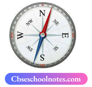
- There are four major directions that are North, South, East and West. They are called cardinal points.
- North-East (NE), South-East (SE), South-West (SW) and North-West (NW) are the other four directions which are called intermediate directions. These are used to locate any place accurately on the map.
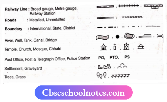
Symbols: It is impossible to draw the exact size of different ) features such as buildings, roads, bridges, trees, railway lines or a well on a map. So they are shown by using symbols like certain letters, shades, colours, pictures and lines.
- Maps can be drawn easily with the help of these symbols and they give a lot of information in a limited space.
- Maps have a universal language so that they can be understood by the people speaking any language.
- There is an international agreement regarding the use of these symbols and these are called conventional symbols.
- Various colours are used to show different features on a map. For example, generally, blue colour is used for showing water bodies, brown is for mountains, yellow is for plateaus and green is for plains.
CBSE Notes For Class 6 Geography Chapter 4 Sketch and Plan
- A sketch is a drawing mainly based on memory and spot observation and not on scale. Sometimes, a rough sketch is required to tell, where a particular area is located with respect to other places.
- Suppose one wants to go to his/her friend’s house and he/she doesn’t know the way, then his/her friend may make a rough sketch to show the way to his/her house. Such a rough drawing is called a sketch map.
- A plan is a drawing of a small area on a large scale. A plan of an area gives information about certain things which one wants to know, For Example. length and breadth of a particular location.